MyTopo
Classic USGS Pennine Tennessee 7.5'x7.5' Topo Map
Couldn't load pickup availability
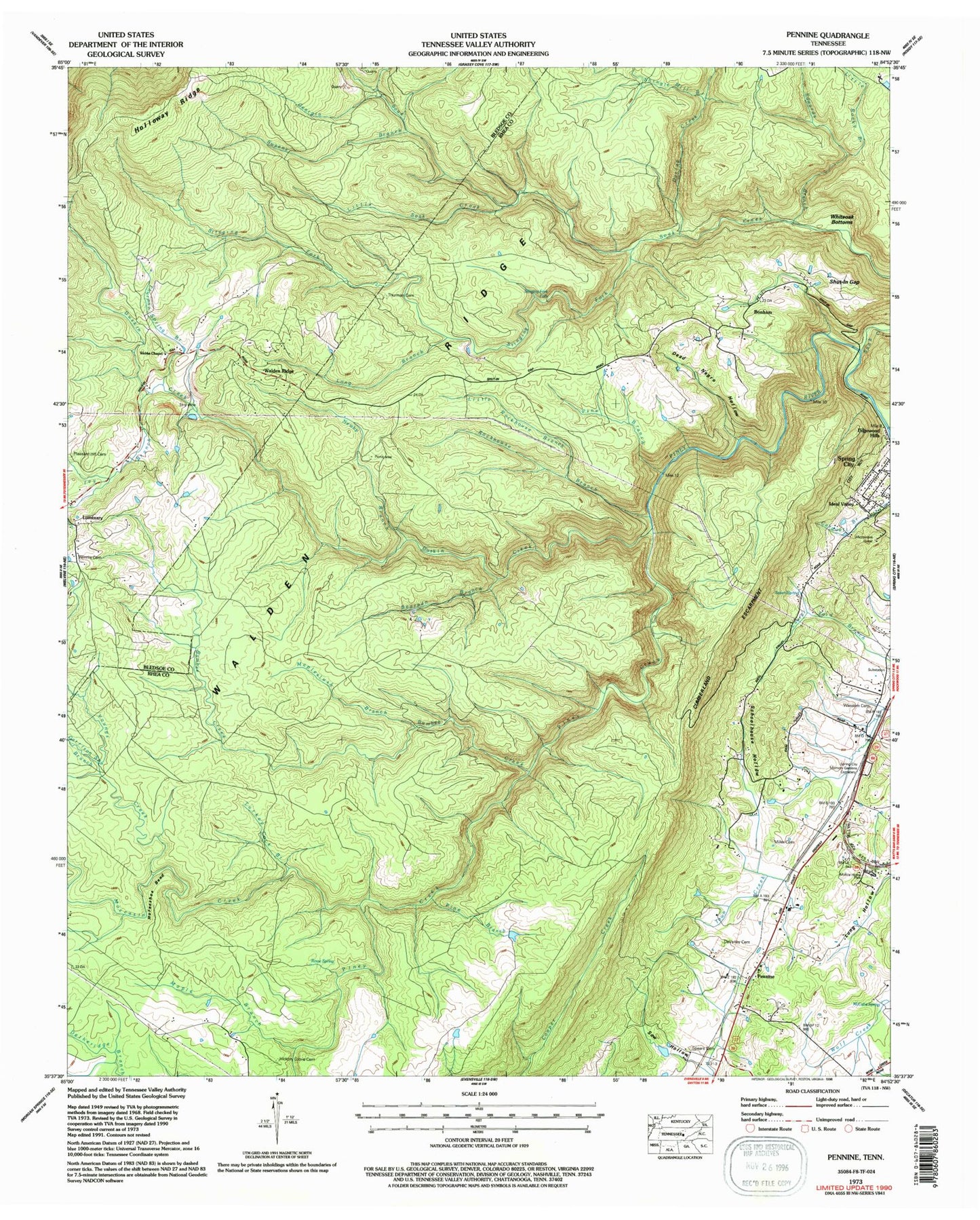
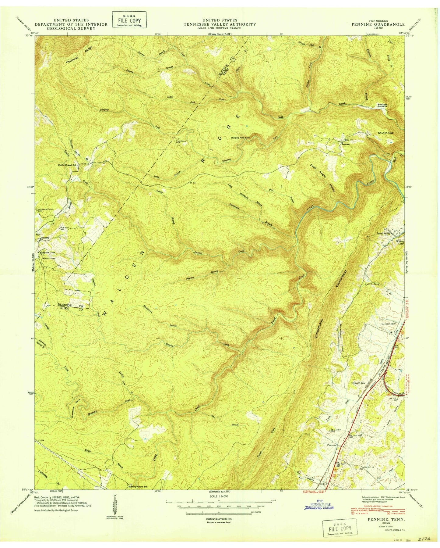
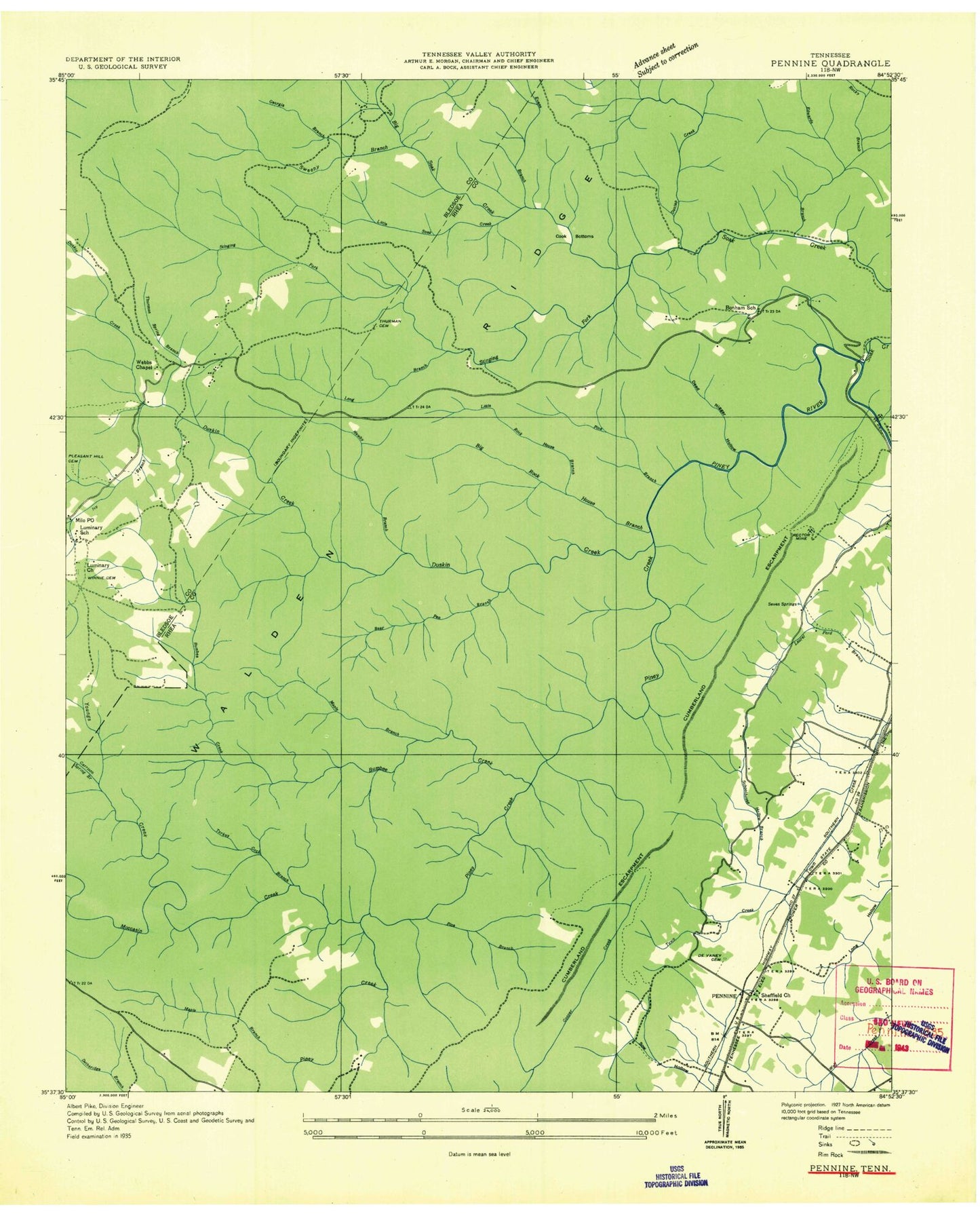
Historical USGS topographic quad map of Pennine in the state of Tennessee. Typical map scale is 1:24,000, but may vary for certain years, if available. Print size: 24" x 27"
This quadrangle is in the following counties: Bledsoe, Rhea.
The map contains contour lines, roads, rivers, towns, and lakes. Printed on high-quality waterproof paper with UV fade-resistant inks, and shipped rolled.
Contains the following named places: Moccasin Creek, Shingle Mill Branch, Shut in Gap, Sow Hollow, Spears Cemetery, Spring City Memory Gardens, Stinging Fork Falls, Thurman Cemetery, Thurman Spring Branch, Turkey Cock Branch, Walden Ridge, Wassom Cemetery, Webbs Chapel, Whiteoak Bottoms, Winnie Cemetery, Bumbee Creek, Coalbank Hollow, DeVaney Cemetery, Bonham Hollow, Dunlap Creek, Duskin Creek, Edgewood Hills, Edwards Branch, Evans Branch, Garrison Spring Branch, Georgia Branch, Hickory Grove Cemetery, Horseshoe Bend, Ideal Valley, Ivy Branch, Little Rockhouse Branch, Little Rocky Branch, Little Soak Creek, Long Branch, Maple Branch, Mapleslush Branch, McCabe Spring, Miller Cemetery, Newby Branch, Pennine, Pine Branch, Pine Branch, Piney Creek, Pleasant Hill Cemetery, Rockhouse Branch, Rowe Spring, Schoolhouse Hollow, Seven Spring, Soak Creek, Stinging Fork, Sweeny Branch, Walden Ridge, Youngs Creek, Bearpen Branch, Milo, Bonneville (historical), Bonham, Luminary School (historical), Mountain View Church (historical), Webbs Chapel School (historical), Bonham School (historical), Hickory Grove School (historical), Kirkwood Number One Mine, Norris Number One Mine, Pennine Baptist Church, Rector Mine, Rocky Creek Number Six Mine, Sheffield Church, WXQK-AM (Spring City), WXQK-AM (Spring City), Pennine Post Office (historical), Commissioner District 2, Moccasin Creek, Shingle Mill Branch, Shut in Gap, Sow Hollow, Spears Cemetery, Spring City Memory Gardens, Stinging Fork Falls, Thurman Cemetery, Thurman Spring Branch, Turkey Cock Branch, Walden Ridge, Wassom Cemetery, Webbs Chapel, Whiteoak Bottoms, Winnie Cemetery, Bumbee Creek, Coalbank Hollow, DeVaney Cemetery, Bonham Hollow, Dunlap Creek, Duskin Creek, Edgewood Hills, Edwards Branch, Evans Branch, Garrison Spring Branch, Georgia Branch, Hickory Grove Cemetery, Horseshoe Bend, Ideal Valley, Ivy Branch, Little Rockhouse Branch, Little Rocky Branch, Little Soak Creek, Long Branch, Maple Branch, Mapleslush Branch, McCabe Spring, Miller Cemetery, Newby Branch, Pennine, Pine Branch, Pine Branch, Piney Creek, Pleasant Hill Cemetery, Rockhouse Branch, Rowe Spring, Schoolhouse Hollow, Seven Spring, Soak Creek, Stinging Fork, Sweeny Branch, Walden Ridge, Youngs Creek, Bearpen Branch, Milo, Bonneville (historical), Bonham, Luminary School (historical), Mountain View Church (historical), Webbs Chapel School (historical), Bonham School (historical), Hickory Grove School (historical), Kirkwood Number One Mine, Norris Number One Mine, Pennine Baptist Church, Rector Mine, Rocky Creek Number Six Mine, Sheffield Church, WXQK-AM (Spring City), WXQK-AM (Spring City), Pennine Post Office (historical), Commissioner District 2


