MyTopo
Classic USGS Pennington Alabama 7.5'x7.5' Topo Map
Couldn't load pickup availability
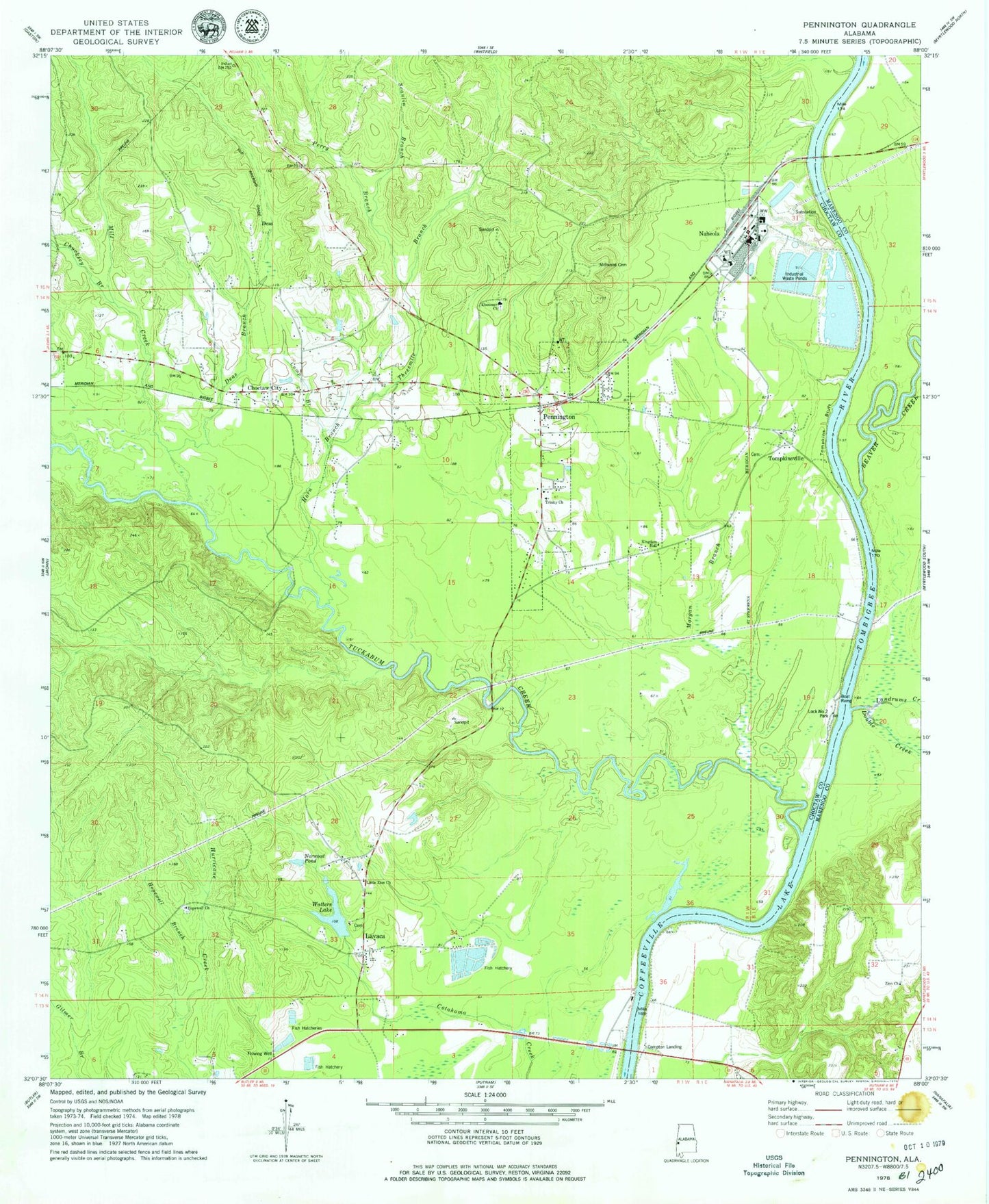
Historical USGS topographic quad map of Pennington in the state of Alabama. Map scale may vary for some years, but is generally around 1:24,000. Print size is approximately 24" x 27"
This quadrangle is in the following counties: Choctaw, Marengo.
The map contains contour lines, roads, rivers, towns, and lakes. Printed on high-quality waterproof paper with UV fade-resistant inks, and shipped rolled.
Contains the following named places: Aces Hunting Club, Barrons, Barrons Landing, Beaver Creek, Beaver Creek Landing, Breckenridge Landing, C A Ezell Dam, C A Ezell Fish Hatchery, C A Ezell Fish Hatchery Dam, Camp Branch, Cherokee, Choctaw City, Chucksey Branch, Coffeeville Lake, Compton, Compton Landing, Deas, Deas Branch, Double Creek, Ebenezer Cemetery, Ebenzer Baptist Church, Eureka Landing, Ezell Camp, Final Mill Effluent Treatment Pon, G B Chaneys Landing, Hill Branch, Hopewell Baptist Church, Hopewell Branch, Hopewell Cemetery, Horn Branch, James Bluff, Julian Waters Lake Dam, Kemp Branch, Kemps Landing, Landrums Creek, Lavaca, Little Zion African Methodist Episcopal Zion Church, Lock Number Two, Lock Number Two Park, Lotts Ferry, Manns Old Landing, Marengo Chute, Mill Creek, Millwood Cemetery, Morgan Branch, Moss Horn Hunting Club, Mulberry Creek, Murphys Bluff, Murphys Ferry, Naheola, Naheola Landing, Nanafalia Bluff, Nanafalia Landing, Norwood Pond, Pennington, Pennington Fire Department, Pennington Post Office, Perry Branch, Red House Cemetery, Scanlin Branch, Thompkinsville African Methodist Episcopal Zion Church, Threemile Branch, Tompkins Bluff, Tompkinsville, Town of Pennington, Trinity United Methodist Church, Tuckabum Creek, Watters Lake, William B Crumpton Bridge, Zion Church, ZIP Code: 36916