MyTopo
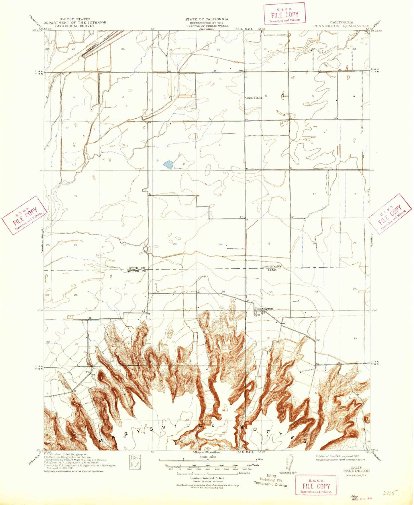
Classic USGS Pennington California 7.5'x7.5' Topo Map
Regular price
$16.95
Regular price
Sale price
$16.95
Unit price
per
Couldn't load pickup availability
Historical USGS topographic quad map of Pennington in the state of California. Map scale may vary for some years, but is generally around 1:24,000. Print size is approximately 24" x 27"
This quadrangle is in the following counties: Butte, Sutter.
The map contains contour lines, roads, rivers, towns, and lakes. Printed on high-quality waterproof paper with UV fade-resistant inks, and shipped rolled.
Contains the following named places: Belding Lateral, Butte County Fire Department Station 77, Gray Lodge Waterfowl Management Area, Green Lateral, Gridley Division, Little Dry Creek, North Butte Cemetery, Peace Valley, Pennington, Pugh Cemetery, Sutter Buttes State Park, ZIP Codes: 95948, 95953