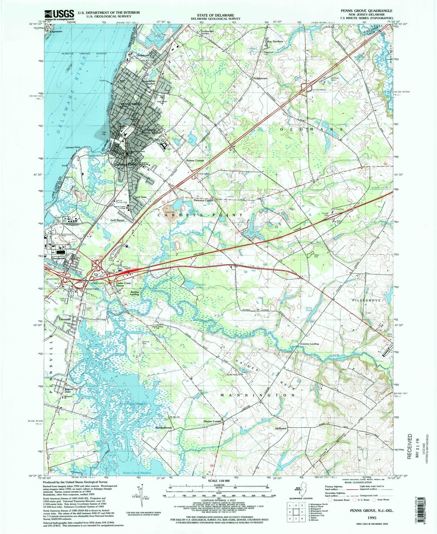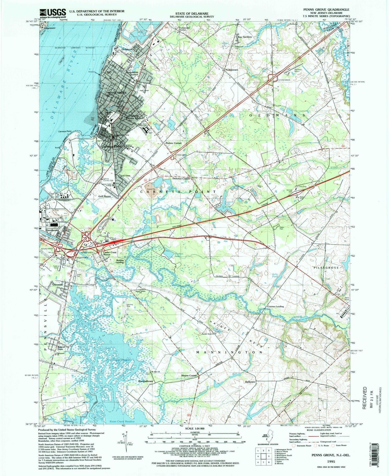

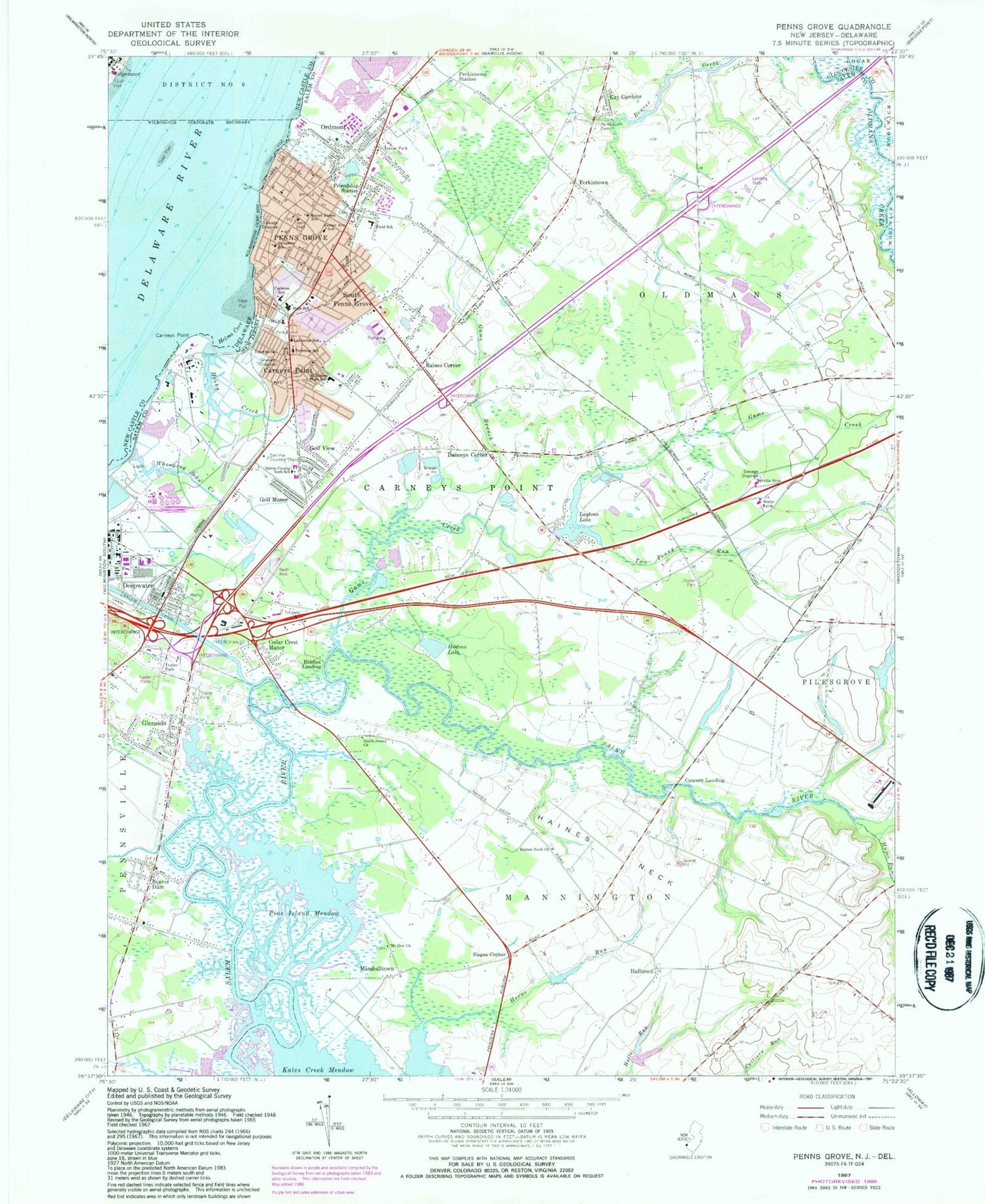
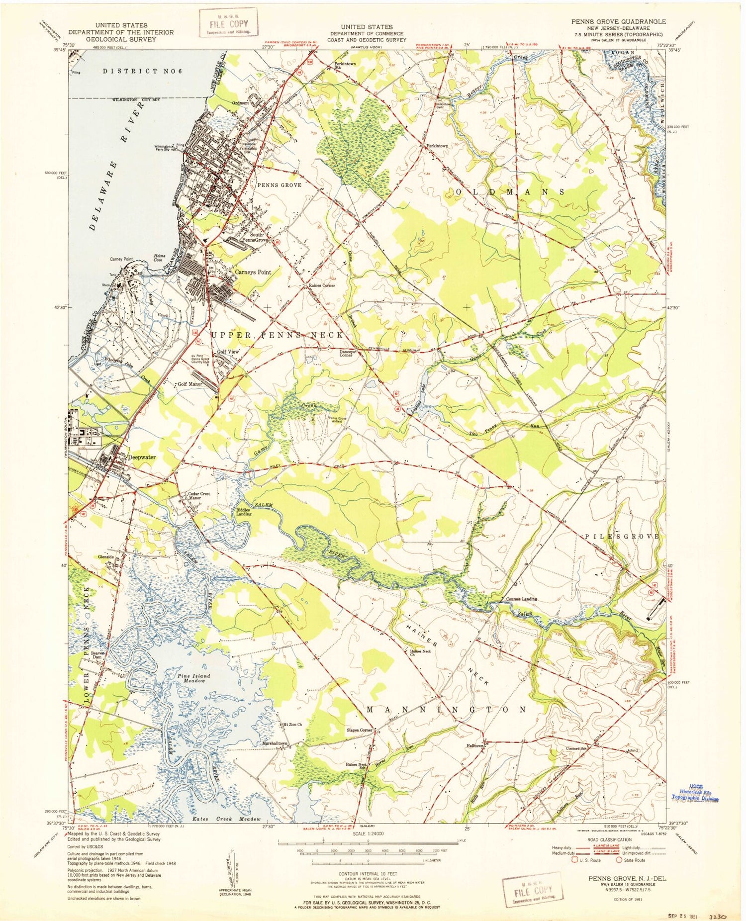
MyTopo
Classic USGS Penns Grove New Jersey 7.5'x7.5' Topo Map
Couldn't load pickup availability
Historical USGS topographic quad map of Penns Grove in the states of New Jersey, Delaware. Map scale may vary for some years, but is generally around 1:24,000. Print size is approximately 24" x 27"
This quadrangle is in the following counties: Gloucester, New Castle, Salem.
The map contains contour lines, roads, rivers, towns, and lakes. Printed on high-quality waterproof paper with UV fade-resistant inks, and shipped rolled.
Contains the following named places: Barber Avenue School, Beaver Dam, Biddles Landing, Bishop Guilfoyle Regional Catholic School, Borough of Penns Grove, Broad Street School, Carneys Point, Carneys Point Census Designated Place, Carneys Point Fire and Rescue Squad, Carneys Point Police Department, Cedar Crest Manor, Cherry Island Flats, Courses Landing, Danceys Corner, Deepwater, Deepwater Fire Company, Deepwater Heliport, Deepwater Post Office, Dupont Chambers Works Fire House / Emergency Medical Services, Emmanuel Methodist Episcopal Cemetery, Field Street Elementary School, Friendship Station, Game Branch, Game Creek, Glenside, Golf Manor, Golf View, Haines Neck, Haines Neck Church, Halltown, Hanby Creek, Helms Cove, Horne Run, Hudson Lake, Kates Creek Meadow, Kay Gardens, Kelly Dam, Kelly Pond, Lafayette Pershing Elementary School, Lafayette School, Laytons Lake, Major Run, Marshalltown, Mount Zion Church, Oldmans Township Airport, Ordmont, Paul W Carleton Elementary School, Penns Grove, Penns Grove Ambulance Squad, Penns Grove High School, Penns Grove Liberty Fire Company 1, Penns Grove Middle School, Penns Grove Police Dept, Penns Grove Post Office, Perkintown, Perkintown Cemetery, Perkintown Station, Pine Island Meadow, Rainbow's End Airport, Raines Corner, Riverview Cemetery, Saint James School, Sakima Country Club, Salem Canal, Salem Community College, Salem Country Technical School, Slapes Corner, South Jersey Church, South Penns Grove, Township of Carneys Point, Township of Oldmans, Two Penny Run, Whooping John Creek, Woodstown State Police Station Troop A, ZIP Codes: 08023, 08067, 08069