MyTopo
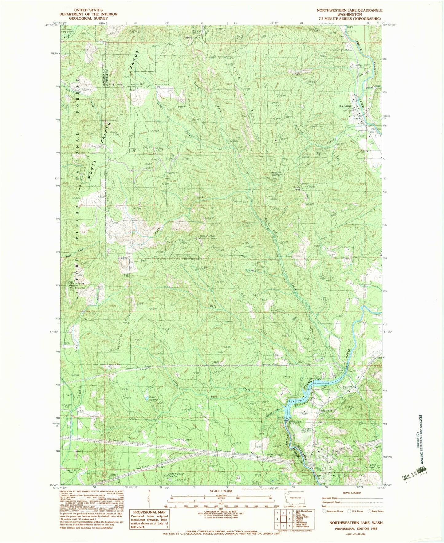
Classic USGS Penny Ridge Washington 7.5'x7.5' Topo Map
Couldn't load pickup availability
Historical USGS topographic quad map of Penny Ridge in the state of Washington. Typical map scale is 1:24,000, but may vary for certain years, if available. Print size: 24" x 27"
This quadrangle is in the following counties: Klickitat, Skamania.
The map contains contour lines, roads, rivers, towns, and lakes. Printed on high-quality waterproof paper with UV fade-resistant inks, and shipped rolled.
Contains the following named places: B Z Corner, Baldy Peak, Buck Creek, Gilmer Creek, Homes Trail, Little Baldy Peak, Little Baldy Trail, Little Buck Creek, Mill B Flat, Mill Creek, Monte Carlo, Nestor Peak, Northwestern Lake (historical), Oklahoma Campground, Pleasant View School, Spring Creek, Timberhead Mountain, Whistling Ridge, McIlroy Canyon, South Fork Buck Creek, Middle Fork Buck Creek, North Fork Buck Creek, Middle Fork Camp, Green Mountain, Bald Mountain, Cedar Swamp, Penny Ridge, McIlroy Saddle, Little Baldy LOH, Little Baldy Peak Lookout, Spring Creek, Condit Dam (historical)