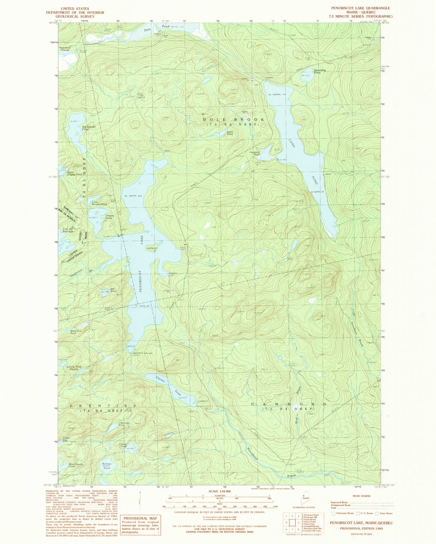
MyTopo
Classic USGS Penobscot Lake Maine 7.5'x7.5' Topo Map
Couldn't load pickup availability
Historical USGS topographic quad map of Penobscot Lake in the state of Maine. Typical map scale is 1:24,000, but may vary for certain years, if available. Print size: 24" x 27"
This quadrangle is in the following counties: Somerset.
The map contains contour lines, roads, rivers, towns, and lakes. Printed on high-quality waterproof paper with UV fade-resistant inks, and shipped rolled.
Contains the following named places: Big Grenier Pond, Cheney Pond, Clearwater Pond, Deadwater Brook, Dingley Pond, Dubois Pond, Hill Pond, Lewiston Pond, Little Dingley Pond, Little Fish Ponds, Lizzies Bog, Long Pond, Mary Petuche Pond, Mud Brook, Penobscot Lake, Sears Pond, Spaulding Pond, Upper Dingley Pond, Welman Pond, White Deer Pond, Long Pond Dam, Penobscot Lake Dam, Dole Brook Township, Hammond Township