MyTopo
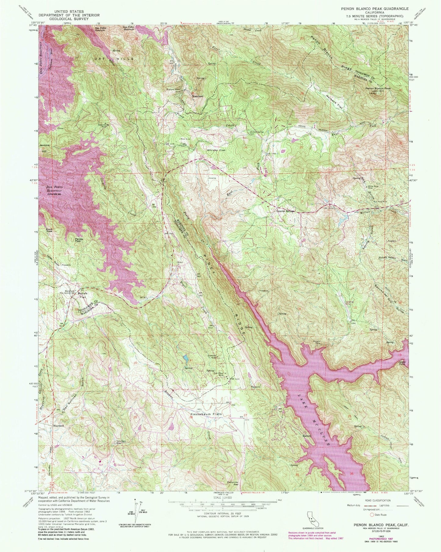
Classic USGS Penon Blanco Peak California 7.5'x7.5' Topo Map
Couldn't load pickup availability
Historical USGS topographic quad map of Penon Blanco Peak in the state of California. Map scale may vary for some years, but is generally around 1:24,000. Print size is approximately 24" x 27"
This quadrangle is in the following counties: Mariposa, Tuolumne.
The map contains contour lines, roads, rivers, towns, and lakes. Printed on high-quality waterproof paper with UV fade-resistant inks, and shipped rolled.
Contains the following named places: Barrett, Barrett Cove Recreation Area, Blanchard, Blanchard Fire Control Station, Blank Peak, Bonds Flat, Bruschi Mine, Bull Pine Mine, Burr Mine, Buzzard Roost Mine, Dan Sullivan Gulch, Diamond Mine, East Fork Piney Creek, Fleming Creek, Fortynine Gap, Granite Spring School, Granite Springs, Granite Springs Cemetery, Graveyard Creek, Hatch Creek, Hayward, Hedley Mine, Herbeck Flat, Jasper Point, Kassabaum Flats, Lake Don Pedro Census Designated Place, Mariposa County Fire Department Company 24 Don Pedro, Mariposa County Sheriff's Office, Ned Gulch, New Years Mine, Oak Mesa Mine, Oat Hills, Penole Peak, Penon Blanco Peak, Piney Creek, Piney Ridge, Roger Creek, Solambo Mine, Spring Gulch, Tuolumne County Fire Department Station 64 Don Pedro, Whisky Flat, White Rock Mine, Willow Creek