MyTopo
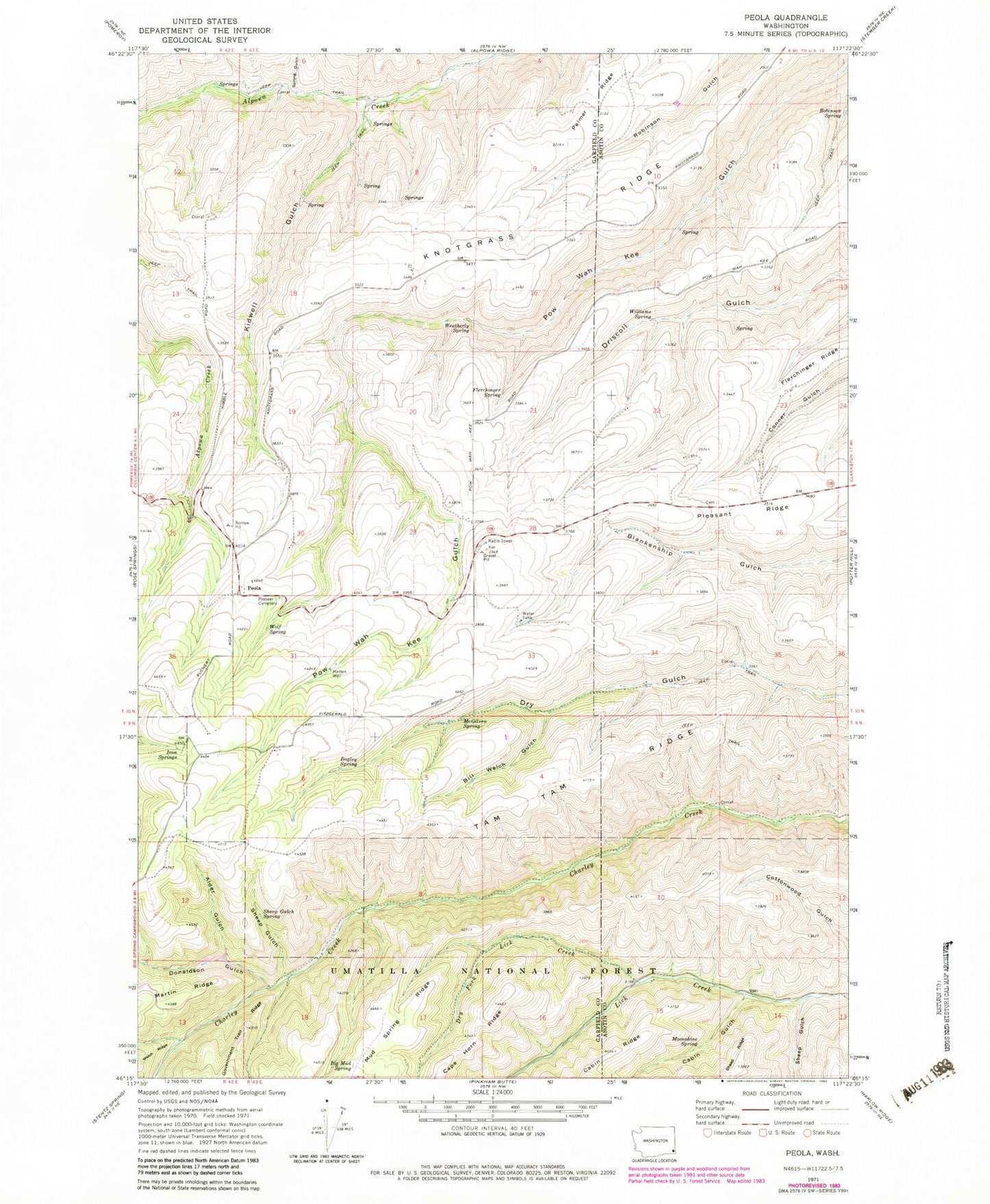
Classic USGS Peola Washington 7.5'x7.5' Topo Map
Couldn't load pickup availability
Historical USGS topographic quad map of Peola in the state of Washington. Map scale may vary for some years, but is generally around 1:24,000. Print size is approximately 24" x 27"
This quadrangle is in the following counties: Asotin, Garfield.
The map contains contour lines, roads, rivers, towns, and lakes. Printed on high-quality waterproof paper with UV fade-resistant inks, and shipped rolled.
Contains the following named places: Alder Spring, Bagley Spring, Big Mud Spring, Bill Welch Gulch, Cabin Gulch, Cottonwood Spring, Donaldson Creek, Donaldson Gulch, Dry Fork Lick Creek, Flerchinger Ridge, Flerchinger Spring, Iron Springs, Iron Springs Guard Station, Kidwell Gulch, Knotgrass Ridge, McGilvra Spring, Moonshine Spring, Pataha Research Natural Area, Peola, Peola Pioneer Cemetery, Pleasant Ridge, Robinson Spring, Sheep Gulch, Sheep Gulch Spring, Spring Gulch, Weatherly Spring, Williams Spring, Wolf Spring