
MyTopo
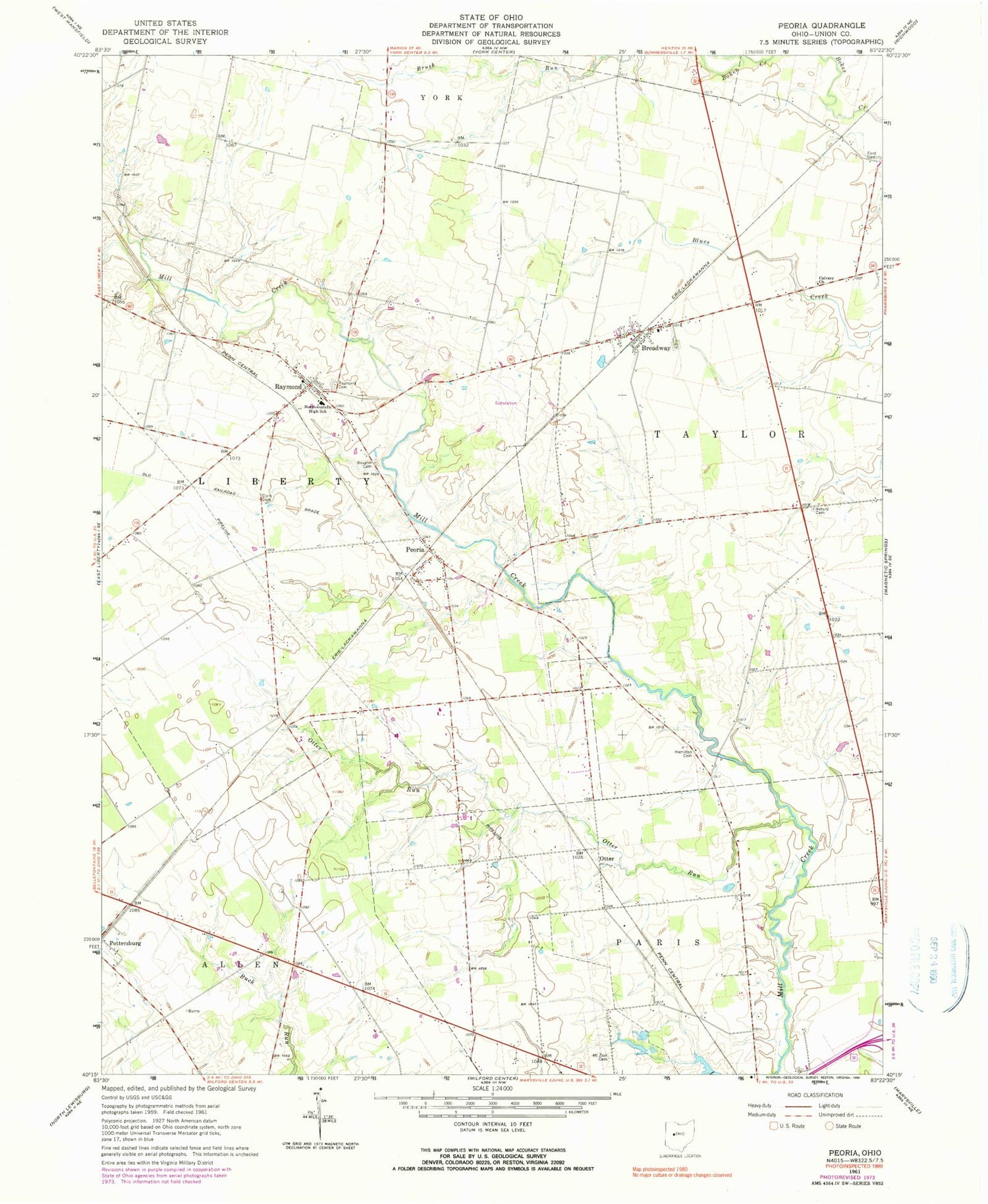
Classic USGS Peoria Ohio 7.5'x7.5' Topo Map
Couldn't load pickup availability
Historical USGS topographic quad map of Peoria in the state of Ohio. Typical map scale is 1:24,000, but may vary for certain years, if available. Print size: 24" x 27"
This quadrangle is in the following counties: Union.
The map contains contour lines, roads, rivers, towns, and lakes. Printed on high-quality waterproof paper with UV fade-resistant inks, and shipped rolled.
Contains the following named places: Amerine Cemetery, Asbury Cemetery, Baughn Cemetery, Calvary Church, Clark Cemetery, Ford Cemetery, Hamilton Cemetery, Mount Zion Cemetery, North Western High School, Otter Run, Raymond Cemetery, Otter, Peoria, Amarine School (historical), Asbury School (historical), Bear Swamp (historical), Blue School (historical), Bokes Creek School (historical), Braum School (historical), Carter School (historical), Henpeck School (historical), Raymond Elementary School, Shirk School (historical), Stub School (historical), Taylor School (historical), Broadway, Raymond, Bear Swamp Run, Taylor Centre (historical), East Elementary School, Township of Liberty, Township of Taylor, Broadway Cemetery, Broadway Post Office, Peoria Post Office (historical), Raymond Post Office, Taylor Centre Post Office (historical), Fruit-Full Acres, Liberty Township Fire Department and Emergency Medical Services Department, Raymond Census Designated Place, Bliss Dairy, Ohio State Highway Patrol - Marysville Patrol Post


