MyTopo
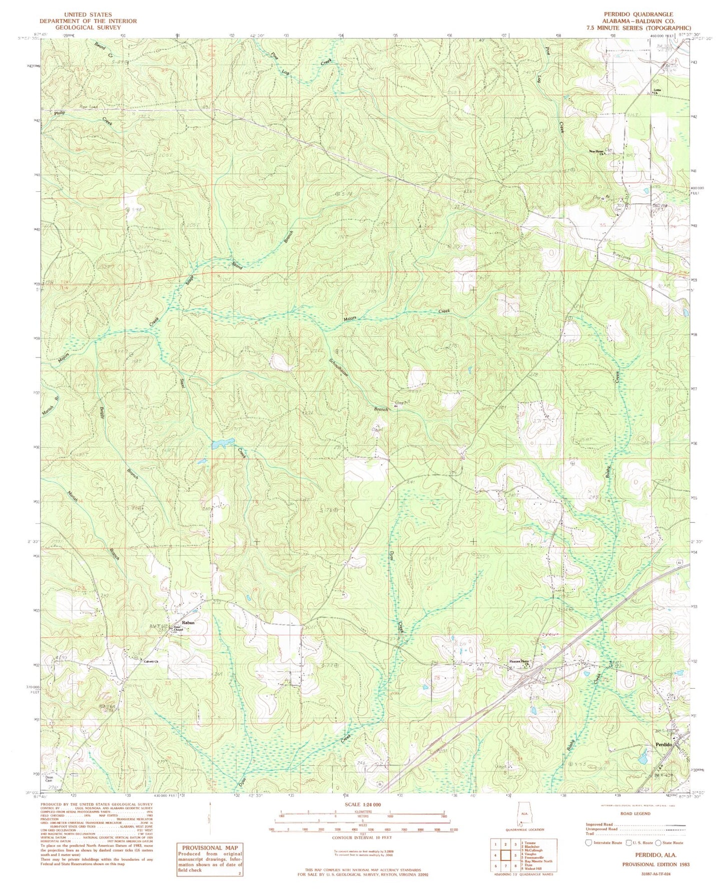
Classic USGS Perdido Alabama 7.5'x7.5' Topo Map
Couldn't load pickup availability
Historical USGS topographic quad map of Perdido in the state of Alabama. Map scale may vary for some years, but is generally around 1:24,000. Print size is approximately 24" x 27"
This quadrangle is in the following counties: Baldwin.
The map contains contour lines, roads, rivers, towns, and lakes. Printed on high-quality waterproof paper with UV fade-resistant inks, and shipped rolled.
Contains the following named places: Boggy Branch, Bryars McGill Cemetery, Calvary Church, Dean Cemetery, Frisco School, Gentry Cemetery, Guys Chapel, Langham Lottie School, Lottie Church, Lottie Volunteer Fire Department, Millers Cemetery, Perdido, Perdido Census Designated Place, Perdido Church, Perdido Church of God, Perdido Post Office, Perdido Volunteer Fire Department, Pine Grove Church, Pleasant Plains Church, Rabun, Rabun Church of God, Rabun Volunteer Fire Department, Rabun Volunteer Fire Department Station 4, Schoolhouse Branch, Stage Stand Branch, Steel Creek, ZIP Code: 36562