MyTopo
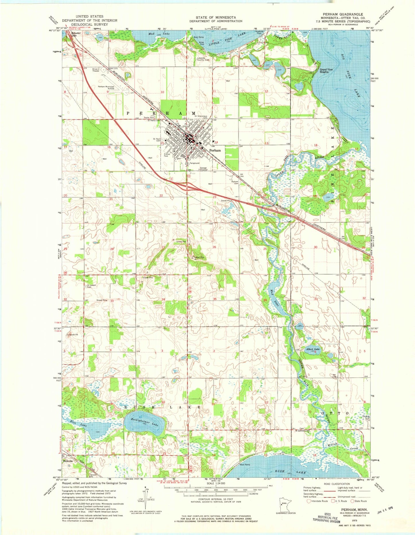
Classic USGS Perham Minnesota 7.5'x7.5' Topo Map
Couldn't load pickup availability
Historical USGS topographic quad map of Perham in the state of Minnesota. Map scale may vary for some years, but is generally around 1:24,000. Print size is approximately 24" x 27"
This quadrangle is in the following counties: Otter Tail.
The map contains contour lines, roads, rivers, towns, and lakes. Printed on high-quality waterproof paper with UV fade-resistant inks, and shipped rolled.
Contains the following named places: Albert Lake, Arvig Park, Assembly of God Church, Bible Baptist Church, Boedigheimer Lake, Calvary Lutheran Church, Church of Christ, City Hall Park, City of Perham, Country Pines Park, East Ottertail Clinic, Grand View Heights, Hagen Airport, Heart of the Lake Elementary School, History Museum of East Otter Tail County, Krauss Park, Lake's Mobile Home Park, Lakeside Country Club, Little Pine Lake, Little Pine Lake Dam, Miller Park, Mud Lake, Museum/Library Park, Northern Pacific Park, Perham, Perham Area Emergency Medical Services, Perham Cemetery, Perham Community Church, Perham Fairgrounds, Perham Fire Department, Perham High School, Perham Library, Perham Memorial Hospital and Home, Perham Memorial Hospital Heliport, Perham Meritcare Clinic, Perham Municipal Airport, Perham Police Department, Perham Post Office, Pine Cone Court, Pine Lake, Pine Lake Big Dam, Pioneer Village, Prairie Wind Middle School, Rice Lake, Saint Henry Cemetery, Saint Henry's Catholic Church, Saint Henry's School, Saint Joseph Cemetery, Saint Lawrence Church, Saint Lawrence Church Cemetery, Saint Lawrence Post Office, Saint Paul Cemetery, Saint Paul's Lutheran Church, Saint Paul's Lutheran School, Saint Stanislaus Cemetery, Saint Stanislaus Church, Township of Perham, United Methodist Church, Willow Creek, ZIP Code: 56573