MyTopo
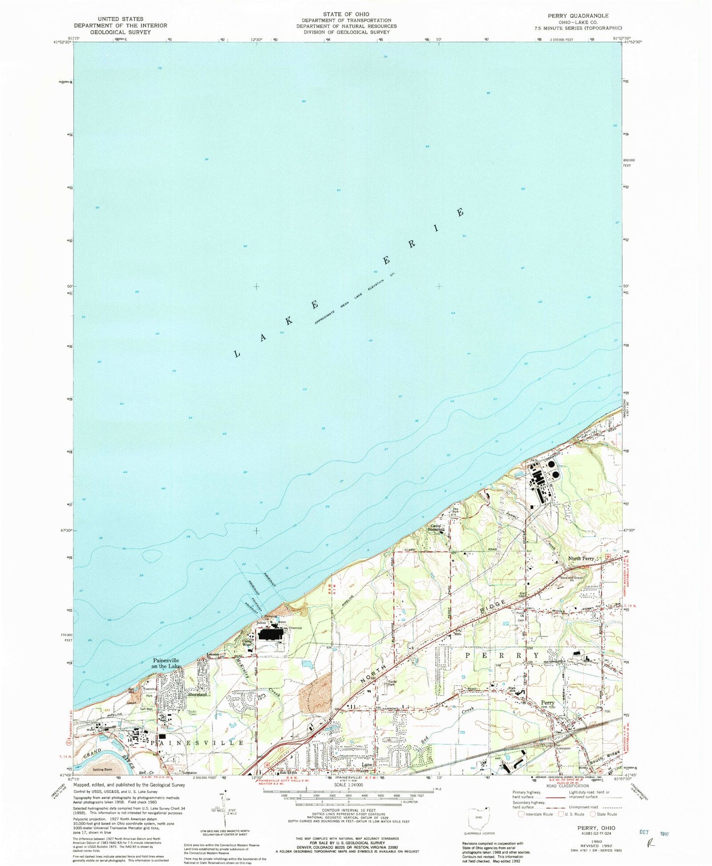
Classic USGS Perry Ohio 7.5'x7.5' Topo Map
Couldn't load pickup availability
Historical USGS topographic quad map of Perry in the state of Ohio. Map scale may vary for some years, but is generally around 1:24,000. Print size is approximately 24" x 27"
This quadrangle is in the following counties: Lake.
The map contains contour lines, roads, rivers, towns, and lakes. Printed on high-quality waterproof paper with UV fade-resistant inks, and shipped rolled.
Contains the following named places: Beardslee Nursery, Blackacre Farm Airport, Buena Vista Beach, Camp Roosevelt, Camp Wise, Center Road Elementary School, Community Christian Church, Fairway Pines Golf Course, First Baptist Church, Golfway Pines, Hale Road Elementary School, Lake County Solid Waste Facility, Lake County Water Service Center, Lakeside Church, Lambo Nursery, Lane, Lane Post Office, Long Meadow Square Shopping Center, Manchester Elementary School, Martin's Nursery, McKinley Creek, Moretti Nursery, North Perry, North Perry Park, North Perry Police Department, North Perry Post Office, North Perry Village Hall, Painesville on-the-Lake, Painesville Township Park, Parmly Park, Perry, Perry Cemetery, Perry Christian Church, Perry High School, Perry Historical Museum, Perry Joint Fire District - Station 1 Headquarters, Perry Middle School, Perry Mobile Homes, Perry Nuclear Power Plant, Perry Nuclear Power Plant Heliport, Perry Post Office, Perry Township Park, Perry Township Town Hall, Perry United Methodist Church, Perry Village Hall, Shoreland, Springlake Nursery, Township Park, Village of Perry, West Orchards, ZIP Code: 44081