MyTopo
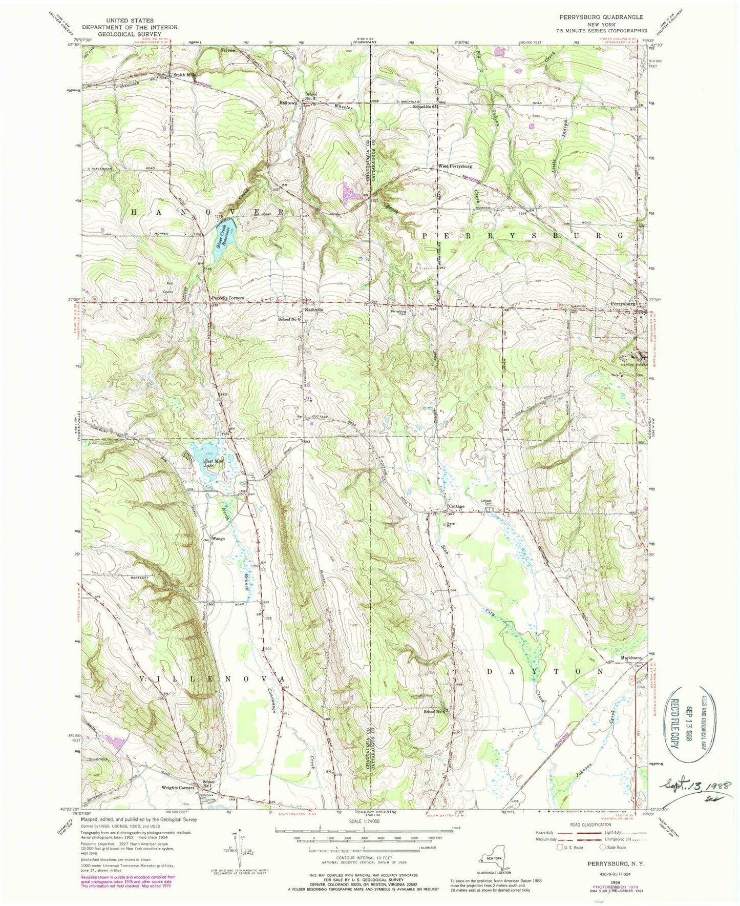
Classic USGS Perrysburg New York 7.5'x7.5' Topo Map
Couldn't load pickup availability
Historical USGS topographic quad map of Perrysburg in the state of New York. Map scale may vary for some years, but is generally around 1:24,000. Print size is approximately 24" x 27"
This quadrangle is in the following counties: Cattaraugus, Chautauqua.
The map contains contour lines, roads, rivers, towns, and lakes. Printed on high-quality waterproof paper with UV fade-resistant inks, and shipped rolled.
Contains the following named places: Balltown, Balltown Cemetery, Blueberry Hill Farm And Greenhouse, Butcher Crest Farm, Cottage, Cottage Cemetery, East Mud Lake, H and H Aviation Service Incorporated Heliport, Hanova Hill Farm, Johnson Creek, Markhams, Nashville, Parcells Corners, Perrysburg, Perrysburg - Dayton Methodist Church, Perrysburg Cemetery, Perrysburg Census Designated Place, Perrysburg Post Office, Perrysburg Volunteer Fire Company, Rugg Town Cemetery, School Number 1, School Number 3, School Number 4, School Number 6, Seventh Day Adventist Church, Silver Creek Reservoir, Smith Mills, Town of Dayton, Town of Perrysburg, Town of Villenova, Tri County Country Club, Village of Perrysburg, Villenova Cemetery, Wango, West Perrysburg, Wheeler Brook, Wrights Corners, ZIP Codes: 14129, 14138