
MyTopo
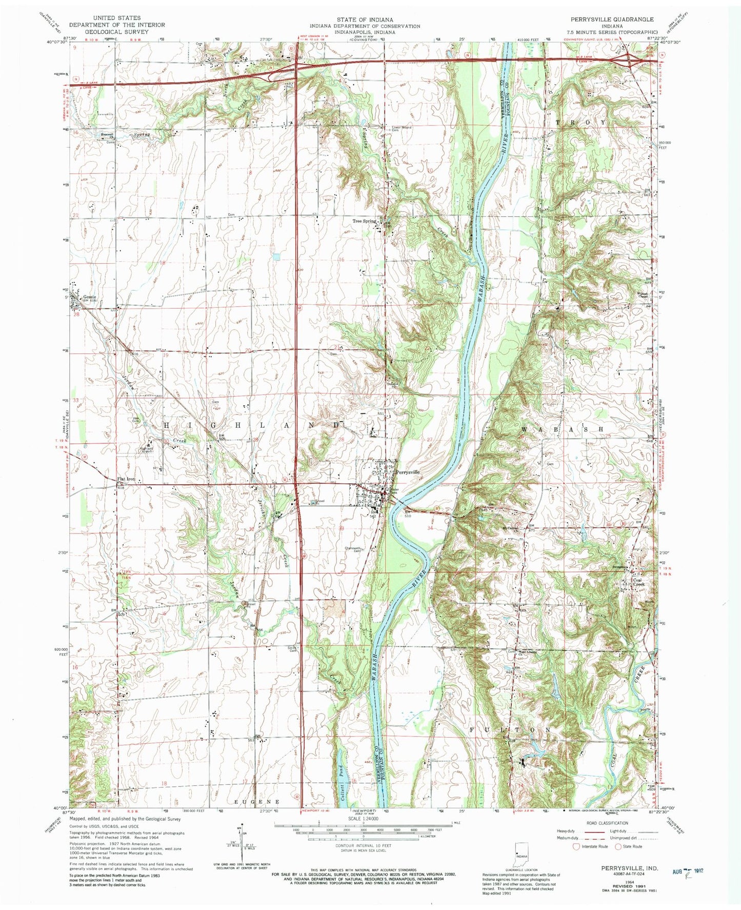
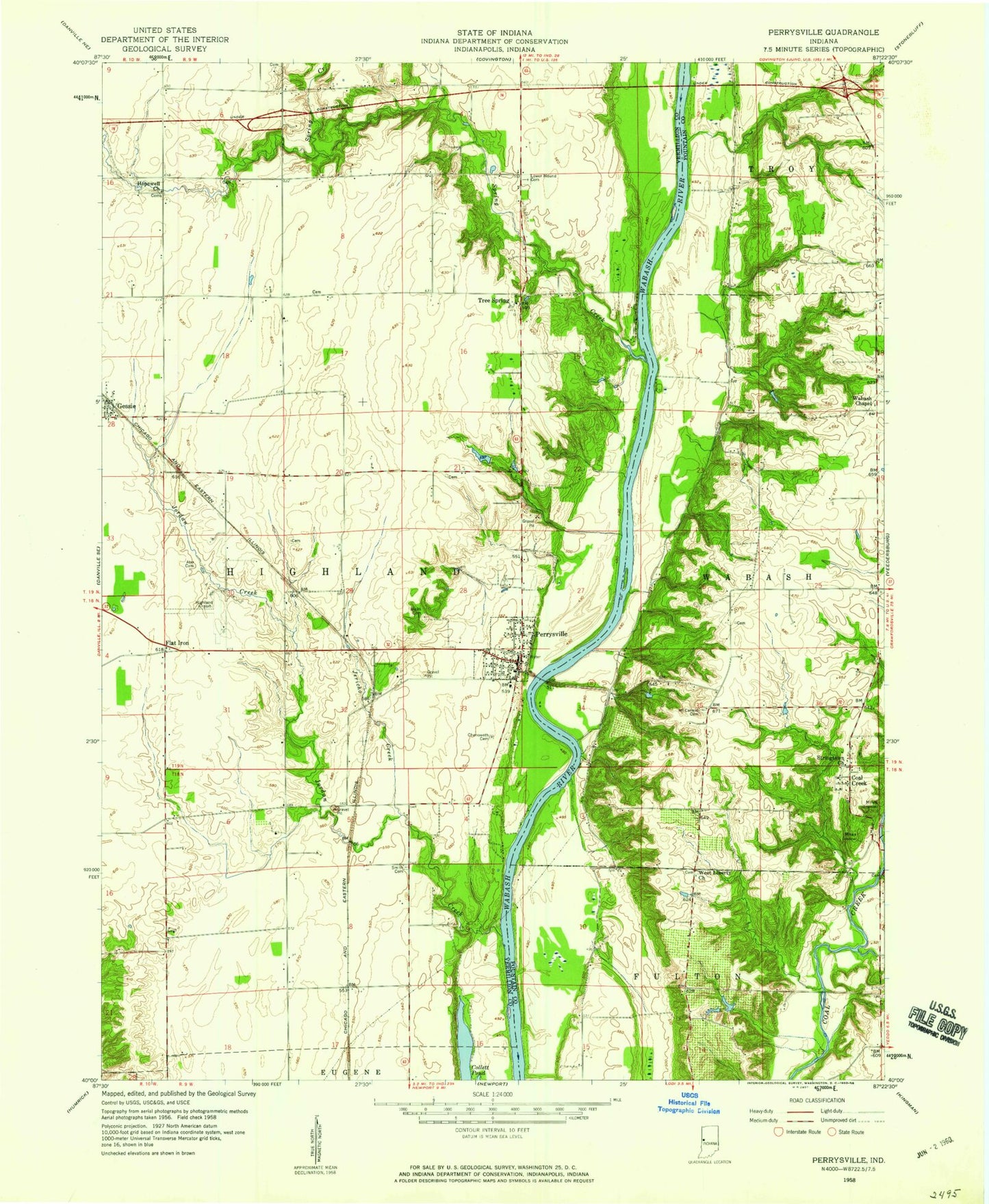
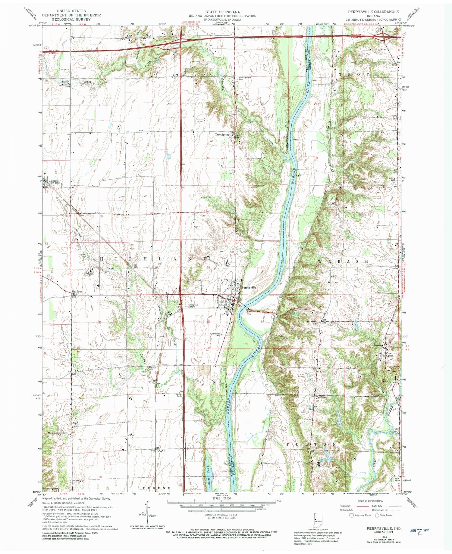
Classic USGS Perrysville Indiana 7.5'x7.5' Topo Map
Couldn't load pickup availability
Historical USGS topographic quad map of Perrysville in the state of Indiana. Map scale may vary for some years, but is generally around 1:24,000. Print size is approximately 24" x 27"
This quadrangle is in the following counties: Fountain, Vermillion.
The map contains contour lines, roads, rivers, towns, and lakes. Printed on high-quality waterproof paper with UV fade-resistant inks, and shipped rolled.
Contains the following named places: Ater Cemetery, Chenoweth Cemetery, Coal Creek, Coffing Brothers Dam, Coffing Brothers Lake, Collett Pond, Flat Iron, Gessie, Highland Airport, Highland Elementary School, Hopewell Church, Jericho Creek, Jordan Creek, Lower Mound Cemetery, Mount Carmel Church, North Fork Spring Creek, Perrysville, Perrysville Post Office, Perrysville Volunteer Fire Department, Prairie Creek, Smith Cemetery, Spring Creek, Stringtown Church, Town of Perrysville, Township of Highland, Tree Spring, Wabash Chapel, West Liberty Church, ZIP Code: 47974