
MyTopo
Classic USGS Perrysville Ohio 7.5'x7.5' Topo Map
Couldn't load pickup availability
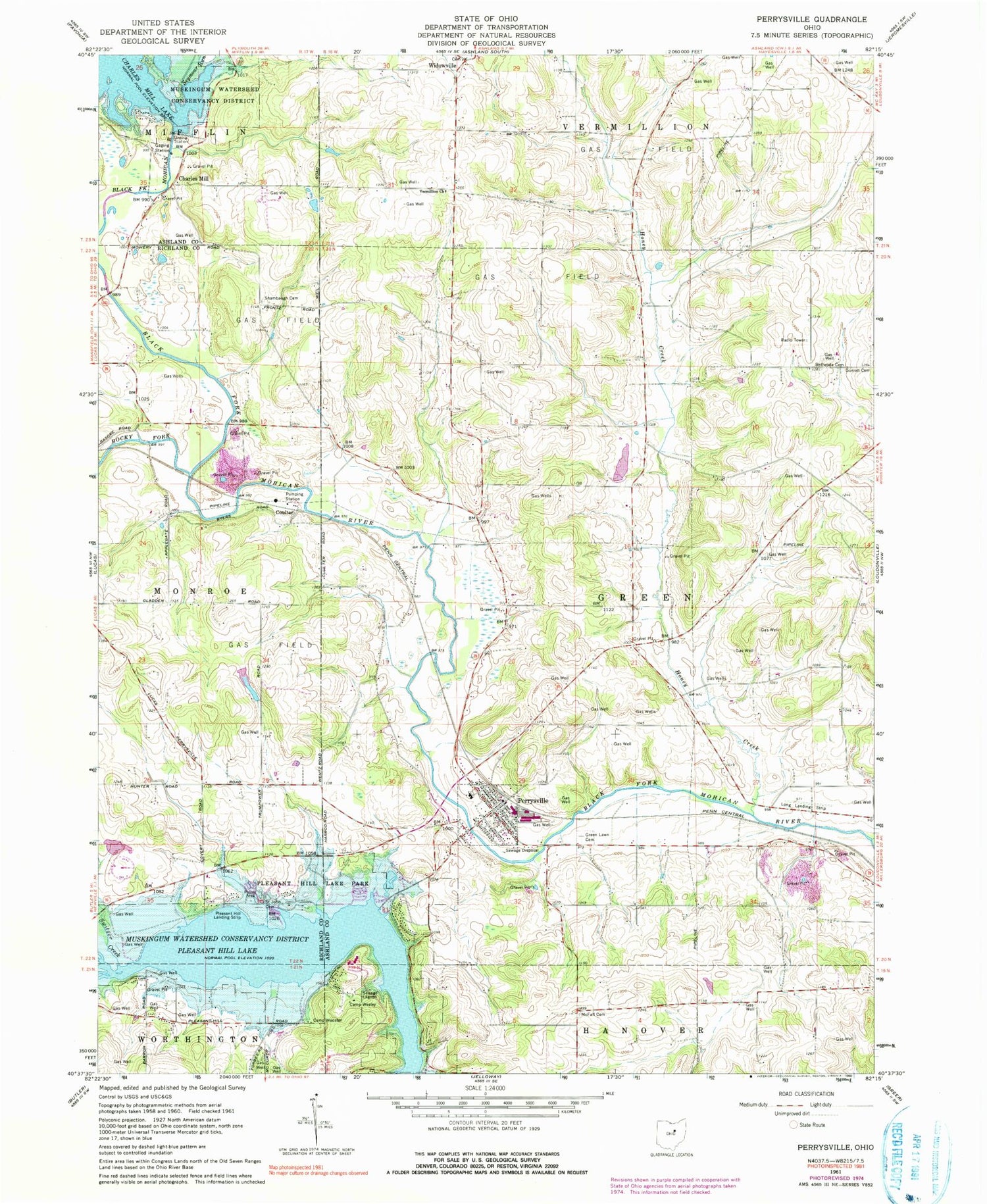
Historical USGS topographic quad map of Perrysville in the state of Ohio. Typical map scale is 1:24,000, but may vary for certain years, if available. Print size: 24" x 27"
This quadrangle is in the following counties: Ashland, Richland.
The map contains contour lines, roads, rivers, towns, and lakes. Printed on high-quality waterproof paper with UV fade-resistant inks, and shipped rolled.
Contains the following named places: Pleasant Hill Lake, Bethesda Cemetery, Big Run, Camp Wesley, Camp Wooster, Green Lawn Cemetery, Honey Creek, McFall Cemetery, Pleasant Hill Lake Park, Rocky Fork, Saint John Cemetery, Seymour Run, Shambaugh Cemetery, Sunset Cemetery, Vermillion Church, Charles Mill, Walnut Hall School (historical), Hazel Dell School (historical), Melco, Perrysville Junior High School, Pleasant Hill School (historical), School Number 6 (historical), Sugar Grove School (historical), Switzer Creek, Widowville, Coulter, School Number 8 (historical), Perrysville, Saint Johns (historical), Long Landing Strip (historical), Charles Mill Dam, Mohican Trail Camp Lake Dam, Mohican Trail Camp Lake, Banks Pond Dam, Banks Pond, Township of Green, Copus Hill Cemetery, Hammond Methodist Cemetery, Harlan Cemetery, Old Presbyterian Cemetery, Peterson Cemetery, Pleasant Hill Landing Strip (historical), Perrysville Post Office, Widowville Post Office (historical), Idlewood Cottage Area, Mohican Sailing Club, Mohican State Lodge, Pleasant Hill Boat Club, Yacht Point Cottage Area, First Presbyterian Church, Perrysville Baptist Church, Saint Johns Lutheran Church, Pleasant Hill Marina, Richland Cottage Area, Village of Perrysville, Green - Perrysville Fire Department


