MyTopo
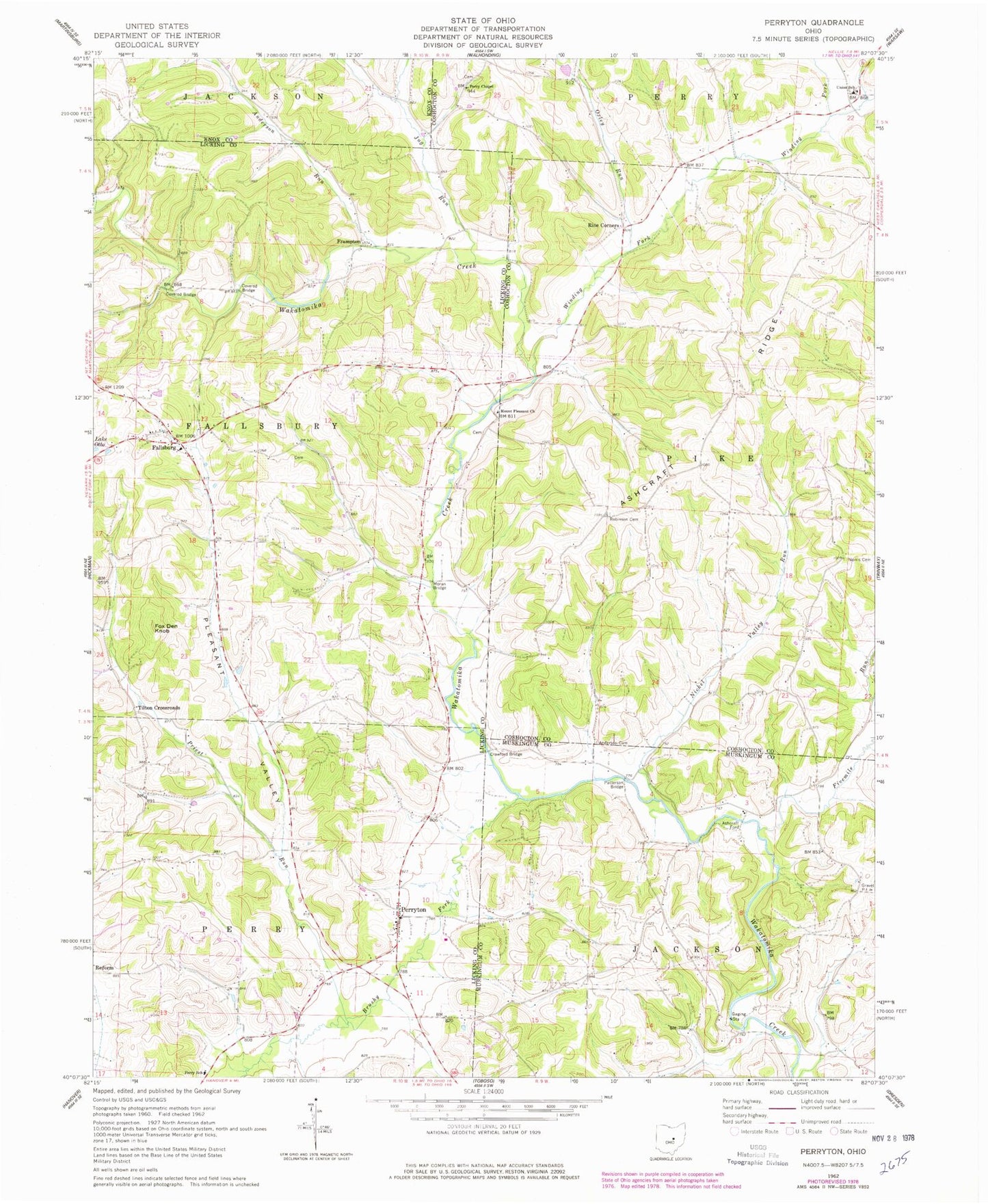
Classic USGS Perryton Ohio 7.5'x7.5' Topo Map
Couldn't load pickup availability
Historical USGS topographic quad map of Perryton in the state of Ohio. Map scale may vary for some years, but is generally around 1:24,000. Print size is approximately 24" x 27"
This quadrangle is in the following counties: Coshocton, Knox, Licking, Muskingum.
The map contains contour lines, roads, rivers, towns, and lakes. Printed on high-quality waterproof paper with UV fade-resistant inks, and shipped rolled.
Contains the following named places: Anderson Cemetery, Anderson Run, Ashcraft Ford, Ashcraft Ridge, Ashcraft School, Brushy Fork, Crawford Bridge, Fairview School, Fallsburg, Fallsburg Cemetery, Fallsburg Post Office, Fivemile Run, Fox Den Knob, Frampton, Frampton Post Office, Framptons Mills, Gardner School, Gregg Mill Bridge, Holmes Mill, Jug Run, Meek Cemetery, Moran Bridge, Mount Pleasant Cemetery, Mount Pleasant Church, Nickel Valley Run, Norris Cemetery, Oxley Run, Patterson Bridge, Perry Chapel, Perry Chapel Cemetery, Perry Elementary School, Perryton, Perryton Cemetery, Perryton Church of Christ, Perryton Post Office, Perryton United Methodist Church, Pisgah School, Pleasant Valley, Priest Run, Rine Corners, Robinson Cemetery, Rocky Run School, Tilton Crossroads, Township of Fallsbury, Township of Jackson, Township of Perry, Township of Pike, Union Elementary School, Winding Fork, ZIP Code: 43822