MyTopo
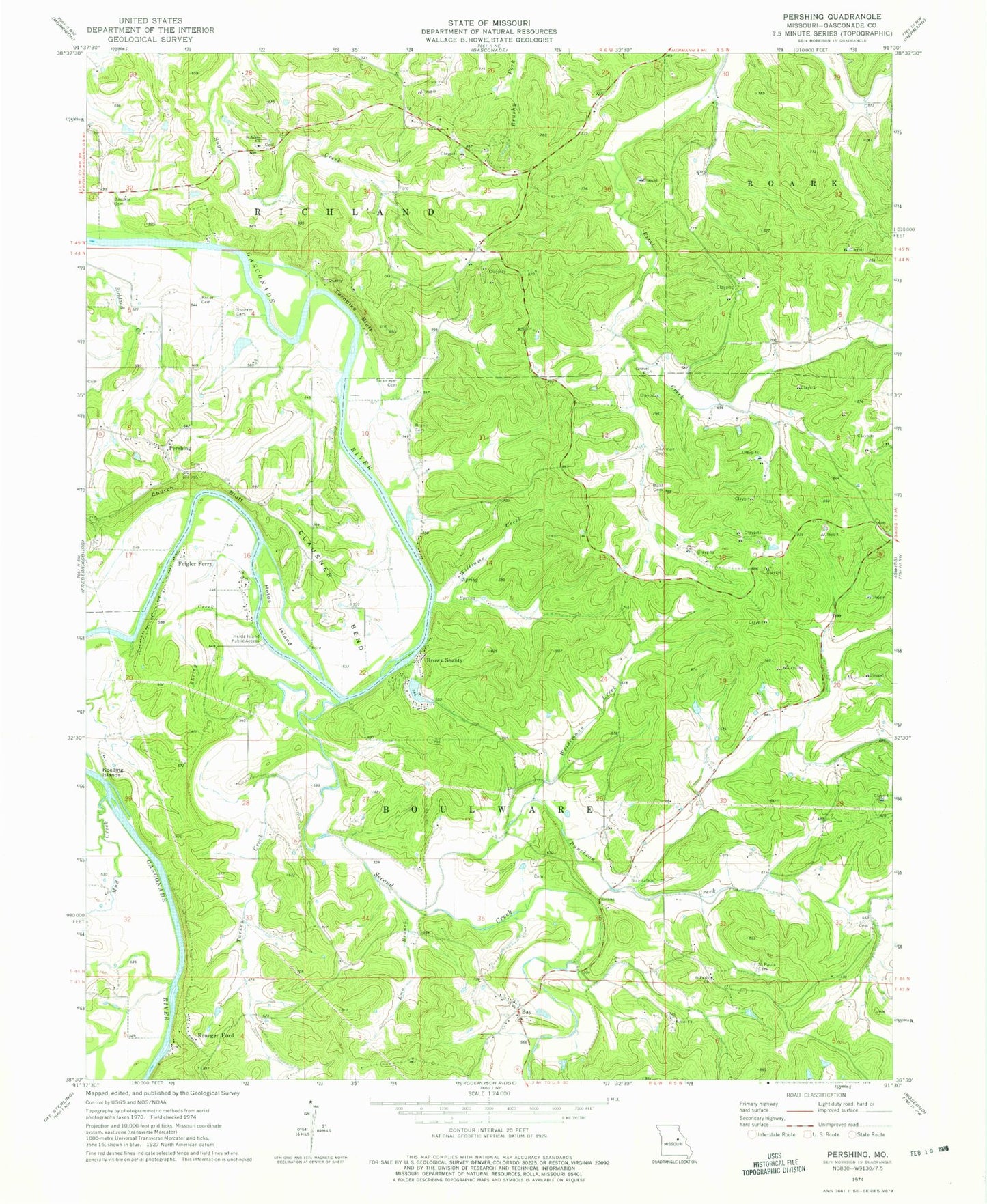
Classic USGS Pershing Missouri 7.5'x7.5' Topo Map
Couldn't load pickup availability
Historical USGS topographic quad map of Pershing in the state of Missouri. Map scale may vary for some years, but is generally around 1:24,000. Print size is approximately 24" x 27"
This quadrangle is in the following counties: Gasconade.
The map contains contour lines, roads, rivers, towns, and lakes. Printed on high-quality waterproof paper with UV fade-resistant inks, and shipped rolled.
Contains the following named places: Ahring Creek, Baecker Cemetery, Bay, Bethel Church, Bickmeyer Cemetery, Bohl Cemetery, Brant Cemetery, Brown Shanty, Brown Shanty Ferry, Brown Shanty Lake, Brown Shanty Lake Dam, Church Bluff, Clausner Bend, Eikerman Cemetery, Emo Branch, Feigler Ferry, Harring Lake Dam, Helds Island, Helds Island Public Access, Hoppe School, Keller Cemetery, Krueger Ford, Lost Hill School, Miller Farm Airport, Mud Creek, Number 75 Lake, Pershing, Pershing Farms Dam, Puncheon Creek, Saint Johns Church, Saint Pauls Cemetery, Saint Pauls Church, Second Creek, Spohrer Cemetery, Stoenner School, Stolpe School, Township of Boulware, Turkey Creek, Turnpike Bluff, Upper First Creek School, Weidemann Creek, Weidemann School, Williams Creek