MyTopo
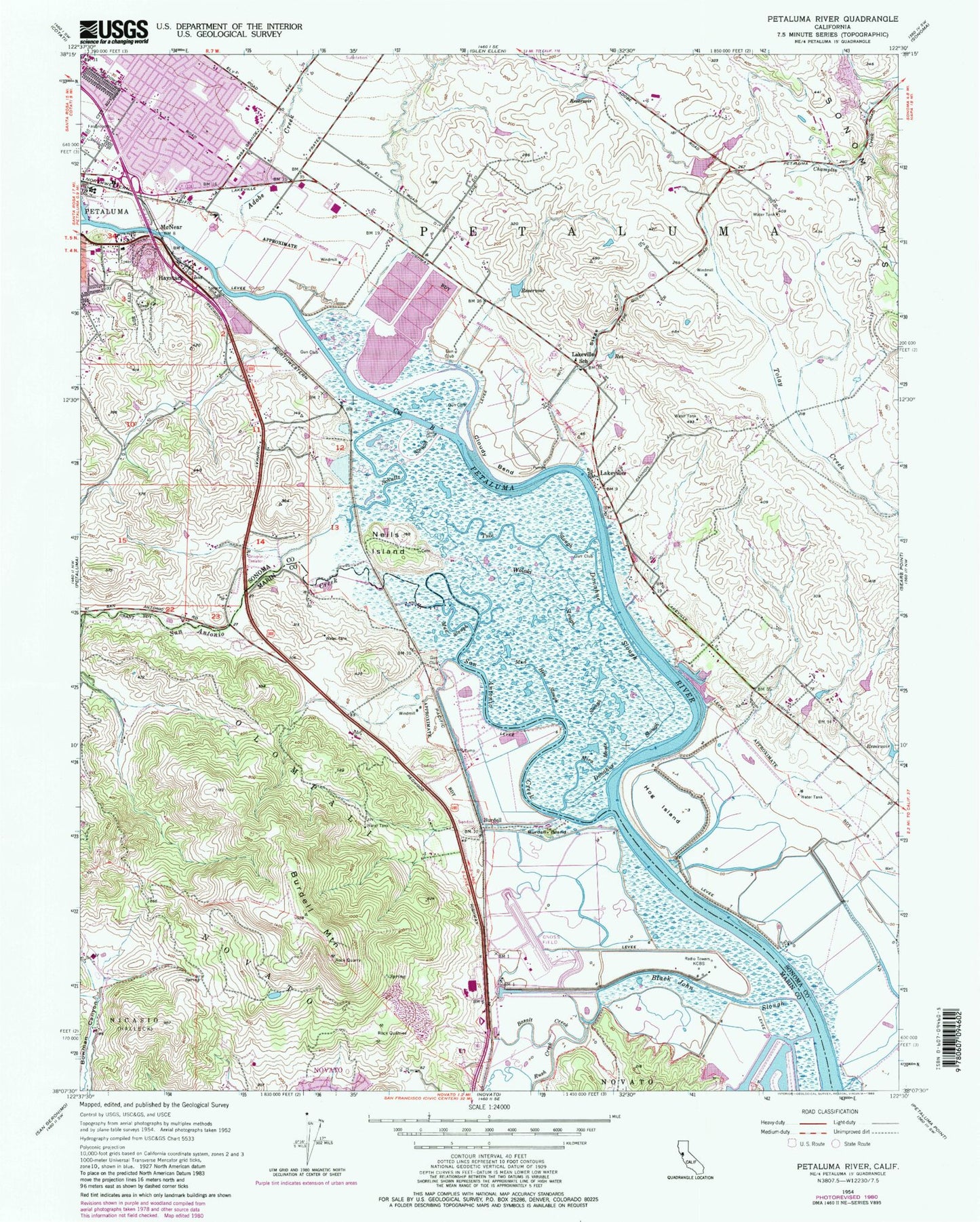
Classic USGS Petaluma River California 7.5'x7.5' Topo Map
Couldn't load pickup availability
Historical USGS topographic quad map of Petaluma River in the state of California. Typical map scale is 1:24,000, but may vary for certain years, if available. Print size: 24" x 27"
This quadrangle is in the following counties: Marin, Sonoma.
The map contains contour lines, roads, rivers, towns, and lakes. Printed on high-quality waterproof paper with UV fade-resistant inks, and shipped rolled.
Contains the following named places: Adobe Creek, Basalt Creek, Black John Slough, Burdell Island, Burdell Mountain, Cloudy Bend, Cut B, Donahue Slough, Hog Island, Lakeville School, Mira Slough, Mud Hen Slough, Mud Slough, Neils Island, Olompali, Rush Creek, Schultz Slough, Stage Gulch, Tule Slough, Woloki Slough, San Antonio Creek, San Antonio, Haystack Landing, Gnoss Field, Mazza Airport (historical), Burdell, Haystack, Lakeville, McNear, Pinheiro 3429 Dam, KTOB-AM (Petaluma), KCBS-AM (San Francisco), Olompali School (historical), Donahue (historical), Eureka School (historical), False Bay (historical), Lake School (historical), San Antonio School (historical), Harvest Christian School, Adobe Creek Golf and Country Club, Cader Business Park, Casa Grande High School, Crinella Park, Del Oro Park, Gateway Plaza Shopping Center, La Tercera Elementary School, La Tercera Park, Lakeville Business Park, Marina Business Park, McDowell Elementary School, McDowell Park, Miwok Park, Miwok Valley Elementary Charter School, Neighborhood Church of the Christian and Missionary Alliance, Oakmead North-Bay Business Park, Petaluma Golf and Country Club, Washington Square Shopping Center, Mount Burdell Preserve, Partridge Knolls Mini Park, Olompali State Historic Park, Rolling Hills Country Club, Sonoma Mountain High School, Petaluma Fire Department Station 3, San Antonio Volunteer Fire Department Station 1 Headquarters, Lakeville Volunteer Fire Department, Ghilotti Brothers Quarry, Hell's Half Acre Quarry, Bettinelli Dairy