MyTopo
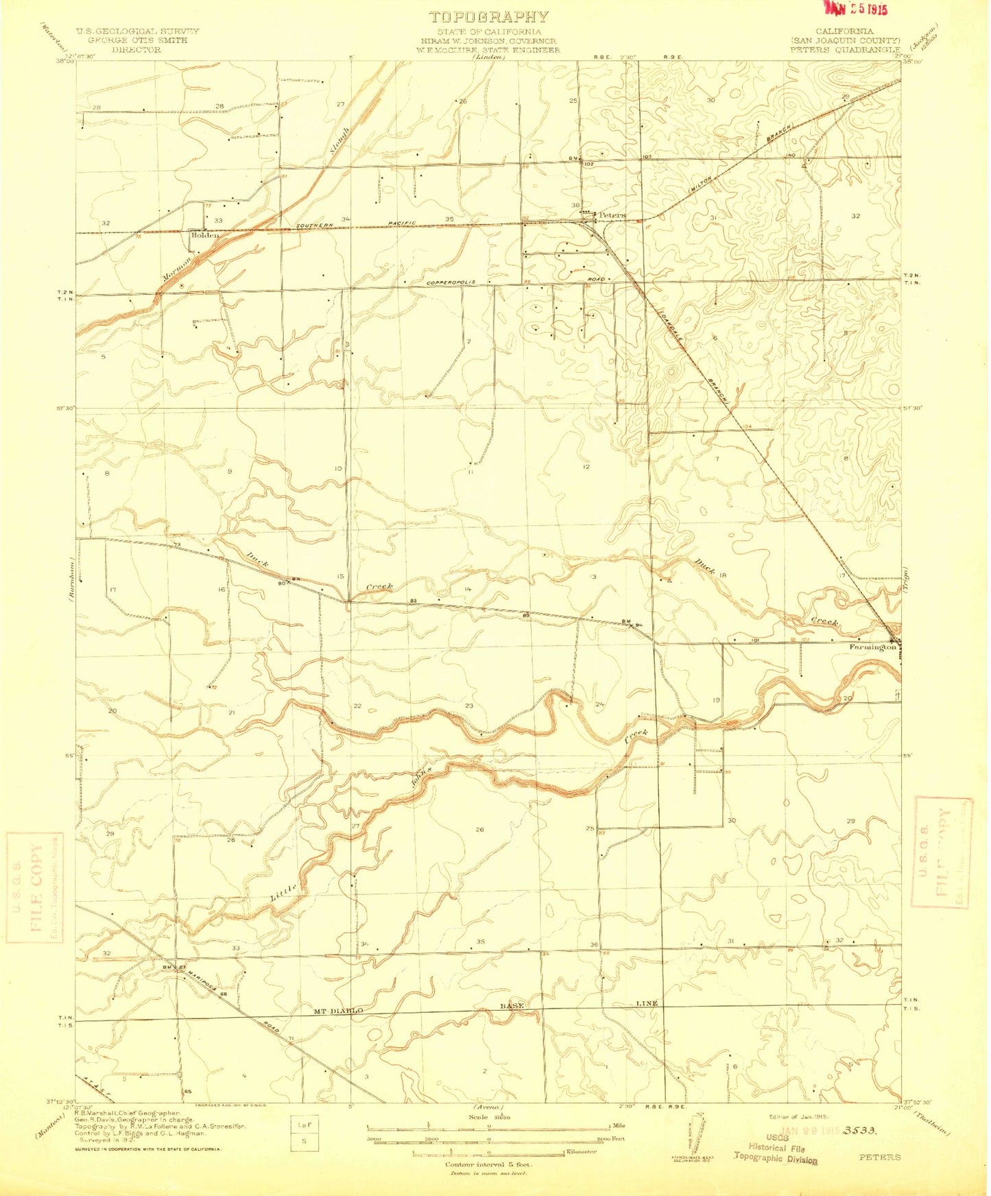
Classic USGS Peters California 7.5'x7.5' Topo Map
Couldn't load pickup availability
Historical USGS topographic quad map of Peters in the state of California. Map scale may vary for some years, but is generally around 1:24,000. Print size is approximately 24" x 27"
This quadrangle is in the following counties: San Joaquin.
The map contains contour lines, roads, rivers, towns, and lakes. Printed on high-quality waterproof paper with UV fade-resistant inks, and shipped rolled.
Contains the following named places: Everett School, Farmington, Farmington Census Designated Place, Farmington Elementary School, Farmington Post Office, Farmington Rural Fire Protection District, Highland View Memorial Gardens, Holden, J-B Airport, Linden-Farmington Division, Peters, Peters Census Designated Place, Weststeyn Dairy Number 2