MyTopo
Classic USGS Petersburg B-2 NE Alaska 7.5'x7.5' Topo Map
Couldn't load pickup availability
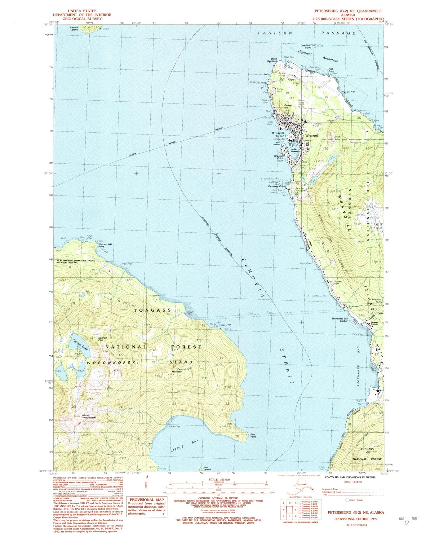
Historical USGS topographic quad map of Petersburg B-2 NE in the state of Alaska. Map scale may vary for some years, but is generally around 1:24,000. Print size is approximately 24" x 27"
This quadrangle is in the following counties: Wrangell.
The map contains contour lines, roads, rivers, towns, and lakes. Printed on high-quality waterproof paper with UV fade-resistant inks, and shipped rolled.
Contains the following named places: Alaska Island Community Services Tideline Clinic, Alaska State Troopers Wrangell, Cemetery Point, Circle Bay, City of Topeka Rock, Deadmans Island, Dewey Hill, East Mountain, East Point, Hat Island, Highfield Anchorage, Institute Creek, KSTK-FM (Wrangell), Mount Woronkofski, Point Highfield, Point Shekesti, Polk Point, Shoemaker Bay, Sunrise Lake, Sunrise Peak, United States Customs and Border Protection Port of Entry Wrangell, Woronkofski Island, Woronkofski Point, Wrangell, Wrangell Airport, Wrangell Alaska Native Village Statistical Area, Wrangell Harbor, Wrangell Institute, Wrangell Lower Dam, Wrangell Lower Reservoir, Wrangell Medical Center, Wrangell Police Department, Wrangell Post Office, Wrangell Public Health Center - Southeast Region, Wrangell Seaplane Base, Wrangell Upper Dam, Wrangell Upper Reservoir, Wrangell Volunteer Fire Department Station 1, Wrangell Volunteer Fire Department Station 2