MyTopo
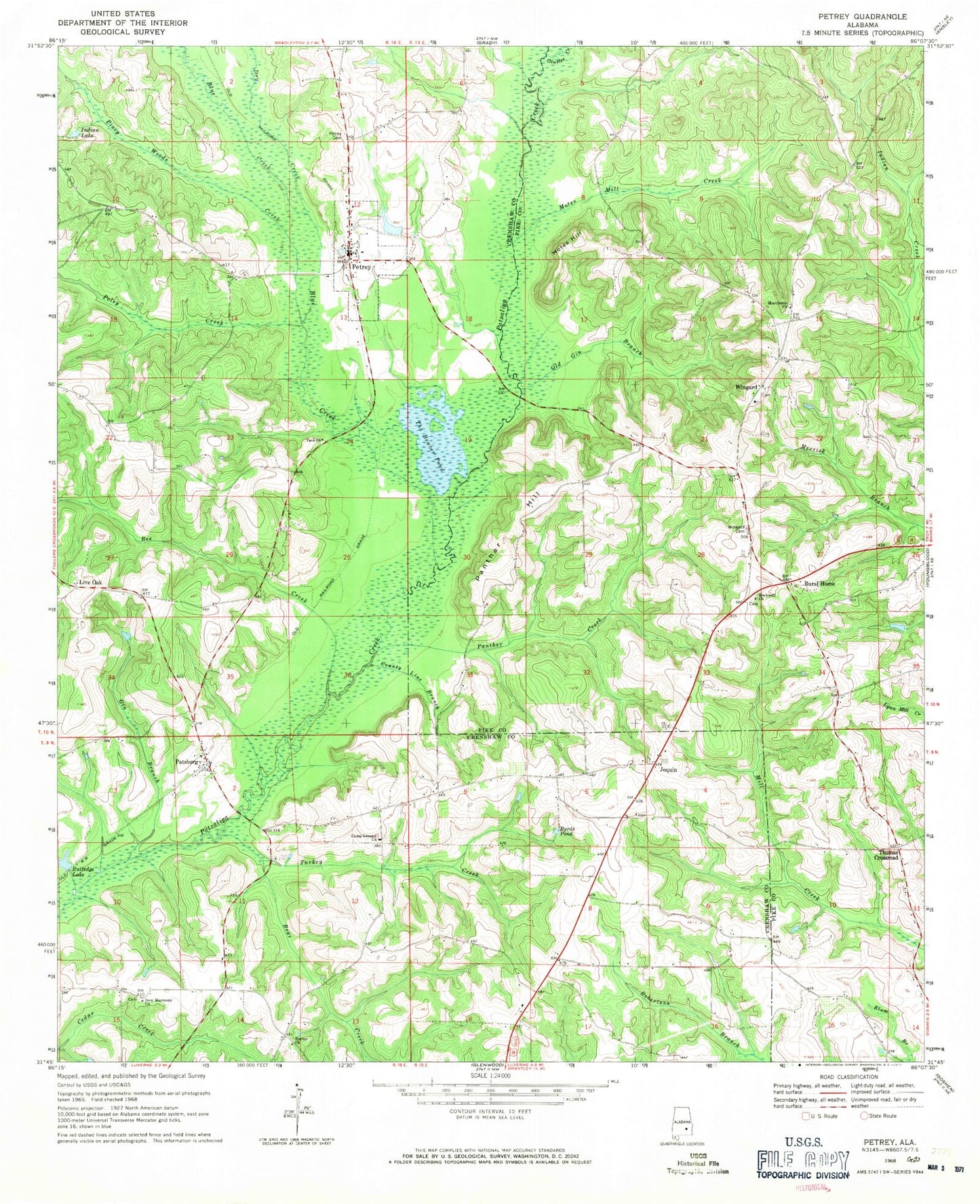
Classic USGS Petrey Alabama 7.5'x7.5' Topo Map
Couldn't load pickup availability
Historical USGS topographic quad map of Petrey in the state of Alabama. Map scale may vary for some years, but is generally around 1:24,000. Print size is approximately 24" x 27"
This quadrangle is in the following counties: Crenshaw, Pike.
The map contains contour lines, roads, rivers, towns, and lakes. Printed on high-quality waterproof paper with UV fade-resistant inks, and shipped rolled.
Contains the following named places: Bear Creek, Bee Creek, Blue Creek, Blue Creek Post Office, Buffs Store, Byrds Pond, Camp Ground Church, Chapel Hill Cemetery, County Line Branch, Darien Church, Davis, Dry Creek, Dyers Bridge, Gin Branch, Green Store, Head Cemetery, Indian Lake, Joquin, Joquin Church, Joquin School, Live Oak, Macedonia Cemetery, Macedonia Church, Mitchell Store, Motes Hill, Motes Mill Creek, Mount Zion Missionary Baptist Church, New Harmony Church, Nichols Store, Northeast Crensahw Volunteer Fire Department, Oak Bluff School, Old Gin Branch, Olustee Creek, Panther Creek, Panther Hill, Patsburg, Patsburg Church, Patsburg Post Office, Petrey, Petrey Cemetery, Piney Woods Creek, Poley Creek, Rockwell Church, Rural Home, Slaughter Mill, Stephens Cemetery, Tank Church, The Beaver Pond, Thomas Crossroad, Town of Petrey, Turkey Creek, Wingard, Wingard Bridge, Wingard Cemetery, ZIP Code: 36035