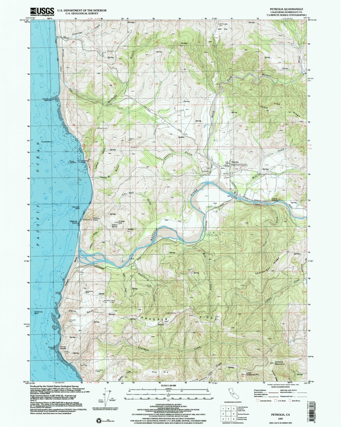
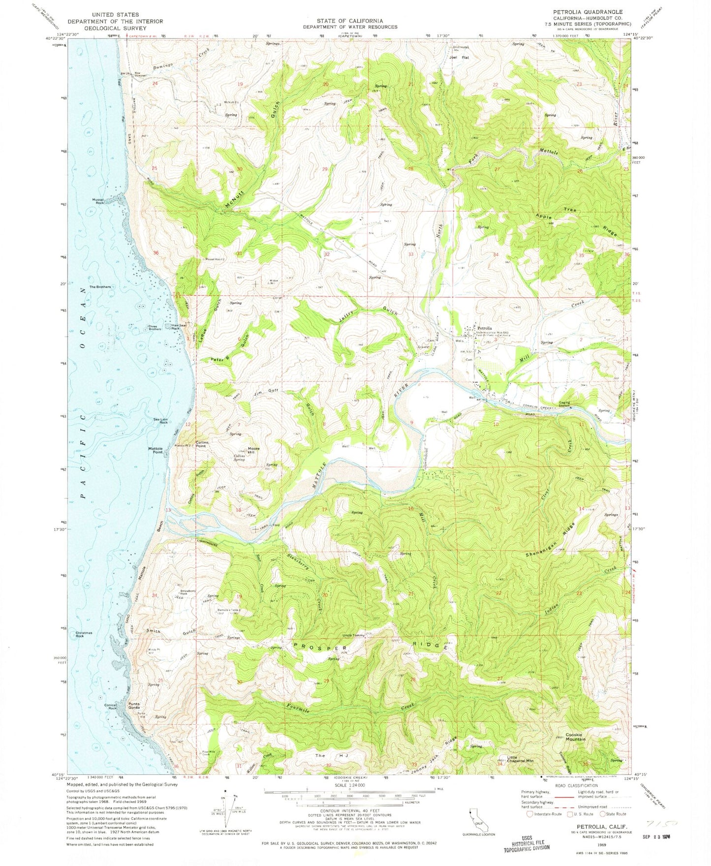
MyTopo
Classic USGS Petrolia California 7.5'x7.5' Topo Map
Couldn't load pickup availability
Historical USGS topographic quad map of Petrolia in the state of California. Typical map scale is 1:24,000, but may vary for certain years, if available. Print size: 24" x 27"
This quadrangle is in the following counties: Humboldt.
The map contains contour lines, roads, rivers, towns, and lakes. Printed on high-quality waterproof paper with UV fade-resistant inks, and shipped rolled.
Contains the following named places: Apple Tree Ridge, Bear Creek, Christmas Rock, Clear Creek, Collins Gulch, Collins Point, Collins Spring, Conical Rock, Cooskie Mountain, Cooskie Ridge, Domingo Creek, Fourmile Creek, Hair Seal Rock, Jeffry Gulch, Jim Goff Gulch, Joel Flat, Johnny Jack Ridge, La Rue Gulch, Little Chaparral Mountain, Mattole Beach, Mattole Point, Mattole River, McNutt Gulch, Mill Creek, Mill Creek, Moore Hill, Mussel Rock, North Fork Mattole River, Peter Gulch, Punta Gorda, Shenanigan Ridge, Smith Gulch, East Branch North Fork Mattole River, Stansberry Creek, Strawberry Rock, The Brothers, The H J, Three Brothers, Uncle Tommy, Sea Lion Rock, State Historical Monument 543 First Oil Field, Prosper Ridge, Petrolia, Mattole Elementary School, Petrolia Volunteer Fire Department, Prosper Ridge Volunteer Fire Department, Petrolia Cemetery, Petrolia Post Office