
MyTopo
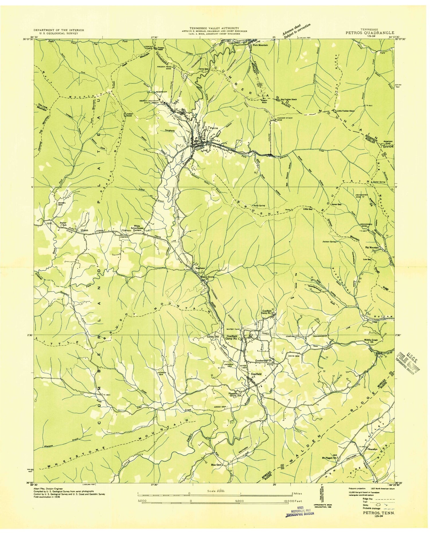
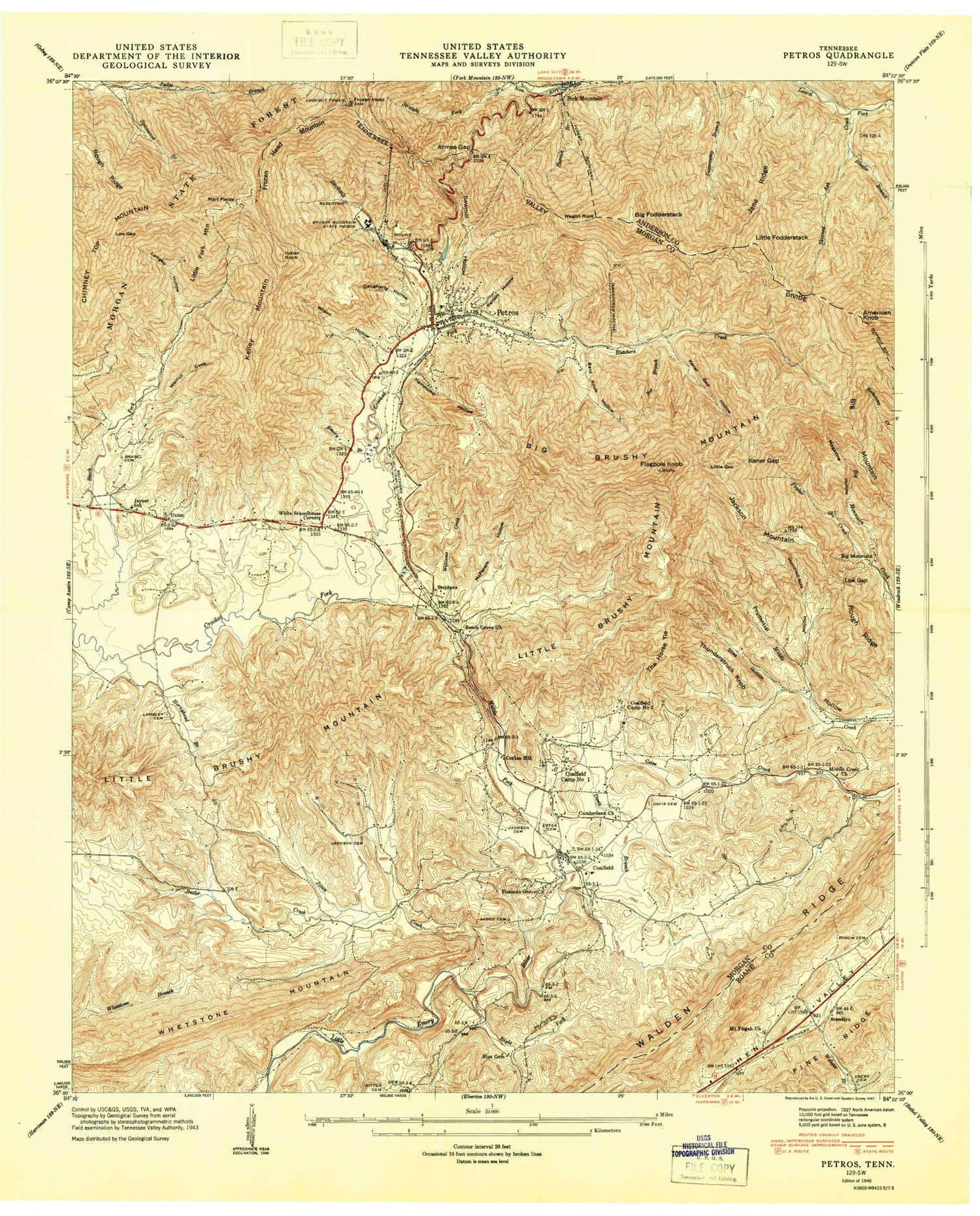
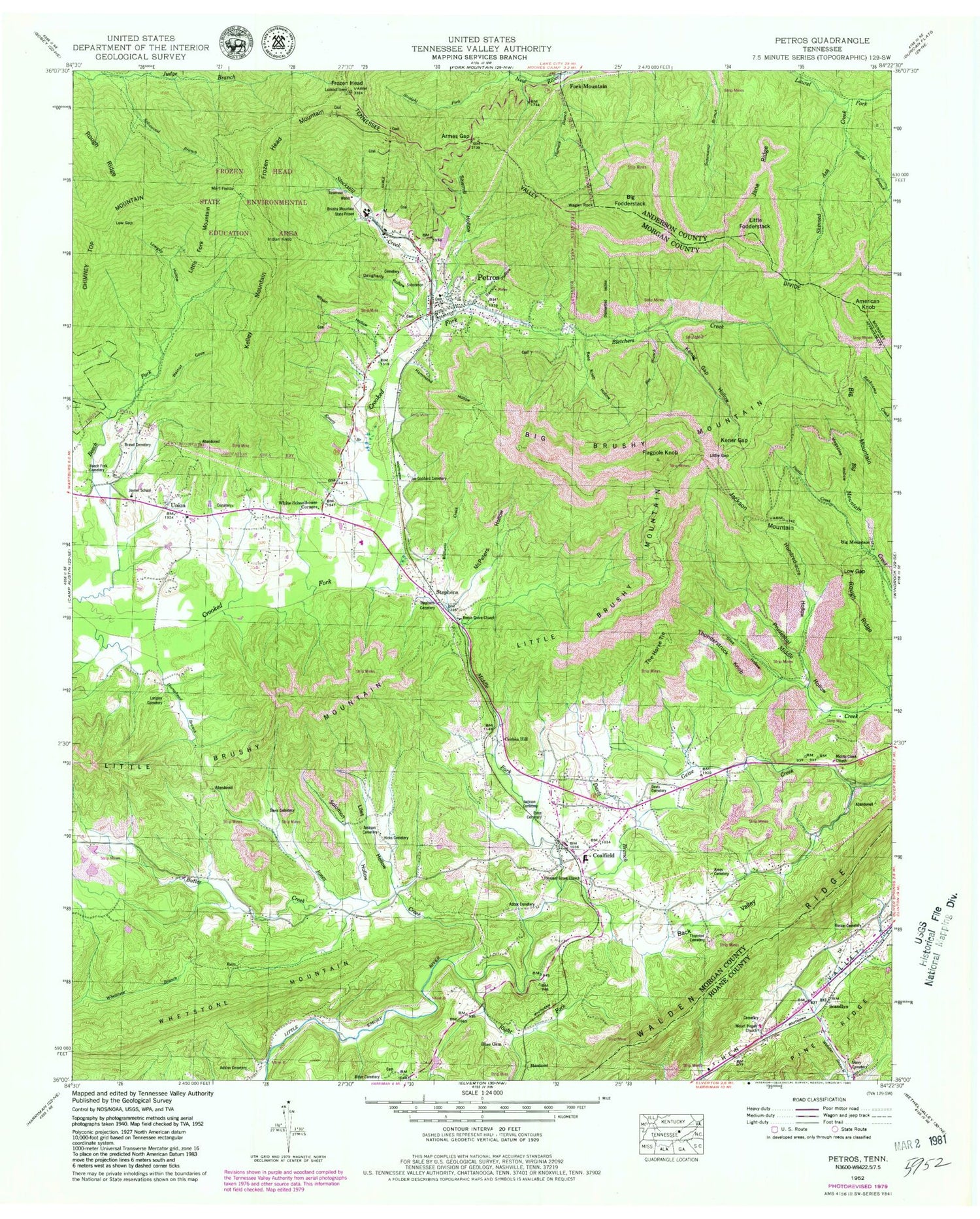
USGS Classic Petros Tennessee 7.5'x7.5' Topo Map
Couldn't load pickup availability
Historical USGS topographic quad map of Petros in the state of Tennessee. Scale: 1:24000. Print size: 24" x 27"
This quadrangle is in the following counties: Anderson, Morgan, Roane.
The map contains contour lines, roads, rivers, towns, lakes, and grids including latitude / longitude and UTM / MGRS. Printed on high-quality waterproof paper with UV fade-resistant inks.
Contains the following named places: Rough Ridge, Silas Hollow, Solomon Hollow, South Fork Geise Creek, Stephens, Stephens Cemetery, Stockstill Creek, Straight Fork, The Horse Tie, Thornton Cemetery, Thunderstruck Knob, Union, Usery Cemetery, Wagon Rock, Walnut Cove, Whetstone Mountain, White Schoolhouse Corners, Williams Creek, Wilson Hollow, American Knob, Bald Knob Hollow, Bee Branch, Beech Fork Cemetery, Beech Grove Church, Big Mountain, Bletchers Creek, Bluefer Branch, Borum Cemetery, Brasel Cemetery, Chimney Top Mountain, Corbin Hill, Cumberland Church, Daugherty Hollow, Davis Branch, Davis Cemetery, Emory Branch, Estes Cemetery, Flagpole Knob, Flatrock Branch, Frozen Head, Frozen Head Mountain, Hammond Hollow, Hicks Cemetery, Hornyhead Branch, Hundred-acre Hollow, Indian Knob, Jackson Cemetery, Jackson Mountain, Jane Ridge, Joe Goddard Cemetery, Jones Creek, Kelly Mountain, Kener Gap, Kener Gap Hollow, Langley Cemetery, Liles Hollow, Little Brushy Mountain, Little Fodderstack, Little Fork Mountain, Little Gap, Low Gap, Low Gap, Lowgap Hollow, Magazine Hollow, Mart Fields, McPeters Hollow, Middle Creek Church, Middle Fork Little Emory River, Petros, Pleasant Grove Baptist Church, Poplar Creek, Rankin Hollow, Right Fork Little Emory River, Ritter Cemetery, Sawmill Hollow, Brushy Mountain Reservoir Dam, Brushy Mountain Reservoir, Skinned Ash Creek, Spicewood Branch, Adcox Cemetery, Adkins Plot, Amos Cemetery, Armes Gap, Back Valley, Big Brushy Mountain, Big Fodderstack, Big Mountain, Brushy Mountain State Prison, Butler Creek, Coalfield, Davis Cemetery, Jackson Cemetery, Mount Pisgah Church, Allen Joyner Mine, Bee Branch Hollow, Brushy Mountain Number 3 Mine, Brushy Mountain Number 7 Mine, Carter Spring, Coalfield Camp Number 1 (historical), Coalfield Camp Number 2 (historical), Crookedfork (historical), Cumberland Church (historical), Frozen Head Mine, Hammond Hollow Branch, Jackson Spring, North Spring, Whetstone (historical), Scandlyn, Mount Pisgah Cemetery, Petros High School, Petros First Baptist Church, Beech Fork Baptist Church, Brushy Mountain Prison Cemetery, Petros Cemetery, Petros Cemetery, Pleasant Grove School (historical), Union Cemetery, Woods Cemetery, Adcock Hollow, Gooch Hollow, Russell Hollow, Union Baptist Church, Walls Hollow, Petros Joyner Elementary School, Coalfield High School, Coalfield Division (historical), Coalfield Post Office, Cofer and Tedder Jellico Mine, Petros Post Office, Commissioner District 1, Commissioner District 6, Coalfield Census Designated Place, Petros Census Designated Place, Joyner Volunteer Fire Department, Coalfield Volunteer Fire Department, Petros Volunteer Fire Department, Flatrock Falls


