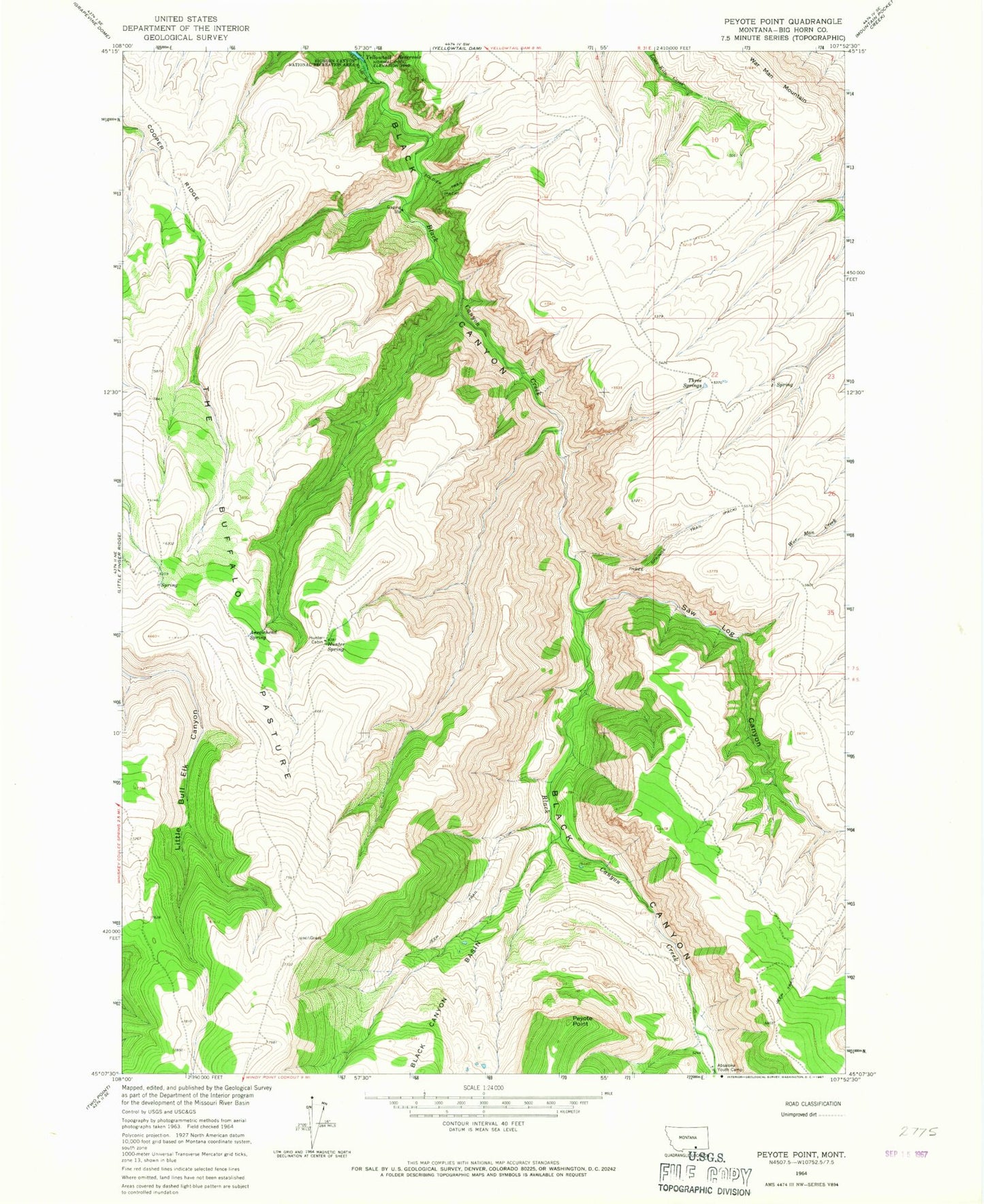
MyTopo
Classic USGS Peyote Point Montana 7.5'x7.5' Topo Map
Regular price
$16.95
Regular price
Sale price
$16.95
Unit price
per
Couldn't load pickup availability
Historical USGS topographic quad map of Peyote Point in the state of Montana. Map scale may vary for some years, but is generally around 1:24,000. Print size is approximately 24" x 27"
This quadrangle is in the following counties: Big Horn.
The map contains contour lines, roads, rivers, towns, and lakes. Printed on high-quality waterproof paper with UV fade-resistant inks, and shipped rolled.
Contains the following named places: Absaloka Youth Camp, Arrowhead Spring, Black Canyon Creek, Cooper Ridge, Hunter Cabin, Hunter Spring, Peyote Point, Saw Log Canyon, Soldier Trail, The Buffalo Pasture, Three Springs, Three Springs Trail