MyTopo
Classic USGS Pfeiffer Point California 7.5'x7.5' Topo Map
Couldn't load pickup availability
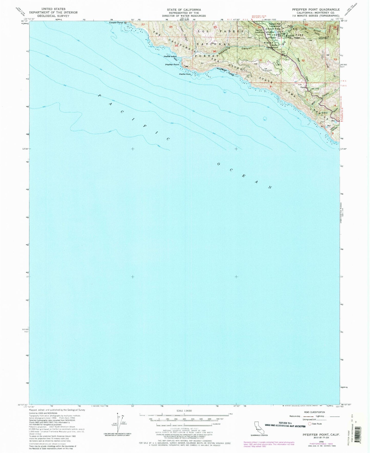
Historical USGS topographic quad map of Pfeiffer Point in the state of California. Map scale may vary for some years, but is generally around 1:24,000. Print size is approximately 24" x 27"
This quadrangle is in the following counties: Monterey.
The map contains contour lines, roads, rivers, towns, and lakes. Printed on high-quality waterproof paper with UV fade-resistant inks, and shipped rolled.
Contains the following named places: Big Sur Guard Station, Big Sur Post Office, Big Sur Volunteer Fire Brigade Station 1 Post Ranch, Buzzards Roost, Castro Canyon, Cooper Point, Gorge Trail, Graves Canyon, Majestic School, Mount Manuel Trail, Mule Canyon Creek, P B S S P South Campground, Pfeiffer Beach, Pfeiffer Beach Recreation Site, Pfeiffer Big Sur State Park, Pfeiffer Gulch, Pfeiffer Point, Pfeiffer Rock, Pfeiffer School, Post Creek, Posts, Sawmill Flat Campground, Sycamore Canyon, Westmed Ambulance Unit 24, Weyland Camp, Wreck Beach