MyTopo
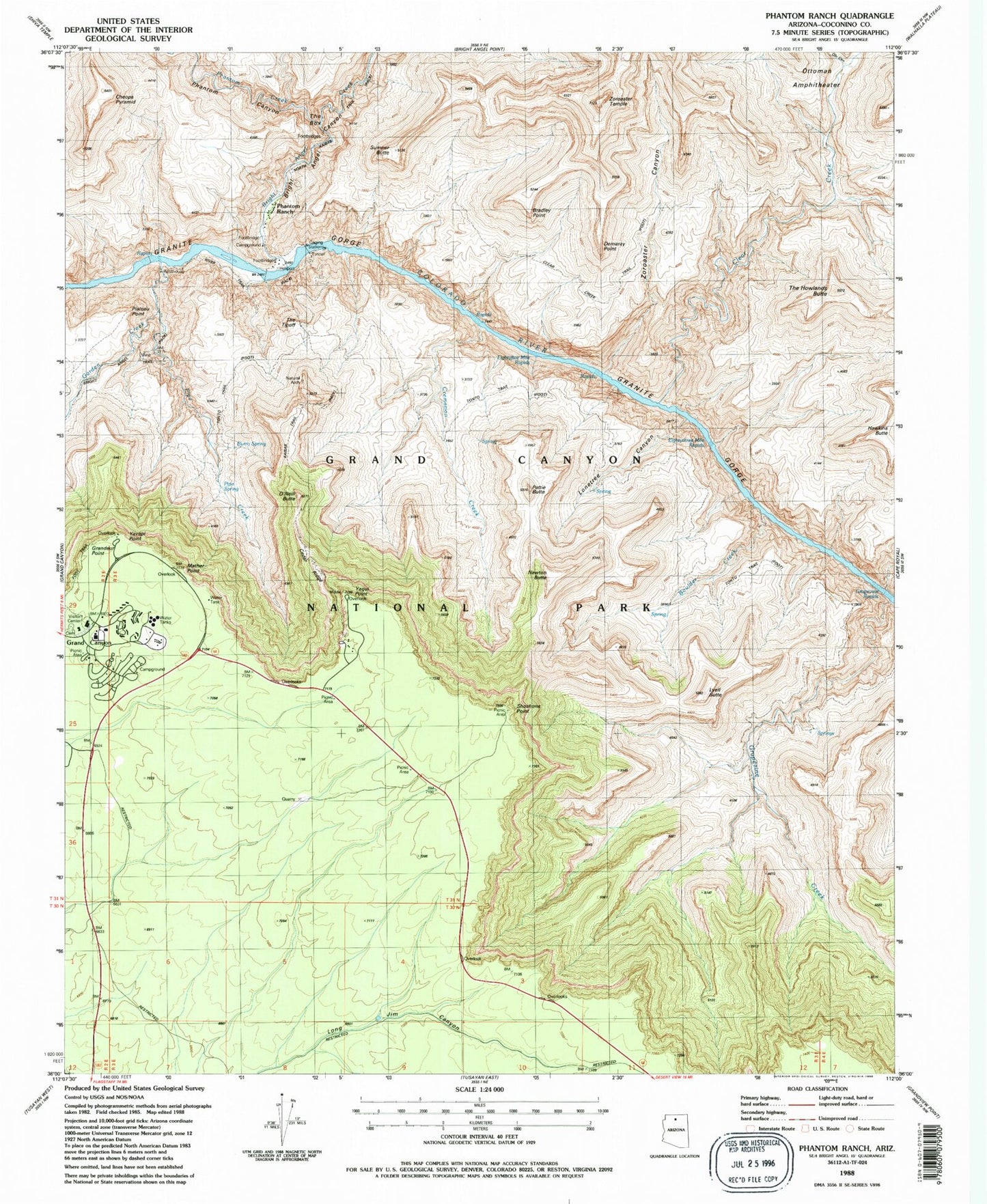
USGS Classic Phantom Ranch Arizona 7.5'x7.5' Topo Map
Couldn't load pickup availability
Historical USGS topographic quad map of Phantom Ranch in the state of Arizona. Scale: 1:24000. Print size: 24" x 27"
This quadrangle is in the following counties: Coconino.
The map contains contour lines, roads, rivers, towns, lakes, and grids including latitude / longitude and UTM / MGRS. Printed on high-quality waterproof paper with UV fade-resistant inks.
Contains the following named places: Boulder Creek, Bradley Point, Bright Angel Canyon, Bright Angel Creek, Burro Spring, Cedar Ridge, Cheops Pyramid, Clear Creek, Clear Creek Trail, Cremation Creek, Demaray Point, Eightythree Mile Rapids, Garden Creek, Grandeur Point, Grapevine Creek, Grapevine Rapids, Hawkins Butte, Indian Garden, Lonetree Canyon, Lyell Butte, Mather Point, Newton Butte, O'Neill Butte, Obi Canyon, Ottoman Amphitheater, Pattie Butte, Phantom Creek, Phantom Ranch, Pipe Creek, Pipe Spring, Plateau Point, River Trail, Shoshone Point, South Entrance Station, The Box, The Howlands Butte, The Tipoff, Yaki Point, Yavapai Point, Zoroaster Canyon, Zoroaster Temple, Grand Canyon National Park Visitor Center, Phantom Canyon, Suspension Bridge Campground, Visitor Center Campground, Eightyfive Mile Rapids, Holloway Tank, Sumner Point, South Kaibab Trail, Phantom Ranger Station, Berry Butte, Kaibab Suspension Bridge, Silver Bridge, Natural Arch, Grand Canyon Post Office