MyTopo
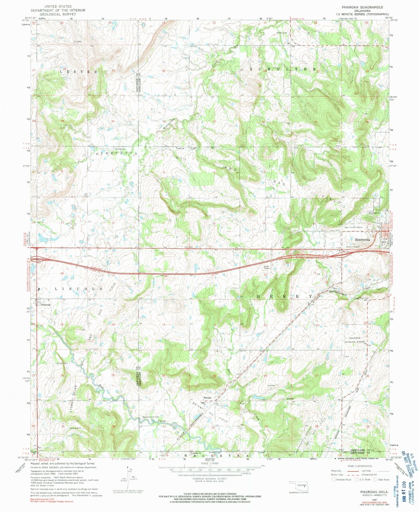
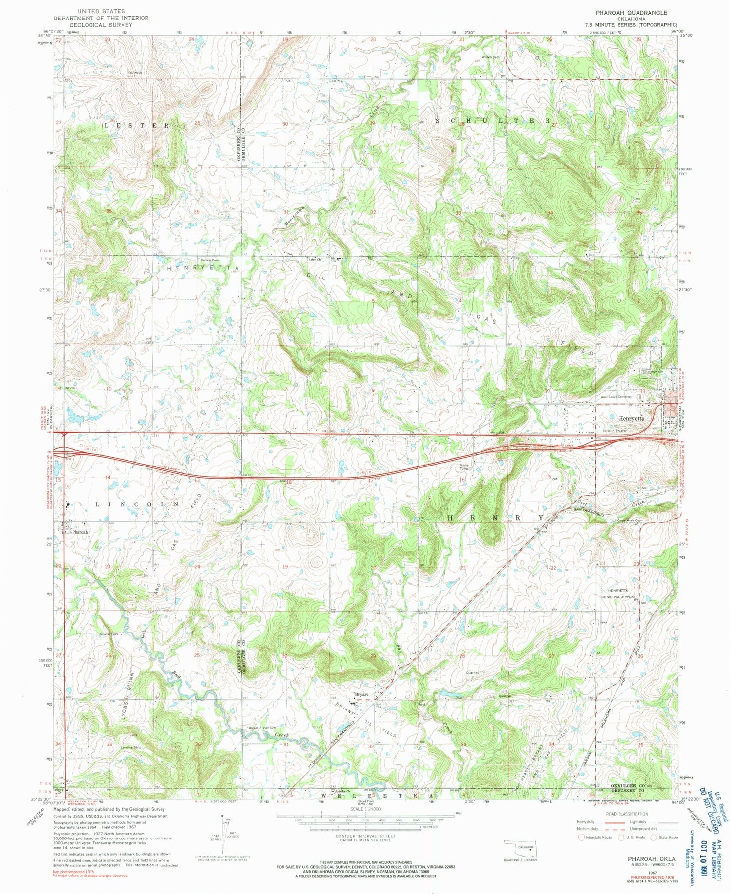
Classic USGS Pharoah Oklahoma 7.5'x7.5' Topo Map
Couldn't load pickup availability
Historical USGS topographic quad map of Pharoah in the state of Oklahoma. Map scale may vary for some years, but is generally around 1:24,000. Print size is approximately 24" x 27"
This quadrangle is in the following counties: Okfuskee, Okmulgee.
The map contains contour lines, roads, rivers, towns, and lakes. Printed on high-quality waterproof paper with UV fade-resistant inks, and shipped rolled.
Contains the following named places: Allen Church, Arbeka Cemetery, Arbeka Church, Aztec Church, Barnet - Fisher Cemetery, Bryant, Bryant Census Designated Place, Bryant Oil Field, Creek Mine Cemetery, Henryetta Elementary School, Henryetta High School, Henryetta Medical Center, Henryetta Middle School, Henryetta Municipal Airport, Henryetta Oil and Gas Field, Likowski Cemetery, Lyons-Quinn Oil and Gas Field, Oknoname 107029 Dam, Oknoname 107029 Reservoir, Oknoname 111033 Dam, Oknoname 111033 Reservoir, Oknoname 111034 Dam, Oknoname 111034 Reservoir, Oknoname 111035 Dam, Oknoname 111035 Reservoir, Oknoname 111036 Dam, Oknoname 111036 Reservoir, Oknoname 111044 Dam, Oknoname 111044 Reservoir, Oknoname 111046 Dam, Oknoname 111046 Reservoir, Oknoname 111047 Dam, Oknoname 111047 Reservoir, Oknoname 111051 Dam, Oknoname 111051 Reservoir, Oknoname 111052 Dam, Oknoname 111052 Reservoir, Oknoname 111054 Dam, Oknoname 111054 Reservoir, Pharoah, Plainview Volunteer Fire Department, Renkie Cemetery, Southeast Bryant Oil and Gas Field, West Lawn Cemetery, Wilson Cemetery, ZIP Code: 74880