MyTopo
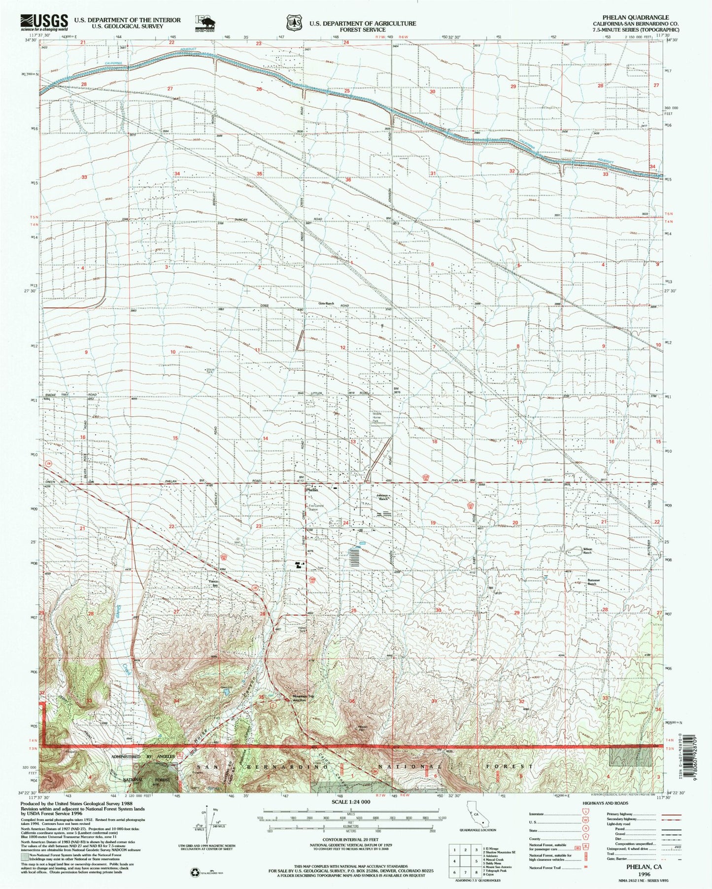
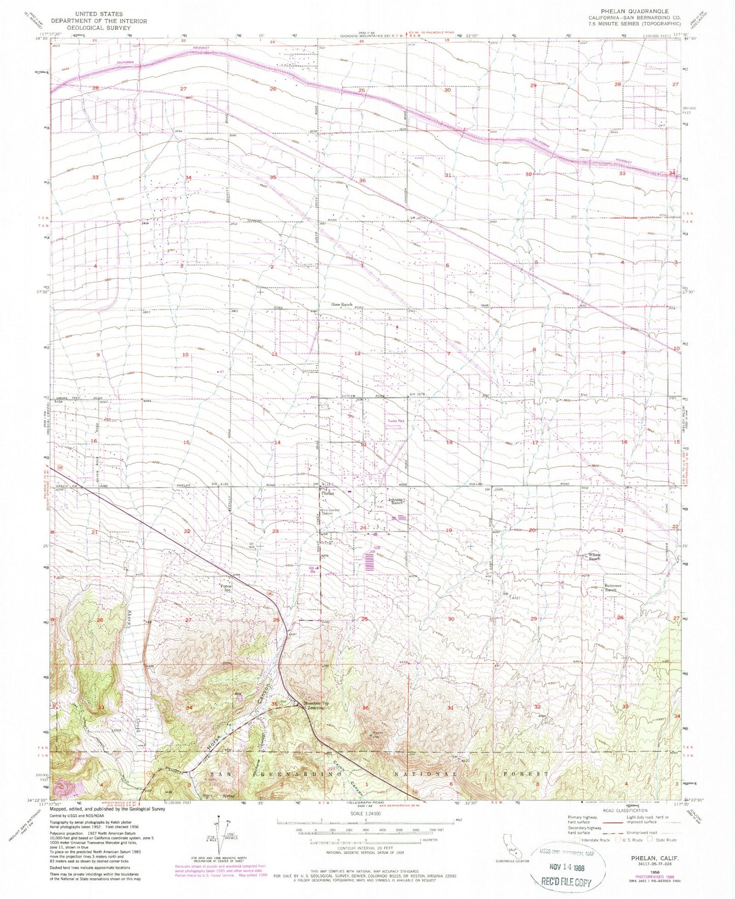
Classic USGS Phelan California 7.5'x7.5' Topo Map
Couldn't load pickup availability
Historical USGS topographic quad map of Phelan in the state of California. Typical map scale is 1:24,000, but may vary for certain years, if available. Print size: 24" x 27"
This quadrangle is in the following counties: San Bernardino.
The map contains contour lines, roads, rivers, towns, and lakes. Printed on high-quality waterproof paper with UV fade-resistant inks, and shipped rolled.
Contains the following named places: Buttemer Ranch, Goss Ranch, Horse Canyon, Johnson Ranch, Phelan, Sheep Creek, Wildhorse Canyon, Wilson Ranch, Mountain Top Junction, Yucca Inn, Chaparral High School, Deer Haven, Phelan Elementary School, Phelan Post Office, Phelan Village Shopping Center, Pinon Mesa Middle School, Serrano High School, Wildhorse Canyon, Phelan Census Designated Place, Pinon Hills Census Designated Place, California Department of Forestry and Fire Protection Station 10 Phelan, San Bernardino County Fire Department Station 10 Phelan, San Bernardino County Sheriff's Department Phelan Substation