MyTopo
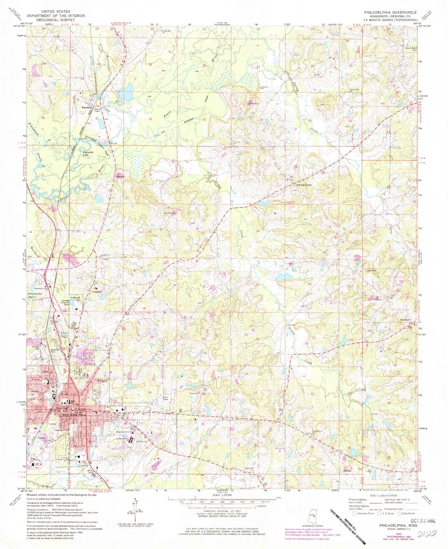
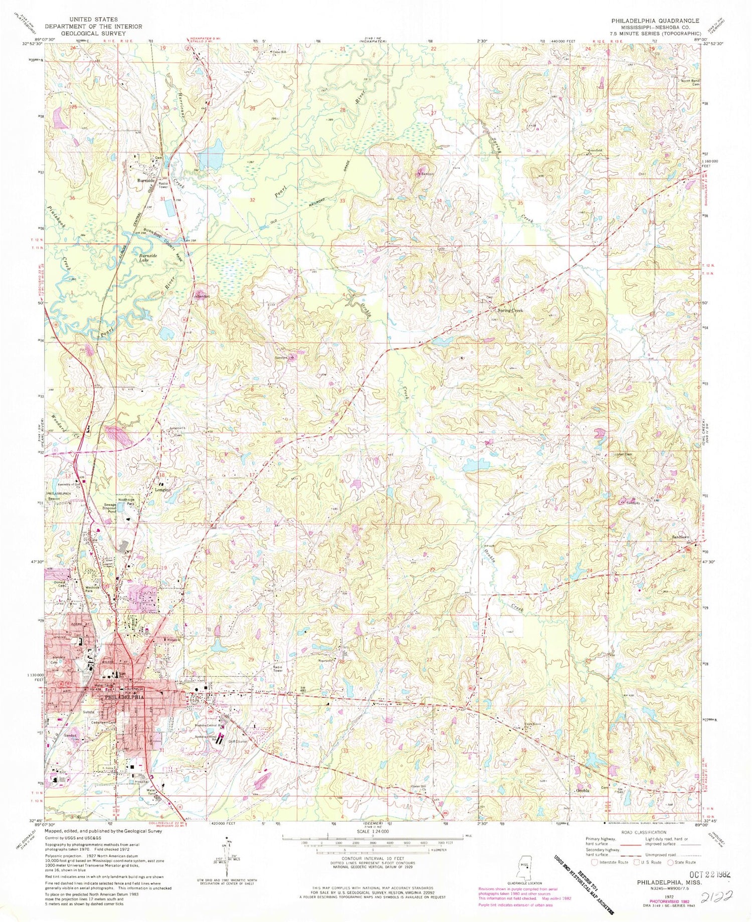
Classic USGS Philadelphia Mississippi 7.5'x7.5' Topo Map
Couldn't load pickup availability
Historical USGS topographic quad map of Philadelphia in the state of Mississippi. Map scale may vary for some years, but is generally around 1:24,000. Print size is approximately 24" x 27"
This quadrangle is in the following counties: Neshoba.
The map contains contour lines, roads, rivers, towns, and lakes. Printed on high-quality waterproof paper with UV fade-resistant inks, and shipped rolled.
Contains the following named places: Barrett Field, Big Lake, Burnside, Burnside County Park, Burnside Lake, Cedar Hill Church, Cedarlawn Cemetery, Center Hill Church, City of Philadelphia, Colonel Eubanks Lake Dam, Country Club Lake Dam, Dewitt-Deweese Memorial Park, Donald Cemetery, East Neshoba Volunteer Fire Department Station 2, East Philadelphia Baptist Church, First Assembly of God Church, First Baptist Church, First Church of God, First Presbyterian Church, First United Methodist Church, Greenfield Church, Holy Cross Catholic School, Hopewell Cemetery, Hopewell Church, Hurricane Creek, Jack Weatherford Lake Dam, Jayroe Farm, John Morrow Lake Dam, Jones Cemetery, Longino, Longino Central Volunteer Fire Department, Longino Church, Lunebuoshah, Marshall Lake Dam, Mrs Jesse Cox Lake Dam, Nash Mills, Neshoba Central Elementary School, Neshoba Central High School, Neshoba County, Neshoba County Courthouse, Neshoba General Hospital, North Bend Cemetery, North Bend Volunteer Fire Department Station 2, North Calvary Baptist Church, Northside Park, Ocobla, Ocobla Creek, Ocopla Baptist Church, Pearl Harrison Lake Dam, Philadelphia, Philadelphia Cemetery, Philadelphia Church of Christ, Philadelphia Church of God, Philadelphia City Hall, Philadelphia Elementary School, Philadelphia Fire Department Station 1 Headquarters, Philadelphia Fire Department Station 2, Philadelphia Fire Department Station 3, Philadelphia High School, Philadelphia Municipal Airport, Philadelphia Police Department, Philadelphia Post Office, Philadelphia-Neshoba County Industrial Park, Philadelphia-Neshoba County Public Library, Philadelphia-Neshoba County Vocational Technical School, Pinishook Creek, Pioneer Academy, Q Copeland Lake Dam, Ross Ferry, Saint Francis Episcopal Church, Sandtown, Sandtown Cemetery, Sandtown United Methodist Church, Schekaha, Spring Creek, Spring Creek Baptist Church, Stevens Chapel United Methodist Church, Supervisor District 2, T Cook Pond Dam, Trinity Baptist Church, Union Grove Church, Valley View Shopping Center, Weatherford Lake Dam, Westside Park, Yates Lake Dam


