MyTopo
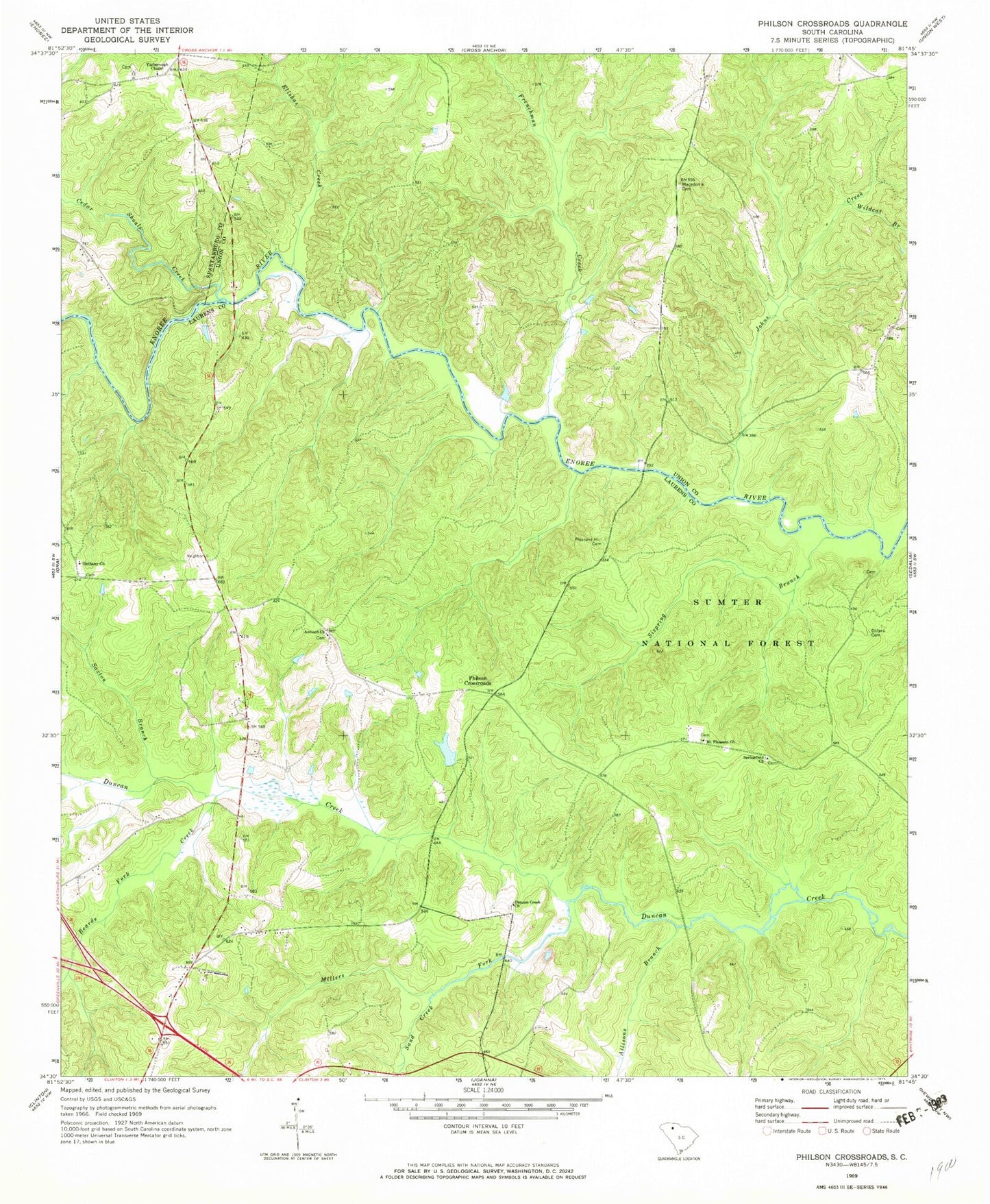
Classic USGS Philson Crossroads South Carolina 7.5'x7.5' Topo Map
Couldn't load pickup availability
Historical USGS topographic quad map of Philson Crossroads in the state of South Carolina. Map scale may vary for some years, but is generally around 1:24,000. Print size is approximately 24" x 27"
This quadrangle is in the following counties: Laurens, Spartanburg, Union.
The map contains contour lines, roads, rivers, towns, and lakes. Printed on high-quality waterproof paper with UV fade-resistant inks, and shipped rolled.
Contains the following named places: Allisons Branch, Antioch Church, Antioch School, Beards Fork Creek, Bethany Cemetery, Bethany Church, Birds Mountain, Bobo Cemetery, Brownings Creek, Cecils Incorporated Pond, Cecils Incorporated Pond Dam D-2996, Cedar Shoals Creek, Clinton Division, Dillard Cemetery, Dodds Branch, Duncan Creek Cemetery, Duncan Creek Church, Duncan Creek WCD Dam Number 10 D-2997, Elishas Creek, Fosters Mill, Frenchman Creek, Garretts Mill, Gordons Mill, Gordons Mill Falls, Harold Branch, Heads Ford, Huntington, Joens Ford, Johns Creek, Johns Creek Bridge, Jones Bridge, Laurens County Fire Department Renno Station 3, Macedonia Cemetery, Macedonia Church, Macedonia School, Millers Fork, Mount Pleasant Cemetery, Mount Pleasant Church, Mount Pleasant School, Musgrove Bridge, Musgrove Ford, Musgrove Mill, Musgrove School, Philson Crossroads, Philson Crossroads Rifle Range, Pleasant Hill Baptist Church, Pleasant Hill Cemetery, Rickels Branch, Sand Creek, Saxton Branch, Shiloh Cemetery, Sispring Branch, Springfield Cemetery, Springfield Church, Wildcat Branch, Yarboroughs Chapel United Methodist Church, Yarboroughs Chapel United Methodist Church Graveyard