MyTopo
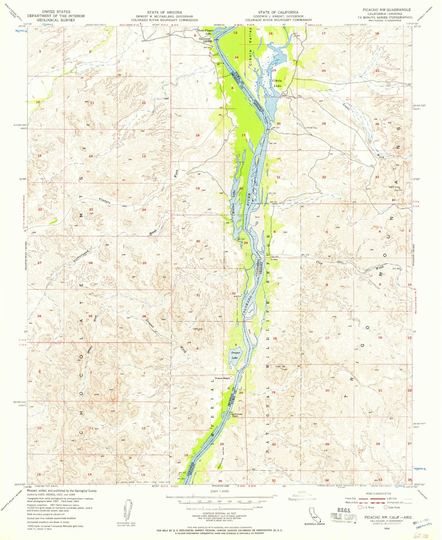
Classic USGS Picacho NW California 7.5'x7.5' Topo Map
Couldn't load pickup availability
Historical USGS topographic quad map of Picacho NW in the states of California, Arizona. Map scale may vary for some years, but is generally around 1:24,000. Print size is approximately 24" x 27"
This quadrangle is in the following counties: Imperial, La Paz.
The map contains contour lines, roads, rivers, towns, and lakes. Printed on high-quality waterproof paper with UV fade-resistant inks, and shipped rolled.
Contains the following named places: Arrowweed Spring, Cibola Camp, Cibola Lake, Cibola Valley, Clip Mill, Clip Wash, Draper Lake, Draper Ranch, Draper Wash, Gilmores Camp, Lighthouse Rock, Lopez Wash, Paymaster Landing, Perphery Gate, Turnaround Wash, Vinagre Wash, Walker Lake, Walters Camp, Walter's Camp Airport