MyTopo
Classic USGS Picacho SW California 7.5'x7.5' Topo Map
Couldn't load pickup availability
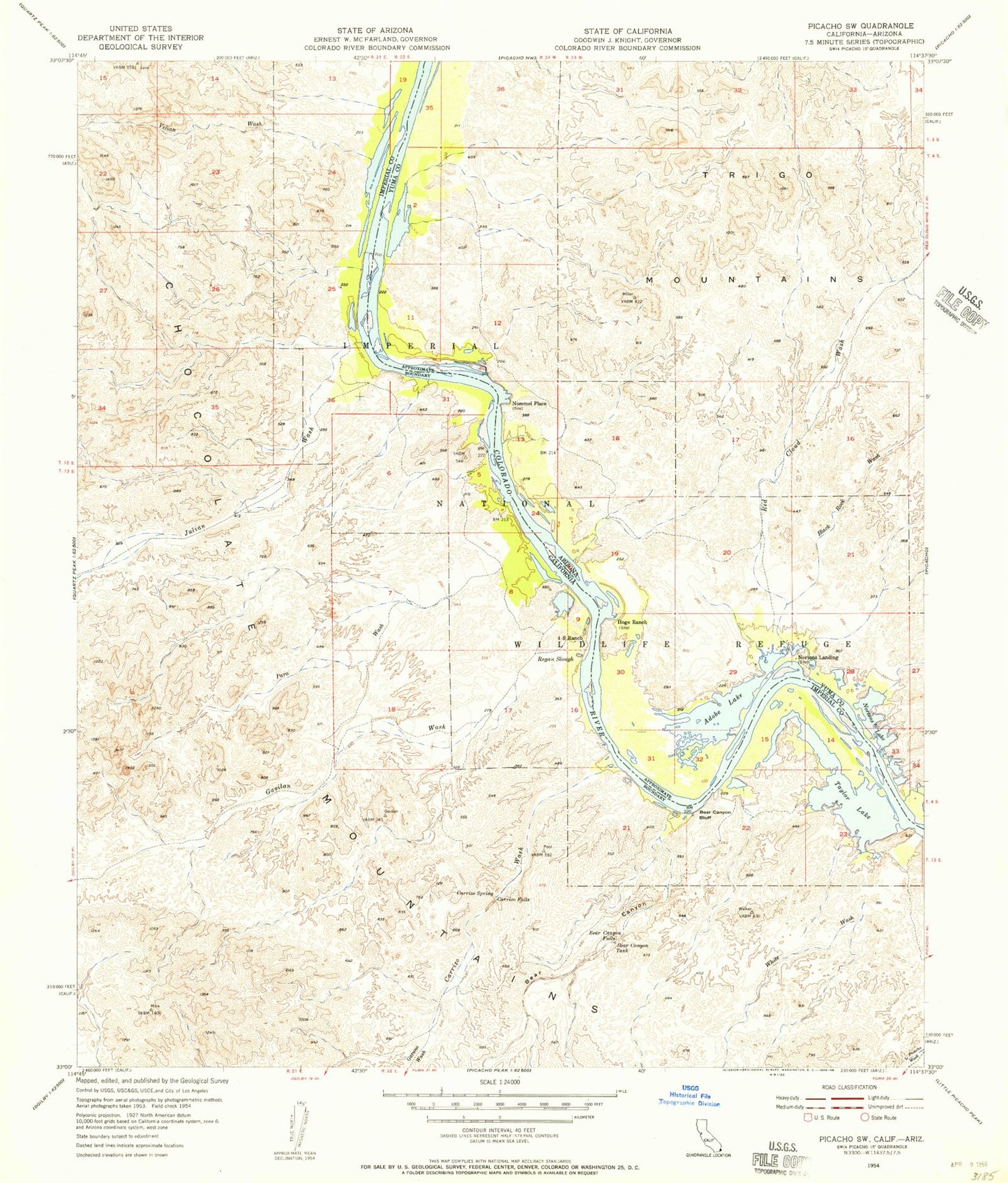
Historical USGS topographic quad map of Picacho SW in the states of California, Arizona. Typical map scale is 1:24,000, but may vary for certain years, if available. Print size: 24" x 27"
This quadrangle is in the following counties: Imperial, La Paz.
The map contains contour lines, roads, rivers, towns, and lakes. Printed on high-quality waterproof paper with UV fade-resistant inks, and shipped rolled.
Contains the following named places: Bear Canyon, Bear Canyon Bluff, Bear Canyon Falls, Bear Canyon Tank, Carrizo Falls, Carrizo Spring, Carrizo Wash, Four-S Ranch, Gatuna Wash, Gavilan Wash, Imperial National Wildlife Refuge, Julian Wash, Para Wash, Picacho State Recreation Area, Regan Slough, Taylor Lake, Velian Wash, White Wash, Hoge Ferry (historical), Carrizo Wash Boat-in Camp, Paddlewheeler Boat-in Camp, Taylor Lake Boat-in Camp, Taylor Lake Overlook, Picacho Peak Wilderness, Adobe Lake, Black Rock Wash, Hoge Ranch, Nortons Lake, Paradise Valley, Red Cloud Wash, Nommel Place, Nortons Landing, Cowbell Lake