MyTopo
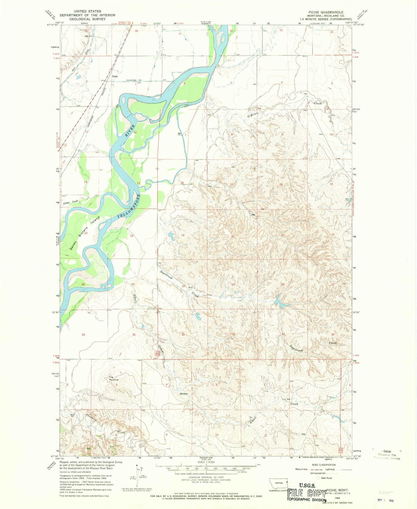
Classic USGS Piche Montana 7.5'x7.5' Topo Map
Couldn't load pickup availability
Historical USGS topographic quad map of Piche in the state of Montana. Map scale may vary for some years, but is generally around 1:24,000. Print size is approximately 24" x 27"
This quadrangle is in the following counties: Richland.
The map contains contour lines, roads, rivers, towns, and lakes. Printed on high-quality waterproof paper with UV fade-resistant inks, and shipped rolled.
Contains the following named places: 20N59E03DBA_01 Well, 20N59E04DDDB01 Well, 20N59E08BC__01 Well, 20N59E11BDC_01 Well, 21N58E01AA__01 Well, 21N58E02AD__01 Well, 21N58E02DD__01 Well, 21N58E11BB__01 Well, 21N58E11BD__01 Well, 21N58E11DC__01 Well, 21N58E14BB__01 Well, 21N58E14DB__01 Well, 21N59E03CC__01 Well, 21N59E08AA__01 Well, 21N59E08BB__01 Well, 21N59E08BCD_01 Well, 21N59E08DB__01 Well, 21N59E15DDBA01 Well, 21N59E18CD__01 Well, 21N59E20AAAC01 Well, 21N59E22DDC_01 Well, 21N59E30BBCA01 Well, 21N59E33DBBB01 Well, 22N58E36DD__01 Well, 22N58E36DDD_01 Well, 22N59E31CB__01 Well, 22N59E31CC__01 Well, 22N59E31DD__01 Well, 22N59E32CD__01 Well, 22N59E32DA__01 Well, 22N59E32DD__01 Well, 22N59E34CA__01 Well, 22N59E34CB__01 Well, 59217, Alkali Creek, Buella Island, Coal Bank Slough, Crane Creek, Diamond Island, Hastetter Number 1 Dam, Hastetter Number 2 Dam, Main Canal, O'Brien Creek, Piche, Sagebrush Creek, Seven Sisters Fishing Access Site, Seven Sisters Island, The Pyramid