MyTopo
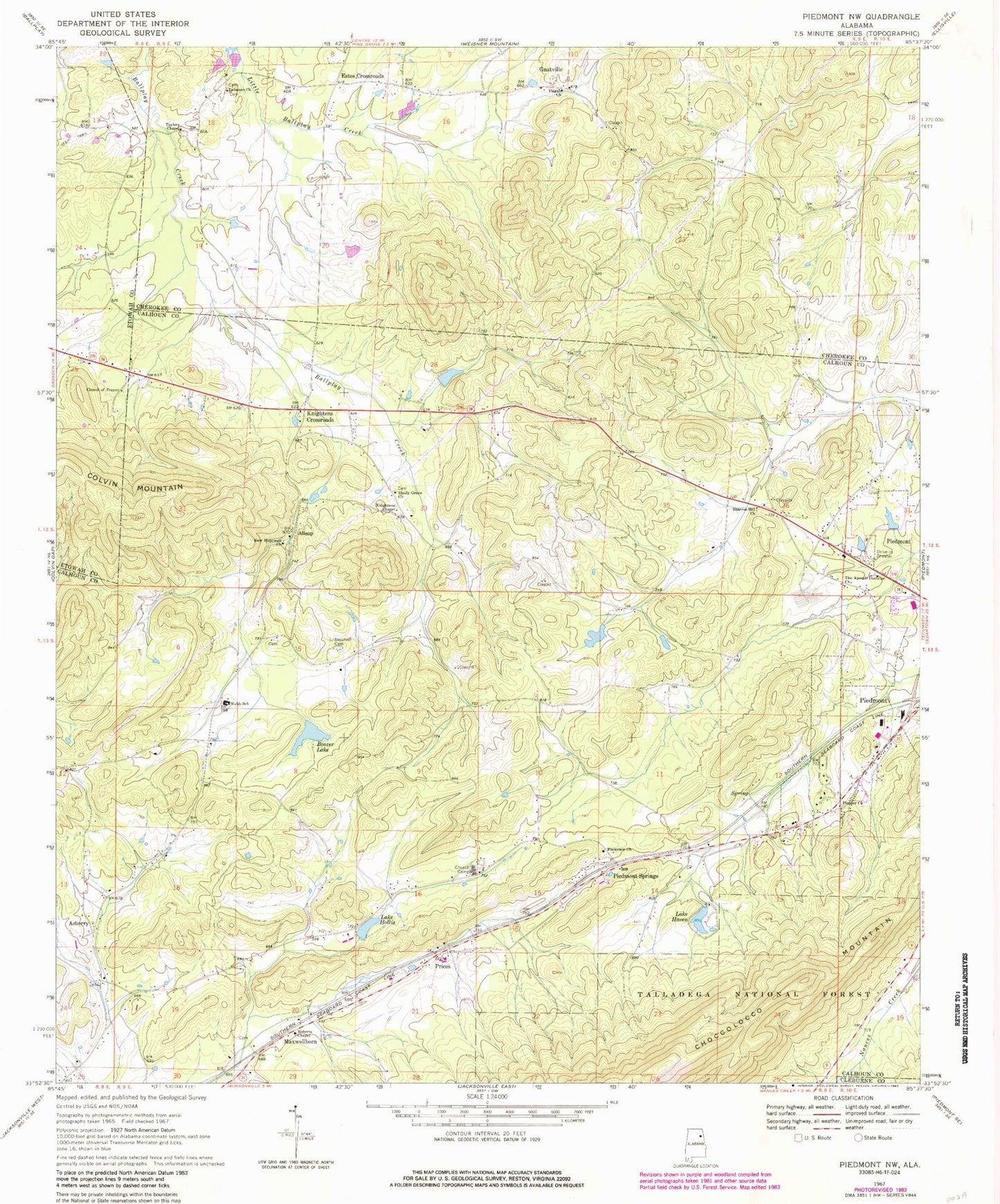
Classic USGS Piedmont NW Alabama 7.5'x7.5' Topo Map
Couldn't load pickup availability
Historical USGS topographic quad map of Piedmont NW in the state of Alabama. Map scale may vary for some years, but is generally around 1:24,000. Print size is approximately 24" x 27"
This quadrangle is in the following counties: Calhoun, Cherokee, Cleburne, Etowah.
The map contains contour lines, roads, rivers, towns, and lakes. Printed on high-quality waterproof paper with UV fade-resistant inks, and shipped rolled.
Contains the following named places: Allsop, Asberry, Asberry Baptist Church, Asberry Methodist Church, Bald Hornet, Big Spring, Big Willow Spring, Boozer Dam, Boozer Lake, Browns School, Cherry Hill, Church of Prayer, Colliers Spring, Collins, Collins Spring, Couch, Estes Crossroads, Gnatville, Haven Dam, Hendon Spring, Hollis Dam, Hopewell Springs, Kearney, Kearney Post Office, Knightens Chapel, Knightens Crossroads, Knightens Crossroads Volunteer Fire Department Station 1, Knightens Crossroads Volunteer Fire Department Station 2, Lake Haven, Lake Hollis, Lake Watson, Lebanon Cemetery, Lebanon Church of Christ, Littlejohn Cemetery, Living Water Church, Maxwellborn, Maxwellborn Spring, Midway, Mill Creek, Millers Poultry Farm Number 1, Morehorn Spring, New Hopewell Baptist Church, Penny Mountain, Piedmont Division, Piedmont Springs, Piedmont Springs Church Camp, Pioneer Church, Pisgah Baptist Church, Pisgah Cemetery, Plainview Congregational Holiness Church, Prices, Rankins Dam, Roberts Chapel, Robertson Spring, Roy Webb, Saddler Mountain, Shady Grove Congregational Methodist Church, Sharon Hill Congregational Holiness Church, Taylors Chapel, Taylors Chapel Cemetery, The Apostle Doctrine Church, Webb School, Zuni, Zuni Post Office, Zuni School