MyTopo
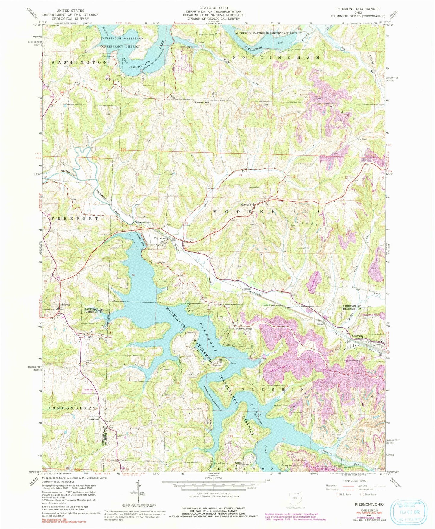
Classic USGS Piedmont Ohio 7.5'x7.5' Topo Map
Couldn't load pickup availability
Historical USGS topographic quad map of Piedmont in the state of Ohio. Typical map scale is 1:24,000, but may vary for certain years, if available. Print size: 24" x 27"
This quadrangle is in the following counties: Belmont, Guernsey, Harrison.
The map contains contour lines, roads, rivers, towns, and lakes. Printed on high-quality waterproof paper with UV fade-resistant inks, and shipped rolled.
Contains the following named places: Piedmont Lake, Camp Presmont, Elk Run, Huff Run, Indian Run, Piedmont Dam, Plum Run, Quaker Cemetery, Rush Run, Stillwater Cemetery, Trail Run, Belmont Ridge, Golda, Holloway, Prospect Hill, Smyrna, Piedmont, East Piedmont, Moorefield, Oakgrove, Sixmile Run, Boggs Fork, Holloway Elementary School (historical), Clendening Lake, Township of Flushing, Township of Moorefield, Belmont Ridge Cemetery, Belmont Ridge Methodist Episcopal Church, Oak Grove Cemetery, Oak Grove Methodist Episcopal Church, Moorefield Methodist Episcopal Cemetery, Smyrna Methodist Episcopal Cemetery, Golda Post Office (historical), Holloway Post Office, Briar Hill Club, Essex Bay, Essex Cove, Goodrich Cottage Area, Harrison County Club, Hazelwood Hill Club, Hidden Ledges Cottage Area, Hilltop Cottage Area, Loghaven, Piedmont Lake Marina, Reynolds Road Cottage Area, Huff Bay, Muskie Bay, Shanty Bay, Oakgrove Post Office (historical), Smyrna Post Office (historical), Moorefield Post Office, Piedmont Post Office, Village of Holloway, Moorefield Township Fire Department, Holloway Volunteer Fire Department Station 26, Briar Hill Farm