
MyTopo
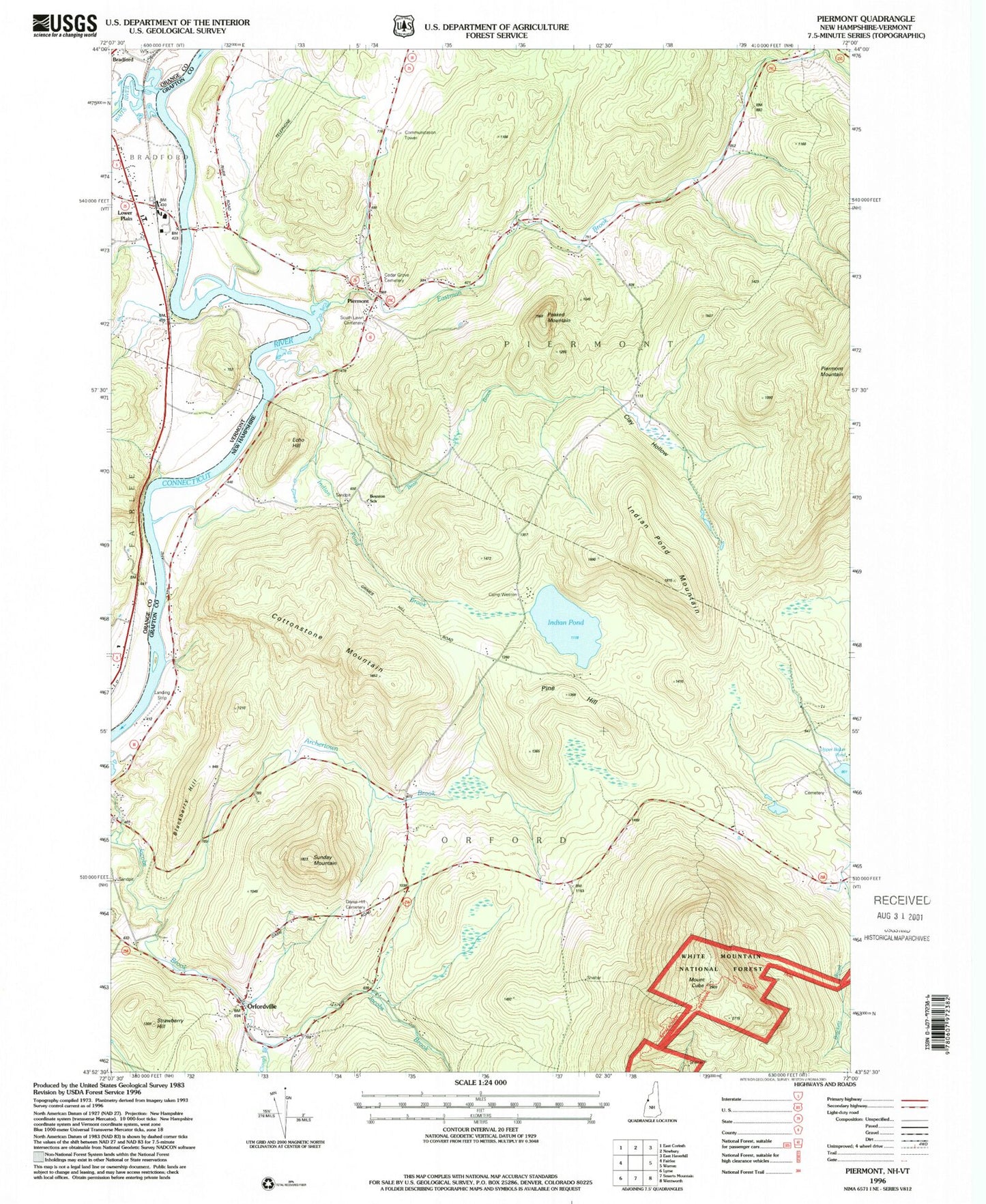
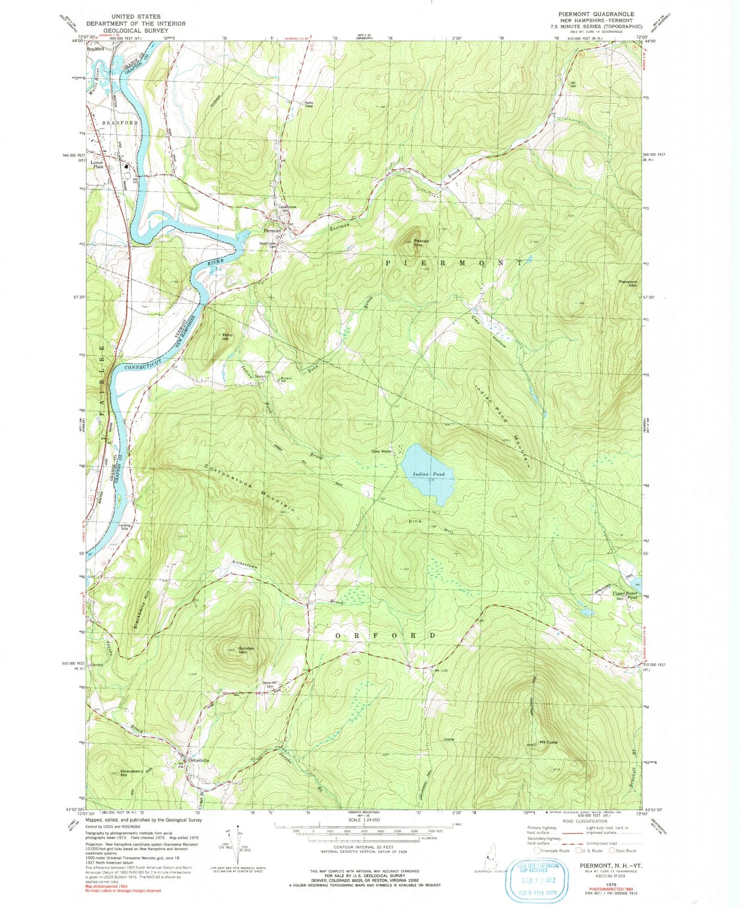
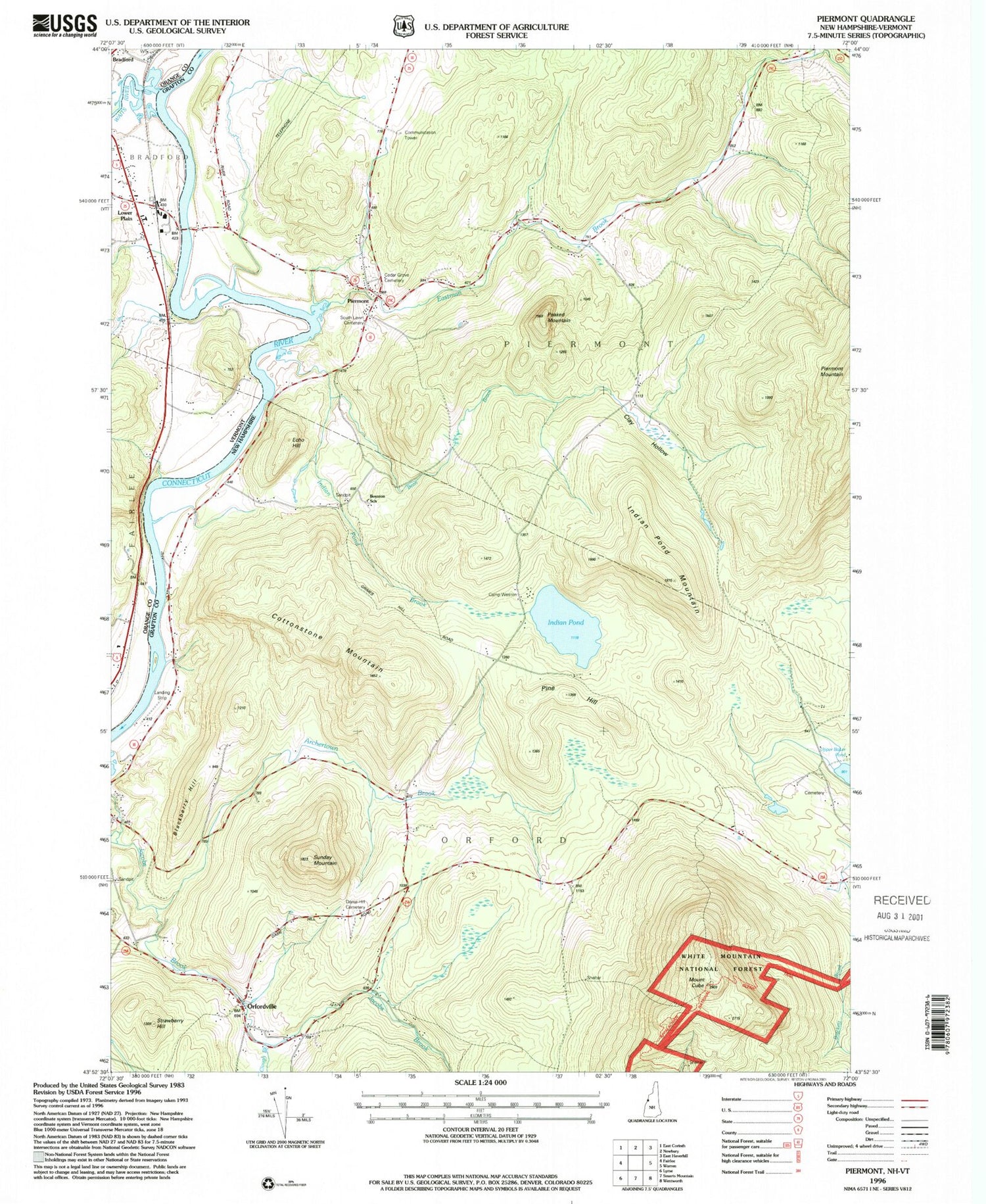
Classic USGS Piermont New Hampshire 7.5'x7.5' Topo Map
Couldn't load pickup availability
Historical USGS topographic quad map of Piermont in the states of New Hampshire, Vermont. Typical map scale is 1:24,000, but may vary for certain years, if available. Print size: 24" x 27"
This quadrangle is in the following counties: Grafton, Orange.
The map contains contour lines, roads, rivers, towns, and lakes. Printed on high-quality waterproof paper with UV fade-resistant inks, and shipped rolled.
Contains the following named places: Archertown Brook, Bean Brook, Blackberry Hill, Boynton School, Camp Weston, Cedar Grove Cemetery, Clay Hollow, Clough Brook, Cottonstone Mountain, Dame Hill, Echo Hill, Grimes Hill Road, Indian Pond, Indian Pond Brook, Indian Pond Mountain, Mount Cube, Orfordville, Peaked Mountain, Piermont, South Lawn Cemetery, Strawberry Hill, Sunday Mountain, Blooms Mountain, Eastman Brook, Town of Orford, Town of Piermont, Dartmouth Outing Club Camp, Mount Cube Ski Touring Center, Piermont Post Office, Piermont Village School, Piermont Fire Department, Piermont First Aid Stabilization Team Squad, Orford Police Department, Lower Plain Piermont Station, Waits River, Bradford Fire Department