MyTopo
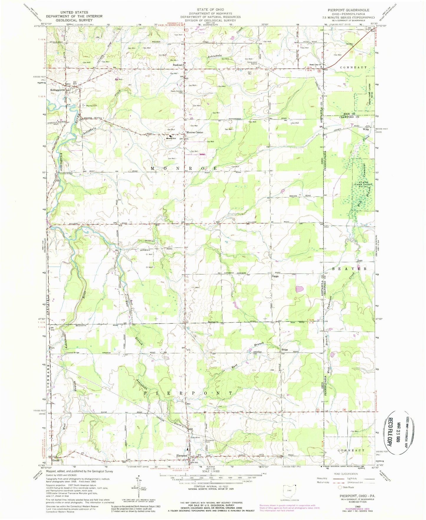
Classic USGS Pierpont Ohio 7.5'x7.5' Topo Map
Couldn't load pickup availability
Historical USGS topographic quad map of Pierpont in the states of Ohio, Pennsylvania. Map scale may vary for some years, but is generally around 1:24,000. Print size is approximately 24" x 27"
This quadrangle is in the following counties: Ashtabula, Crawford, Erie.
The map contains contour lines, roads, rivers, towns, and lakes. Printed on high-quality waterproof paper with UV fade-resistant inks, and shipped rolled.
Contains the following named places: Ashtabula Creek, Bushnell, Caine Road Bridge, East Branch, East Branch Ashtabula River, Evergreen Cemetery, Graham Road Bridge, Kelloggsville, Kellogsville Post Office, Monroe Cemetery, Monroe Center, Monroe Center Post Office, Monroe School, Monroe Township Fire Department, Murtha Airport, Pierpont Elementary School, Pierpont Post Office, Pierpont Volunteer Fire Department, Reeds Corners Cemetery, Riggs, Riggs Post Office, Root Road Bridge, Ship Post Office, Shipp, Speer Farms, State Line United Methodist Church, Township of Monroe, Township of Pierpont, Unionville Post Office, West Branch Ashtabula River, WGOJ-FM (Conneaut), Wing, ZIP Code: 44082