MyTopo
Classic USGS Pierre SW South Dakota 7.5'x7.5' Topo Map
Regular price
$16.95
Regular price
Sale price
$16.95
Unit price
per
Couldn't load pickup availability
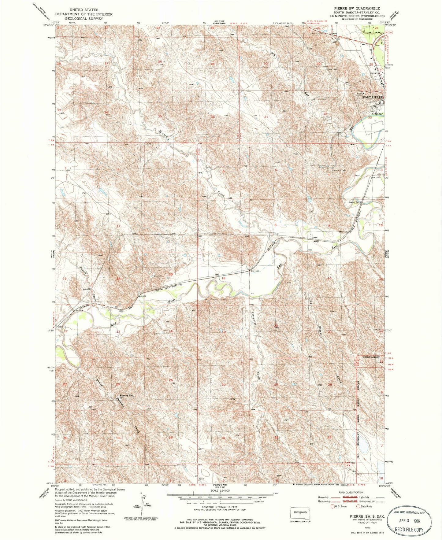
Historical USGS topographic quad map of Pierre SW in the state of South Dakota. Map scale may vary for some years, but is generally around 1:24,000. Print size is approximately 24" x 27"
This quadrangle is in the following counties: Stanley.
The map contains contour lines, roads, rivers, towns, and lakes. Printed on high-quality waterproof paper with UV fade-resistant inks, and shipped rolled.
Contains the following named places: Cedar Hill Cemetery, City of Fort Pierre, Dry Run, Fort Campbell, Gray Blanket Creek, KGFX-FM (Pierre), KNEY-FM (Pierre), Louis Caldwell Dam, Porcupine Creek, Powell Creek, Verendrye Hill, Willow Creek, Yellow Shoulder Creek