

MyTopo
Classic USGS Pigeon Dam Lake Minnesota 7.5'x7.5' Topo Map
Couldn't load pickup availability
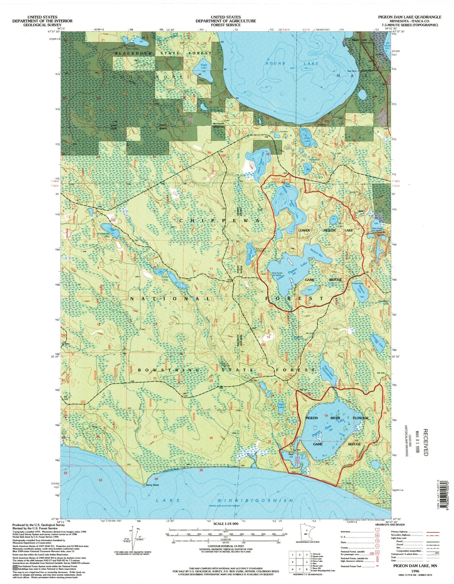
Historical USGS topographic quad map of Pigeon Dam Lake in the state of Minnesota. Map scale may vary for some years, but is generally around 1:24,000. Print size is approximately 24" x 27"
This quadrangle is in the following counties: Itasca.
The map contains contour lines, roads, rivers, towns, and lakes. Printed on high-quality waterproof paper with UV fade-resistant inks, and shipped rolled.
Contains the following named places: Alice Lake, Dunbar River, Farley Creek, Farley Hill Lookout Tower, Farley Lakes, Hale Lake, Lost Lake, Lower Pigeon Lake, Lower Pigeon Lake Game Refuge, Lower Twin Lakes, Mallard Bay, Middle Pigeon Lake, Middle Pigeon River Campground, Mosomo Lake, One Loaf Lake, Pigeon Dam Lake, Pigeon River, Pigeon River Flowage Game Refuge, Pigeon River Impoundment, Round Lake, Simpson Lake, South Round Lake Cemetery, Squaw Lake Cemetery, Squaw Lake Fire Department, Stony Point, Stony Point Brook, Upper Pigeon Lake, Virgin Lake, Wart Lake, Wilderness Lake, ZIP Code: 56681


