MyTopo
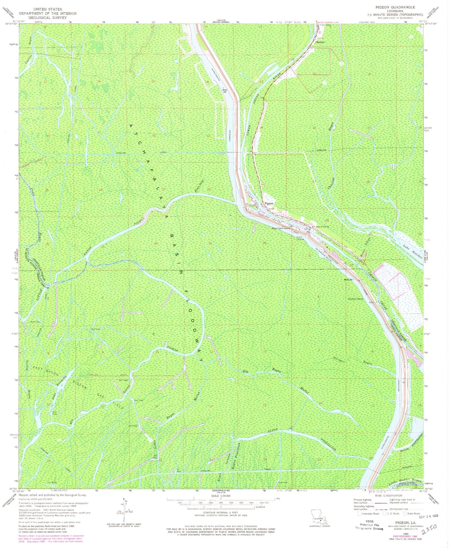
Classic USGS Pigeon Louisiana 7.5'x7.5' Topo Map
Couldn't load pickup availability
Historical USGS topographic quad map of Pigeon in the state of Louisiana. Map scale may vary for some years, but is generally around 1:24,000. Print size is approximately 24" x 27"
This quadrangle is in the following counties: Assumption, Iberia, Iberville, St. Martin.
The map contains contour lines, roads, rivers, towns, and lakes. Printed on high-quality waterproof paper with UV fade-resistant inks, and shipped rolled.
Contains the following named places: Bayou Indigo, Bayou Pigeon Mission, Bayou Pigeon Volunteer Fire Department, Bayou Teche, Big Bayou Mallet, Choctaw Bayou, Cross Bayou, East Bayou Pigeon Gas Field, Lake Runnells, Lower Grand River, North Bayou Pigeon Oil Field, Parish Governing Authority District 2, Pigeon, Pumpkin Point, Saint Joan of Arc Church, Stringer Bayou, Turkey Bayou