MyTopo
Classic USGS Pikes Point California 7.5'x7.5' Topo Map
Couldn't load pickup availability
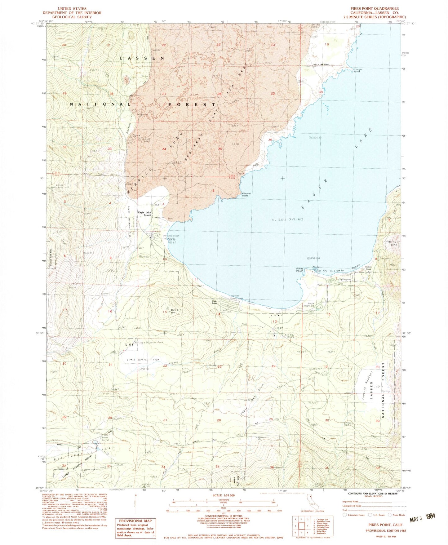
Historical USGS topographic quad map of Pikes Point in the state of California. Map scale may vary for some years, but is generally around 1:24,000. Print size is approximately 24" x 27"
This quadrangle is in the following counties: Lassen.
The map contains contour lines, roads, rivers, towns, and lakes. Printed on high-quality waterproof paper with UV fade-resistant inks, and shipped rolled.
Contains the following named places: Aspen Grove Campground, Aspen Grove Picnic Area, California Department of Forestry and Fire Protection Lassen Modoc Unit Eagle Lake, Christie Beach Campground, Christie Day Use Area Campground, Eagle Campground, Eagle Lake Burn, Eagle Lake Resort, Eagle Lodge, Gallatin Beach, Gallatin House, Gallatin Picnic Area, Lake of the Woods, Little Merrill Flat, Lower Brockman Flat, Merrill Burn, Merrill Campground, Merrill Creek, Merrill Information Center, Merrill Mountain, Miners Bay, Osprey Management Area, Papoose Creek, Papoose Meadows, Pikes Point, Pikes Point Boat Ramp, Pikes Point Picnic Area, Pine Grove Picnic Area, Roney Corral, Slough Point, West Eagle Picnic Area, Wildcat Point