MyTopo
Classic USGS Pine Apple North Alabama 7.5'x7.5' Topo Map
Couldn't load pickup availability
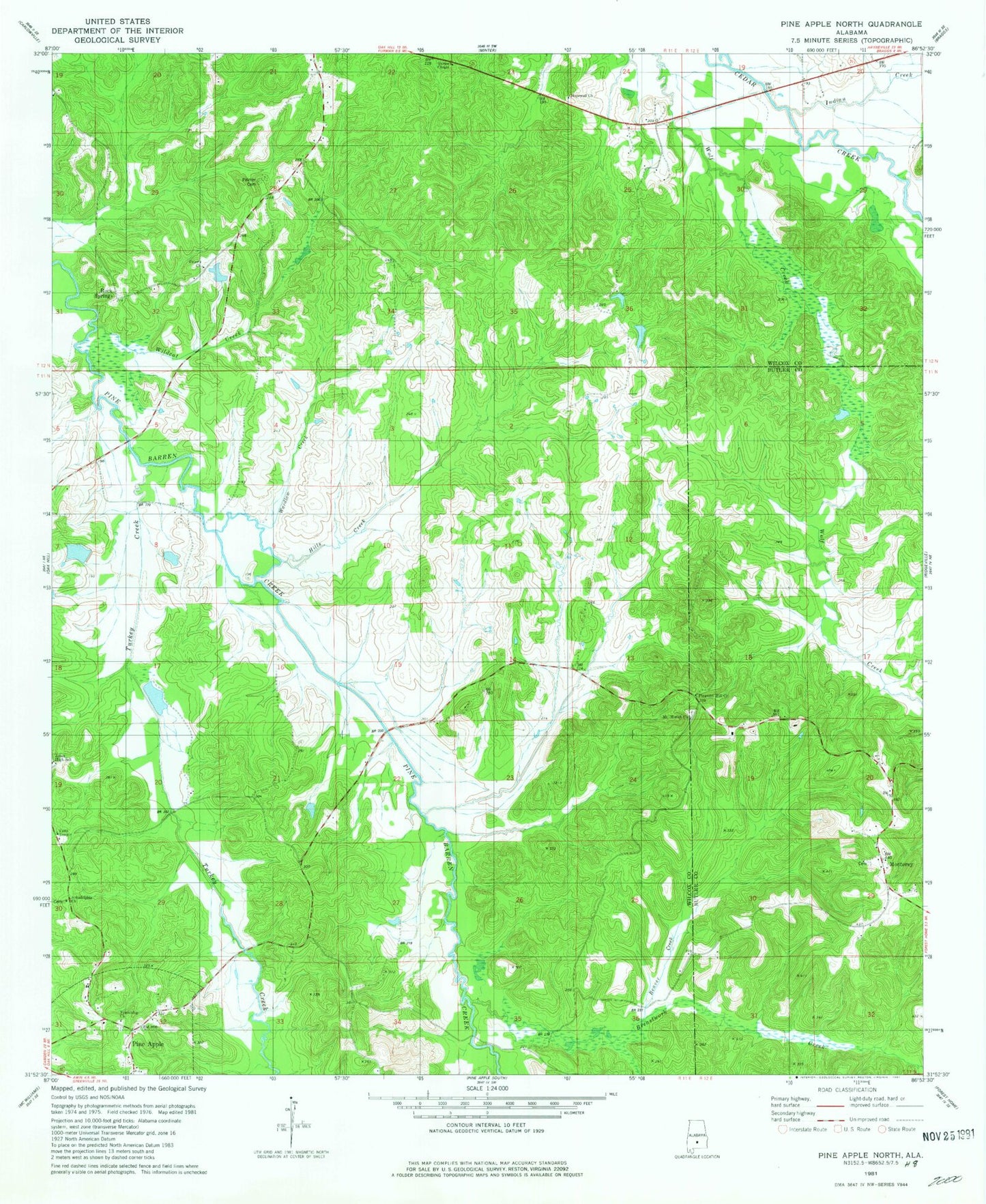
Historical USGS topographic quad map of Pine Apple North in the state of Alabama. Map scale may vary for some years, but is generally around 1:24,000. Print size is approximately 24" x 27"
This quadrangle is in the following counties: Butler, Wilcox.
The map contains contour lines, roads, rivers, towns, and lakes. Printed on high-quality waterproof paper with UV fade-resistant inks, and shipped rolled.
Contains the following named places: Arkadelphia Church, Beaver Creek, Beech Grove School, Brestwork Creek, Cedar Grove church, Copeland Dam, Copelands Pond, Donald Lake, E G Donald Lake Dam, Faith Temple, Friendship Church, Gaines Chapel, Hills Creek, Hopewell Church, Indian Creek, Monterey, Monterey Cemetery, Monterey Church, Mount Moriah, Mount Moriah Baptist Church, Mount Moriah Fellowship Baptist Church Cemetery, Mount Moriah Post Office, Palmer Cemetery, Peters Church, Pleasant Hill Church, Rock Springs, Saint Peters Church, Starling Church, Thurston Adams Dam, Thurston Adams Pond, Turkey Creek, Wardlaw Creek, Wildcat Creek, Windhams Store, Wolf Creek, Womacks Post Office