MyTopo
Classic USGS Pine Grove Pennsylvania 7.5'x7.5' Topo Map
Couldn't load pickup availability
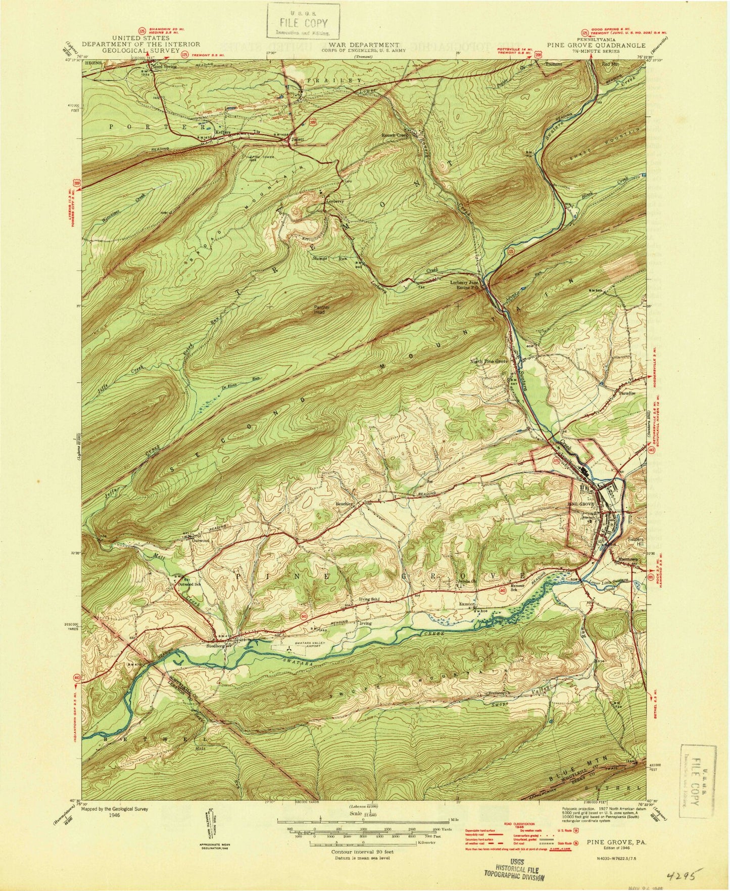
Historical USGS topographic quad map of Pine Grove in the state of Pennsylvania. Typical map scale is 1:24,000, but may vary for certain years, if available. Print size: 24" x 27"
This quadrangle is in the following counties: Berks, Lebanon, Schuylkill.
The map contains contour lines, roads, rivers, towns, and lakes. Printed on high-quality waterproof paper with UV fade-resistant inks, and shipped rolled.
Contains the following named places: Adams Run, Baird Run, Bear Hole Run, Beuchler, Black Creek, Brethren Church, Crowtown School, DeHaas Run, Fishing Creek, Good Spring Creek, Haldeman Family Cemetery, Irving, Jacobs Church, Joliett, Joliett Church, Keffers, Lebanon Reservoir, Lorberry Creek, Lower Little Swatara Creek, Lower Rausch Creek, Marstown, Mill Creek, Oak Grove Union School, Outwood, Outwood School, Panther Head, Paradise, Pine Grove, Pine Grove School, Ravine, Stumps Run, Suedberg, Swope Mountain, Swope Valley Run, West Branch Fishing Creek, Good Spring, Pine Grove Airport (historical), Oakhill Sediment Pond Dam, New Saint Nicholas Breaker Pond Dam, High Bridge Dam, Black Creek Intake Dam, East Franklin, Jeffs Swamp, Echo Valley, Exmoor, Lorberry, Lorberry Junction, Rausch Creek, Pine Grove Area Middle School, Pine Grove Area High School, Pine Grove Elementary School, Swatara State Park, Brookside, Dorans, Keffer Fire Tower, Borough of Pine Grove, Township of Pine Grove, Township of Tremont, Panther Valley School, Ravine Census Designated Place, Fairview Farm Airfield, North End Fire Company District 58 Station 2, Pine Grove Hose Hook and Ladder Fire Company District 58 Station 1, Ravine Fire Department District 21 Station 1, Suedberg Community Fire Company District 21 Station 2, Joliett Volunteer Fire Company District 22 Station 4, Pine Grove Community Ambulance, Pine Grove Landfill, Pine Grove Post Office, Pine Grove Police Department, Adams Run, Baird Run, Bear Hole Run, Beuchler, Black Creek, Brethren Church, Crowtown School, DeHaas Run, Fishing Creek, Good Spring Creek, Haldeman Family Cemetery, Irving, Jacobs Church, Joliett, Joliett Church, Keffers, Lebanon Reservoir, Lorberry Creek, Lower Little Swatara Creek, Lower Rausch Creek, Marstown, Mill Creek, Oak Grove Union School, Outwood, Outwood School, Panther Head, Paradise, Pine Grove, Pine Grove School, Ravine, Stumps Run, Suedberg, Swope Mountain, Swope Valley Run, West Branch Fishing Creek, Good Spring, Pine Grove Airport (historical), Oakhill Sediment Pond Dam, New Saint Nicholas Breaker Pond Dam, High Bridge Dam, Black Creek Intake Dam, East Franklin, Jeffs Swamp, Echo Valley, Exmoor, Lorberry, Lorberry Junction, Rausch Creek, Pine Grove Area Middle School, Pine Grove Area High School, Pine Grove Elementary School, Swatara State Park, Brookside, Dorans, Keffer Fire Tower, Borough of Pine Grove, Township of Pine Grove, Township of Tremont, Panther Valley School, Ravine Census Designated Place, Fairview Farm Airfield, North End Fire Company District 58 Station 2, Pine Grove Hose Hook and Ladder Fire Company District 58 Station 1, Ravine Fire Department District 21 Station 1, Suedberg Community Fire Company District 21 Station 2, Joliett Volunteer Fire Company District 22 Station 4, Pine Grove Community Ambulance, Pine Grove Landfill, Pine Grove Post Office, Pine Grove Police Department


