MyTopo
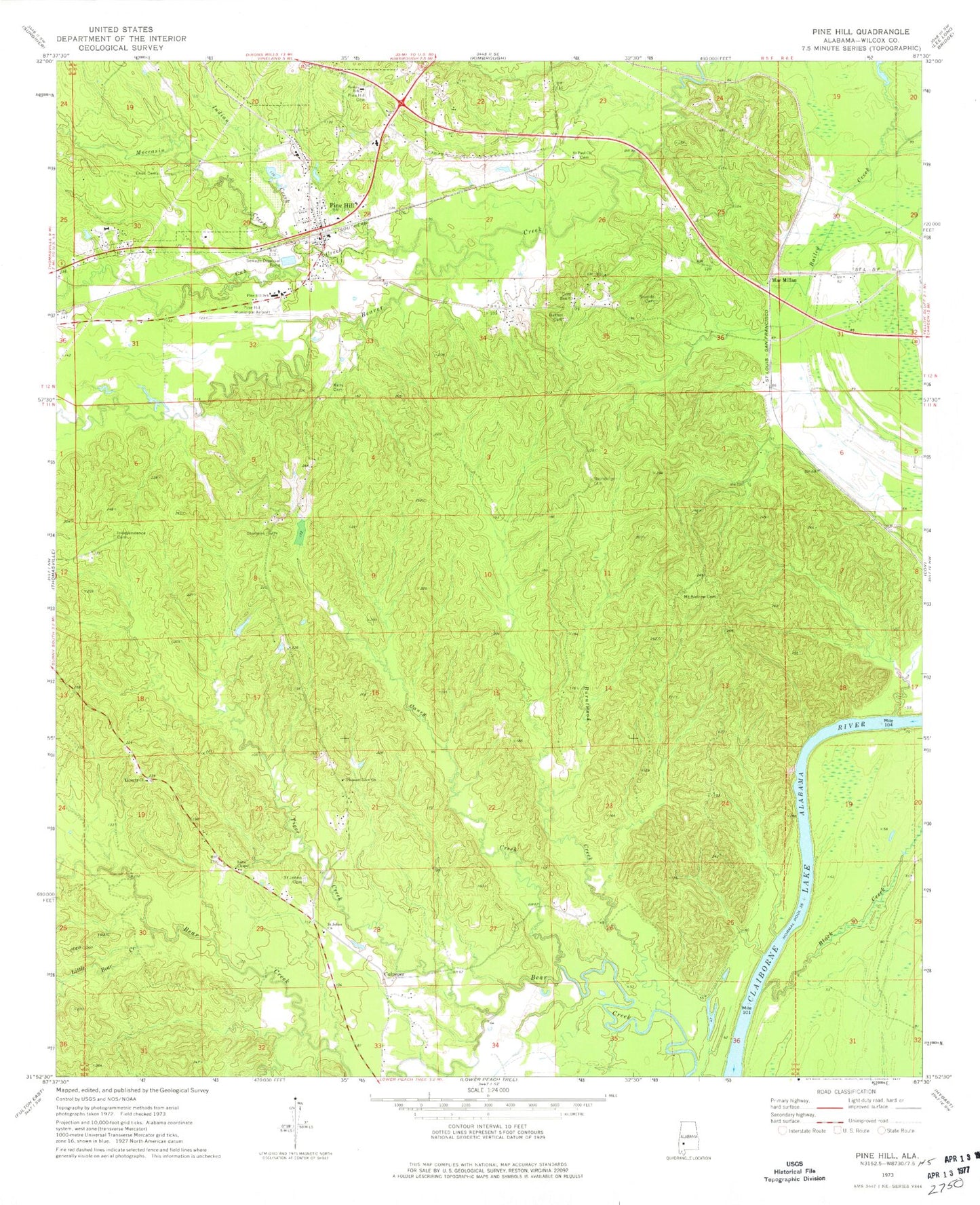
Classic USGS Pine Hill Alabama 7.5'x7.5' Topo Map
Couldn't load pickup availability
Historical USGS topographic quad map of Pine Hill in the state of Alabama. Map scale may vary for some years, but is generally around 1:24,000. Print size is approximately 24" x 27"
This quadrangle is in the following counties: Wilcox.
The map contains contour lines, roads, rivers, towns, and lakes. Printed on high-quality waterproof paper with UV fade-resistant inks, and shipped rolled.
Contains the following named places: Bethel Cemetery, Bethel Church, Black Creek, Burntwood Creek, Caney Creek, Caney Creek School, Cub Creek, Culpeper, Enon Cemetery, Enon Church, Etta Landing, Independence Cemetery, Independence Church, Indian Creek, Kelly Cemetery, Lane Chapel, Lanes Chapel Cemetery, Liberty Church, Little Bear Creek, MacMillan, Moccasin Creek, Montgomery Institute, Mount Andrew Cemetery, Mount Andrew Church, Pine Hill, Pine Hill Cemetery, Pine Hill Division, Pine Hill Municipal Airport, Pine Hill Post Office, Pine Hill School, Pine Hill Volunteer Fire Department, Pine Level School, Pleasant View Church, Saint Johns Cemetery, Saint Johns Church, Saint Paul Church, Shamburger Cemetery, Sheffield Lake, Sheffield Mill, Shields Cemetery, Stokes School, Tiger Creek, Town of Pine Hill, Yellow Bluff, Yellow Bluff Ferry, Yellow Bluff Landing, Zion Church