MyTopo
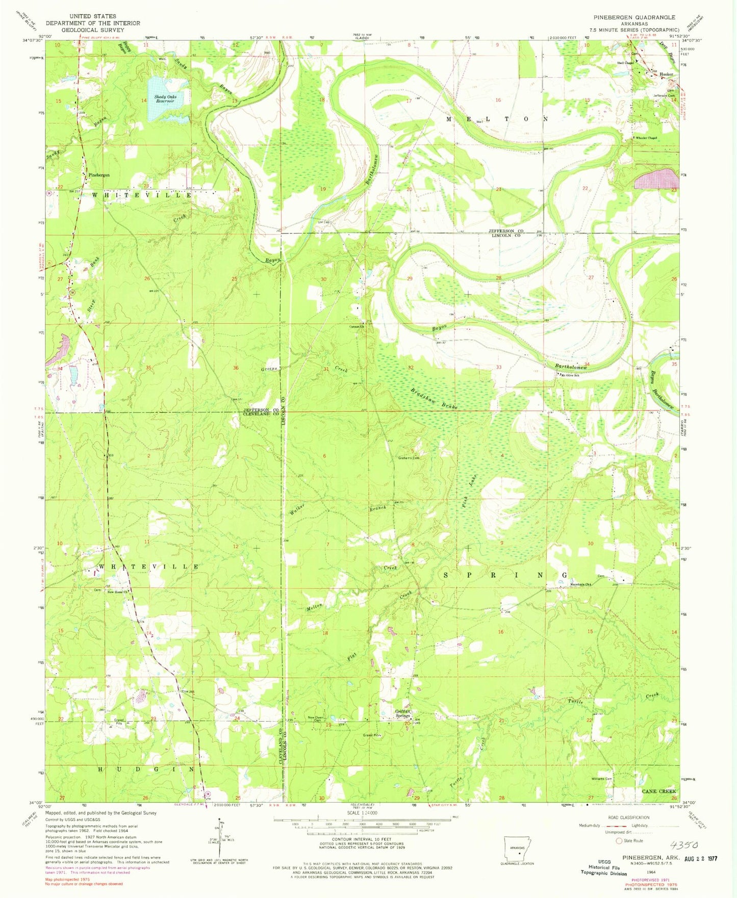
Classic USGS Pinebergen Arkansas 7.5'x7.5' Topo Map
Couldn't load pickup availability
Historical USGS topographic quad map of Pinebergen in the state of Arkansas. Map scale may vary for some years, but is generally around 1:24,000. Print size is approximately 24" x 27"
This quadrangle is in the following counties: Cleveland, Jefferson, Lincoln.
The map contains contour lines, roads, rivers, towns, and lakes. Printed on high-quality waterproof paper with UV fade-resistant inks, and shipped rolled.
Contains the following named places: Boggy Bayou, Bradshaw Brake, Canaan Church, Eunice, Fish Lake, Flat Creek, Grahams Cemetery, Grahams Chapel, Greens Creek, Griffith Springs, Harris Brake, Hooker, Jefferson Cemetery, KPBQ-FM (Pine Bluff), Macedonia Church, Marks Lake, Marks Lake Dam, Melton Creek, Mount Olive Church, Mount Olive School, New Harmony School, New Home Church, New Home School, New Owen Cemetery, Owens Chapel, Pinebergen, Rust Foundation Lake Number One Dam, Rust Foundation Lake Number Two Dam, Rust Lake Number One, Rust Lake Number Two, Sandy Bayou, Shady Oaks Reservoir, Shell Chapel, Steep Bank Creek, Taliaferro Lake Dam, Taylors School, Township of Hudgin, Township of Melton, Township of Spring, Villa Vale, Walker Branch, Wheeler Chapel, Williams Cemetery