MyTopo
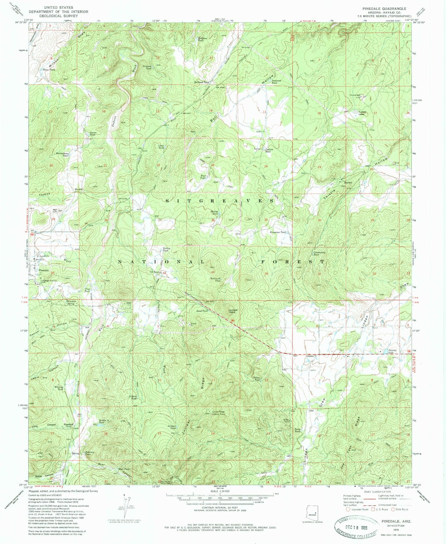
Classic USGS Pinedale Arizona 7.5'x7.5' Topo Map
Couldn't load pickup availability
Historical USGS topographic quad map of Pinedale in the state of Arizona. Typical map scale is 1:24,000, but may vary for certain years, if available. Print size: 24" x 27"
This quadrangle is in the following counties: Navajo.
The map contains contour lines, roads, rivers, towns, and lakes. Printed on high-quality waterproof paper with UV fade-resistant inks, and shipped rolled.
Contains the following named places: Bear Canyon, Bear Tank, Bluegrass Tank, Brittenham Tank, Burton, Carlisle Tank, Colbath Tank, Colbath Wash, Community Tank, Danish Hollow, Halfway Tank, Henrys Tank, Hunt Tank, Ironwood Tank, Juniper Point, Juniper Ridge, Juniper Ridge Lookout Tower, Juniper Tank, Lewis Canyon, Linden, Lons Canyon, Louis Tank, Main Canyon, Owens Tank, Paticho Lake, Petersen Tank, Peterson Tank, Pinedale Spring, Pinedale Wash, Polson Tank, Railroad Tank, Road Tank, Section Thirty Five Tank, Standard, Thistle Well, Thomas Draw, Town Tank, Turkey Lake, Turkey Tank, VD Tank, Water Canyon, West Tank, Whiting Tank, Germ Tank, Lewis Canyon Campground, Lons Tank, Mortensen Wash, Pinedale Ranger Station, Pinedale School, Thistle Tank, Turkey Lake Tank, Little VD Tank, Smith Tank, Pinedale Work Center, Pinedale Forest Service Station, Malone Tank, Bagley Tank, Capps Tank, Sand Tank, Mudhole Tank, Windmill Tank, Puddle Tank, Pinedale Post Office, Pothole Tank, Lost Tank, Draw Tank, Ridge Tank, Pasture Tank, Perkins Tank, Upper Ironwood Tank, Peterson Ranch Tank, Colbath Wash Tank, Silt Tank, American Indian Christian School, Linden Elementary School, Linden Census Designated Place, Clay Springs Pinedale Fire Department Station 610, Lewis Tank Number One


