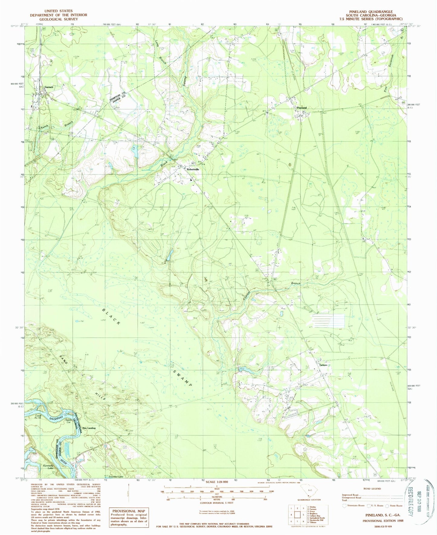
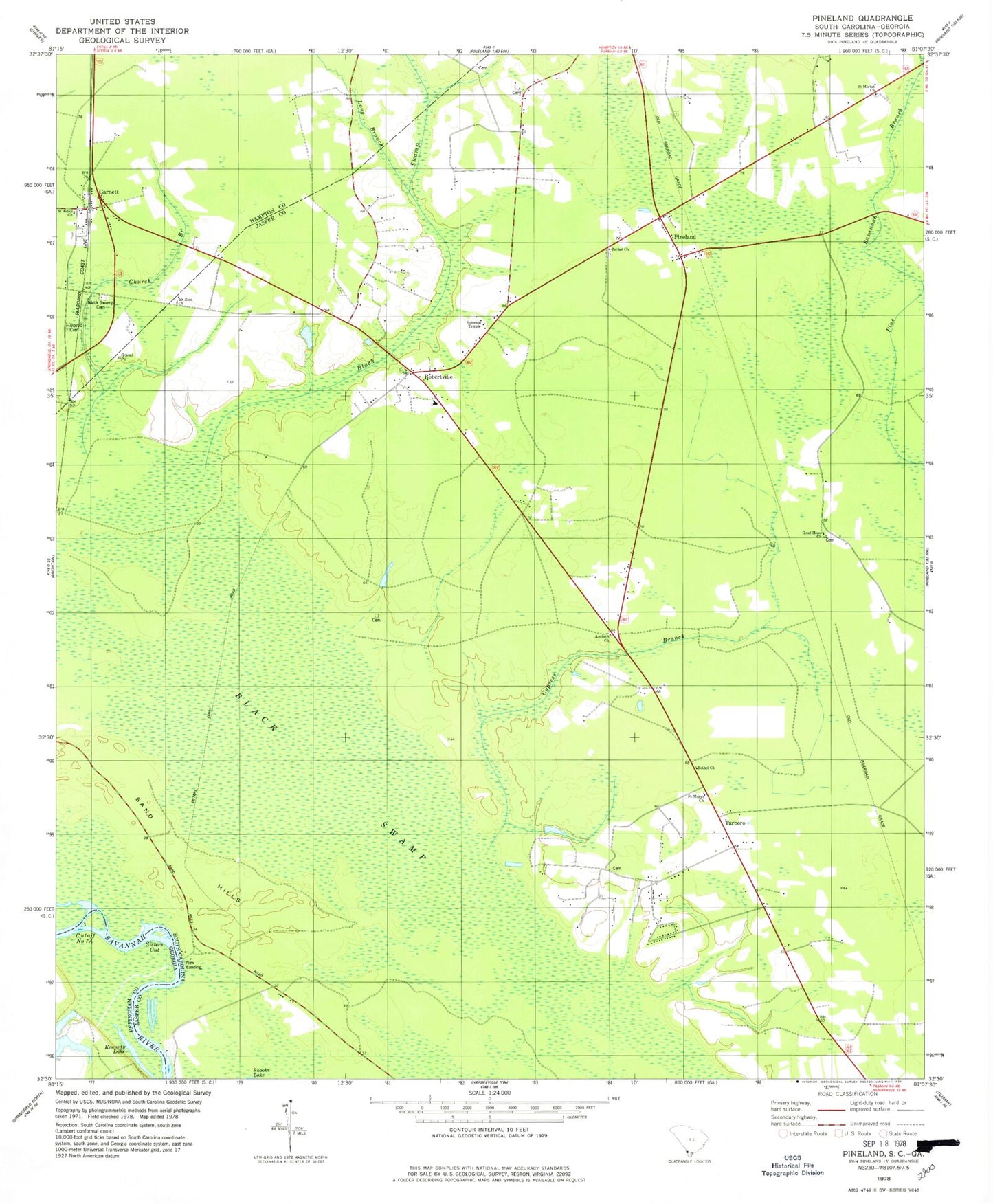
MyTopo
Classic USGS Pineland South Carolina 7.5'x7.5' Topo Map
Couldn't load pickup availability
Historical USGS topographic quad map of Pineland in the states of South Carolina, Georgia. Map scale may vary for some years, but is generally around 1:24,000. Print size is approximately 24" x 27"
This quadrangle is in the following counties: Effingham, Hampton, Jasper.
The map contains contour lines, roads, rivers, towns, and lakes. Printed on high-quality waterproof paper with UV fade-resistant inks, and shipped rolled.
Contains the following named places: Antioch Church, Antioch School, Baxter Pond, Bethel Church, Black Swamp, Black Swamp Baptist Church, Black Swamp Cemetery, Bostic Cemetery, Bowdens Hunting Lodge, Cedar Grove School, Church Branch, Cosby, Cutoff Number 7A, Cypress Branch, Cypress Plantation, Cypress School, Dupies Ferry, Garnett, Garnett Church, Garnett Post Office, Garnett School, Good Hope Church, Good Hope School, Highsmiths Sawmill, Jasper County Fire Department Station 43, Jasper Fire Department Station 44, Kennedy Lake, Long Branch, Long Branch School, Mount Zion African Methodist Episcopal Church, New Landing, Pine Land Hunting Club, Pine Savannah Branch, Pineland, Robertsville Baptist Church, Robertsville School, Robertville, Saint Johns Church, Saint Mariah Church, Saint Marys Church, Sand Hills, Sisters Cut, Solomon Temple, South Carolina Noname 27001 D-2587 Dam, Tarboro, Tarboro School, Tarboro Station, Titi School, Two Sisters Ferry