MyTopo
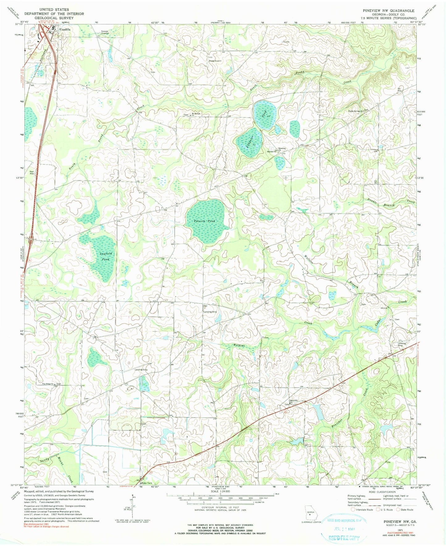
Classic USGS Pineview NW Georgia 7.5'x7.5' Topo Map
Couldn't load pickup availability
Historical USGS topographic quad map of Pineview NW in the state of Georgia. Map scale may vary for some years, but is generally around 1:24,000. Print size is approximately 24" x 27"
This quadrangle is in the following counties: Dooly.
The map contains contour lines, roads, rivers, towns, and lakes. Printed on high-quality waterproof paper with UV fade-resistant inks, and shipped rolled.
Contains the following named places: Alligator Pond, Bratcher Creek, Brown Pond, Brown Pond Dam, Browns Chapel, Daniels Pond, Daniels Pond Dam, Dooly County Fire Department Third District Station, Dunaway School, Griggs South Dam, Griggs South Lake, Harmony Baptist Church, Holly Grove Church, Joiner Cemetery, Layfield Pond, Mars Hill Church, Mars Hill Church Cemetery, Mars Hill Crossroads, Mars Hill School, McCallay, Mount Moriah Cemetery, Mount Moriah Church, Peavy Dam, Peavy Lake, Pine Ridge Cemetery, Pine Ridge Primitive Baptist Church, Pocosin Pond, Poplar Spring Cemetery, Poplar Springs Church, Posey Airport, Saint Pauls Church, Smyrna Cemetery, Smyrna Church, Unadilla Division, Union High School, Wallace Branch, Wildcat Creek, Williams School, ZIP Code: 31091