MyTopo
Classic USGS Pineville South Carolina 7.5'x7.5' Topo Map
Couldn't load pickup availability
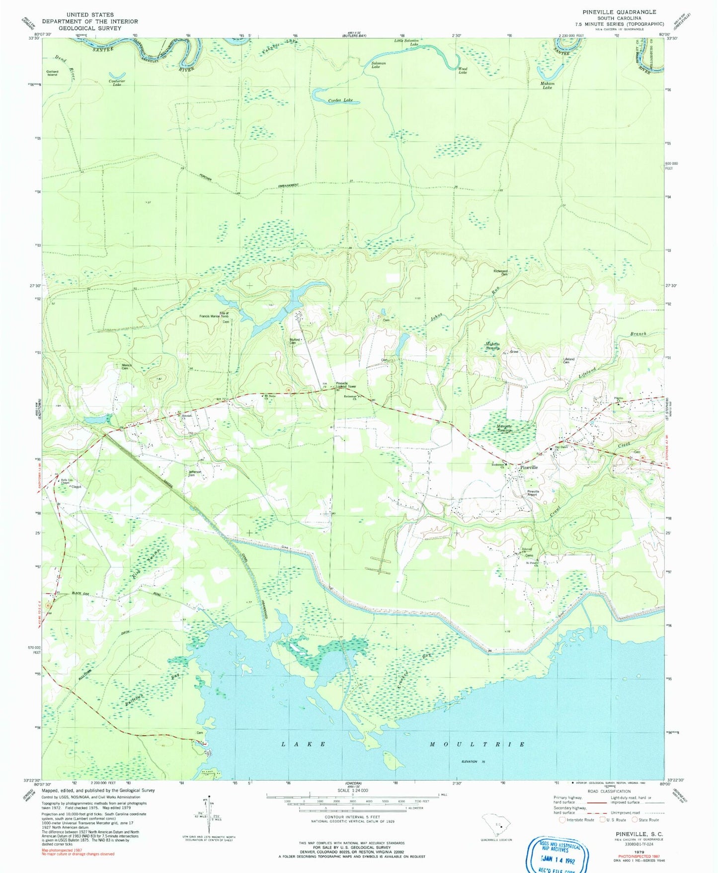
Historical USGS topographic quad map of Pineville in the state of South Carolina. Map scale may vary for some years, but is generally around 1:24,000. Print size is approximately 24" x 27"
This quadrangle is in the following counties: Berkeley, Clarendon, Williamsburg.
The map contains contour lines, roads, rivers, towns, and lakes. Printed on high-quality waterproof paper with UV fade-resistant inks, and shipped rolled.
Contains the following named places: Belle Isle Chapel, Belle Isle Plantation, Belle Isle Plantation Cemetery, Bellisle School, Bluford Cemetery, Buckhall Bay, Bulltown Bay, Bulltown Ditch, Cahusac Lake, Cordes Lake, Couturier Lake, Crooked Bay, Cross School, Day Dawn Church, Dead River, Glen Camp Plantation, Green Hill School, Jefferson Cemetery, Jehovah Church, Johns Run, Judge Town, Kirk Swamp, Lifeland Cemetery, Maham Lake, Maham Swamp, Mahan Plantation Cemetery, Margate Swamp, Maude Cullen Health Center, Messiah Church, Mexico Cemetery, Mount Nebo Church, Murrell, Oakland Club, Palmer Chapel, Pilgrim Church, Pineville, Pineville Lookout Tower, Pineville Post Office, Prince Hill School, Redeemer Church, Redeemer School, Region Town, Richmond Cemetery, Saint Johns Church, Saint Peters Church, Saint Stephen Division, Santee Canal, Sinkler Dam, Site of Francis Marion Tomb, Smiths Chapel, Solomon Lake, South Carolina Noname 14004 D-3508 Dam, Tower Hill Plantation, Wing Road, Wood Lake, ZIP Code: 29468