
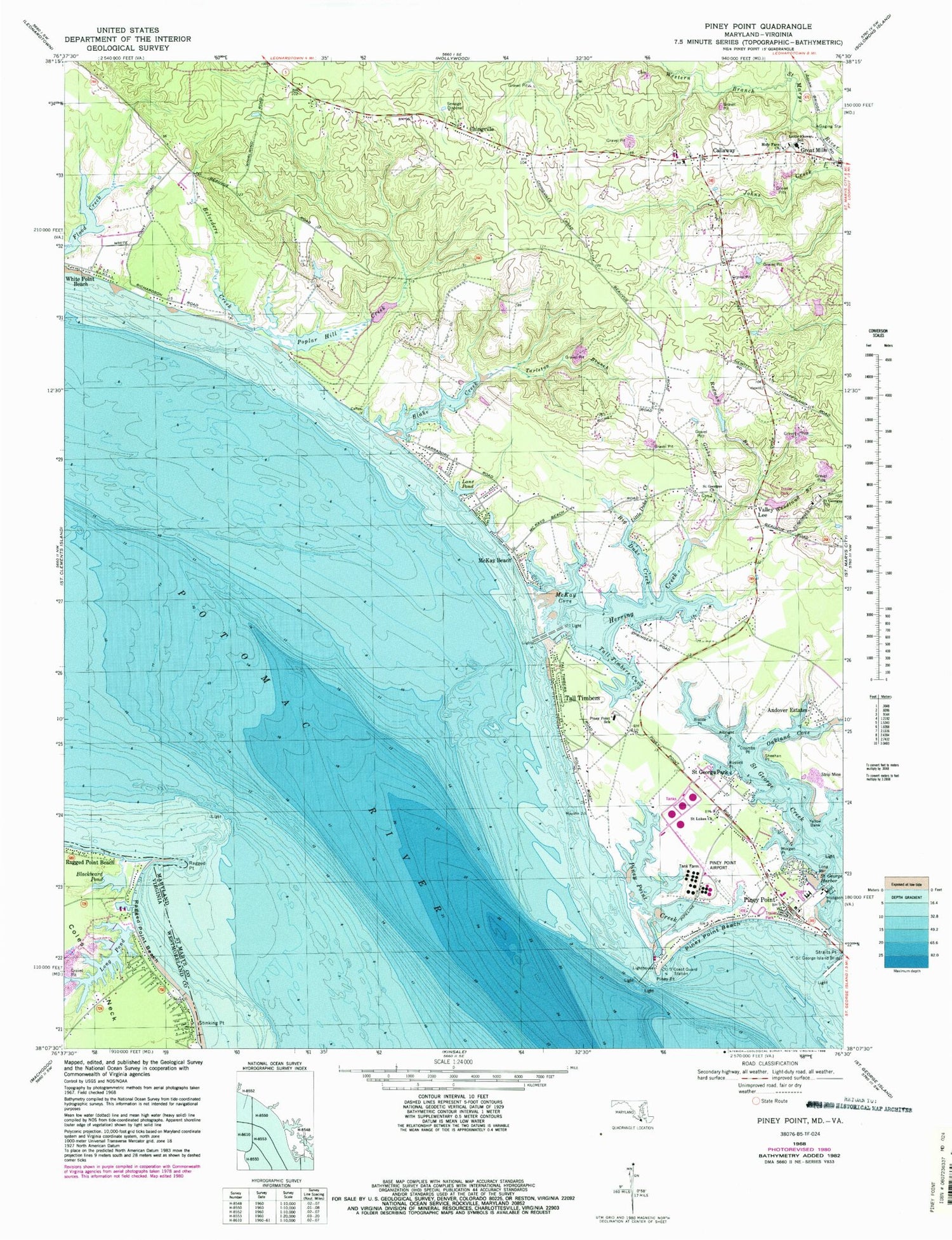
MyTopo
Classic USGS Piney Point Maryland 7.5'x7.5' Topo Map
Couldn't load pickup availability
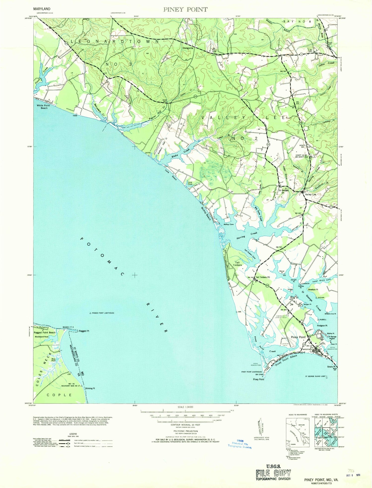
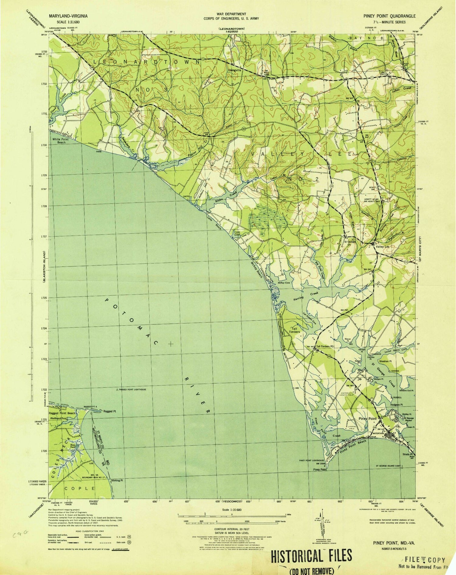
Historical USGS topographic quad map of Piney Point in the states of Maryland, Virginia. Typical map scale is 1:24,000, but may vary for certain years, if available. Print size: 24" x 27"
This quadrangle is in the following counties: St. Mary's, Westmoreland.
The map contains contour lines, roads, rivers, towns, and lakes. Printed on high-quality waterproof paper with UV fade-resistant inks, and shipped rolled.
Contains the following named places: Albright Point, Andover Estates, Belvedere Creek, Big Duke Creek, Biscoe Point, Blake Creek, Callaway, Chingville, Coombs Point, Glebe Branch, Herring Creek, Hodgson Point, Holy Face Church, Lane Pond, Little Duke Creek, Little Flower School, Long Bar, McKay Beach, McKay Cove, Morgan Point, Oakland Cove, Piney Point, Piney Point, Piney Point Beach, Piney Point Creek, Piney Point Elementary School, Poplar Hill Creek, Redman Branch, Russell Point, Saint George Harbor, Saint George Park, Saint Georges Church, Saint Georges Church, Saint Lukes Church, Sheehan Point, Straits Point, Tall Timbers, Tall Timbers Cove, Tarleton Branch, Valley Lee, Western Branch Saint Marys River, White Point Beach, Woodland Branch, Yellow Bank, Lane Beach, Piney Point Airport (historical), Belvedere Woodland, Callaway Post Office, Herring Creek, Herring Creek Estates, Herring Run Bar, Jubilee Farm, Lane Beach, Lane Creek, Mulberry Fields, Patuxent Seventh Day Adventist Church, Potomac Shores, Pustey Creek, Wilderness, Lanedon, Cecils Mill Historic District, Dukes Retreat, George B Cecil Memorial Park, Lundeberg Seamanship School, Herring Creek, Holy Face Parish Cemetery, Holy Family Catholic Church (historical), Nuthalls Folly, Piney Point Bar, Piney Point Lighthouse, Piney Point Post Office, Piney Point Shores, Saint George Beach, Saint Georges Poplar Hill Episcopal Cemetery, Saint Georges Parish Cemetery, Streams End Point, Tall Timbers Post Office, Tolson, Tolson Post Office (historical), Valley Lee Post Office, Westbury Manor, Weston, Saint Mary's County, District 2 Valley Lee, Second District Volunteer Fire Department and Volunteer Rescue Squad Company 6, Paul Hall Center for Maritime Training and Education, Piney Point Naval Outer Landing Field (historical), Piney Point Census Designated Place, Tall Timbers Census Designated Place, Faith Ridge Farm, Callaway Census Designated Place, Blackbeard Pond, Coles Neck, Long Pond, Ragged Point, Ragged Point Beach, Ragged Point Beach, Stinking Point, Pond-A-River Marina, Albright Point, Andover Estates, Belvedere Creek, Big Duke Creek, Biscoe Point, Blake Creek, Callaway, Chingville, Coombs Point, Glebe Branch, Herring Creek, Hodgson Point, Holy Face Church, Lane Pond, Little Duke Creek, Little Flower School, Long Bar, McKay Beach, McKay Cove, Morgan Point, Oakland Cove, Piney Point, Piney Point, Piney Point Beach, Piney Point Creek, Piney Point Elementary School, Poplar Hill Creek, Redman Branch, Russell Point, Saint George Harbor, Saint George Park, Saint Georges Church, Saint Georges Church, Saint Lukes Church, Sheehan Point, Straits Point, Tall Timbers, Tall Timbers Cove, Tarleton Branch, Valley Lee, Western Branch Saint Marys River, White Point Beach, Woodland Branch, Yellow Bank, Lane Beach, Piney Point Airport (historical), Belvedere Woodland, Callaway Post Office, Herring Creek, Herring Creek Estates, Herring Run Bar, Jubilee Farm, Lane Beach, Lane Creek, Mulberry Fields, Patuxent Seventh Day Adventist Church, Potomac Shores, Pustey Creek, Wilderness, Lanedon, Cecils Mill Historic District, Dukes Retreat, George B Cecil Memorial Park, Lundeberg Seamanship School, Herring Creek, Holy Face Parish Cemetery, Holy Family Catholic Church (historical), Nuthalls Folly, Piney Point Bar, Piney Point Lighthouse, Piney Point Post Office, Piney Point Shores, Saint George Beach, Saint Georges Poplar Hill Episcopal Cemetery, Saint Georges Parish Cemetery, Streams End Point, Tall Timbers Post Office, Tolson, Tolson Post Office (historical), Valley Lee Post Office, Westbury Manor, Weston, Saint Mary's County, District 2 Valley Lee, Second District Volunteer Fire Department and Volunteer Rescue Squad Company 6, Paul Hall Center for Maritime Training and Education, Piney Point Naval Outer Landing Field (historical), Piney Point Census Designated Place, Tall Timbers Census Designated Place, Faith Ridge Farm, Callaway Census Designated Place, Blackbeard Pond, Coles Neck, Long Pond, Ragged Point, Ragged Point Beach, Ragged Point Beach, Stinking Point, Pond-A-River Marina


